TopoQuest Logo
Do you find TopoQuest useful?
Help keep TopoQuest running and adding new maps/features by donating!
Bitcoin:  19c7KJd3qBynnjoSw5npx9KScwjBe4ifkT
Litecoin:  LXs6TkuXGGXo1vDsWCkWVdjQX94eUKd6ui
Home View Maps Find Maps Find Places Resources & Links


Blackstone, Illinois Topographic Map

USGS Map Title: Blackstone, IL
USGS Map MRC: 41088A6
DRG (GeoTIFF) Download: o41088a6.tif


Neighboring USGS Topographic Map Quads:


  Streator North, IL  
41088B7
 

  Ransom, IL  
41088B6
 

  Kinsman, IL  
41088B5
 

  Streator South, IL  
41088A7
 

  Blackstone, IL  
41088A6
 

  Odell, IL  
41088A5
 

  Flanagan North, IL  
40088H7
 

  Northwest Pontiac, IL  
40088H6
 

  Northeast Pontiac, IL  
40088H5


Map MRC Location:

N42°
W89°
N42°
W88°
H8 H7 H6 H5 H4 H3 H2 H1
G8 G7 G6 G5 G4 G3 G2 G1
F8 F7 F6 F5 F4 F3 F2 F1
E8 E7 E6 E5 E4 E3 E2 E1
D8 D7 D6 D5 D4 D3 D2 D1
C8 C7 C6 C5 C4 C3 C2 C1
B8 B7 B6 B5 B4 B3 B2 B1
A8 A7 A6 A5 A4 A3 A2 A1
N41°
W89°
N41°
W88°

Blackstone, IL USGS 1:24K Topographic Map Preview:
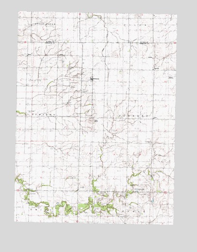
Blackstone, IL USGS Topographic Map
Click on map above to begin viewing in our Map Viewer.

This topographic map contains these locations and features:
Feature Name Type Latitude Longitude GNIS ID View Map
Antique AerodromeAirportN41.0059°W88.6599°2679037View Map
Applegate Landing Strip (historical)AirportN41.0881°W88.6292°1720347View Map
BlackstonePopulated PlaceN41.0845°W88.6909°404529View Map
Blackstone CemeteryCemeteryN41.0777°W88.6989°404530View Map
Blackstone Post OfficePost OfficeN41.0851°W88.6924°2788541View Map
Blackstone United Methodist ChurchChurchN41.0861°W88.6926°1737544View Map
Calder CemeteryCemeteryN41.0267°W88.7063°405344View Map
Camp AramoniLocaleN41.0175°W88.7395°1719766View Map
Davis Chapel United Brethren Church (historical)ChurchN41.0920°W88.7426°1737561View Map
Hadley CemeteryCemeteryN41.0230°W88.6592°409598View Map
Katy DidPopulated PlaceN41.0920°W88.6420°1719764View Map
MissalPopulated PlaceN41.0984°W88.7423°422990View Map
New Michigan (historical)Populated PlaceN41.0550°W88.7428°1737632View Map
New Michigan CemeteryCemeteryN41.0661°W88.7409°414447View Map
Saint Bernard ChurchChurchN41.0920°W88.6251°417201View Map
Smiths MoundSummitN41.0603°W88.6895°1719765View Map
Sunbury CemeteryCemeteryN41.0484°W88.6439°411212View Map
Sunbury SchoolSchoolN41.0634°W88.6426°419371View Map
Testoni Farms AirportAirportN41.0201°W88.6550°427189View Map
Township of SunburyCivilN41.0635°W88.6424°429818View Map

Note: Coordinates in the location and feature list above are referenced to NAD83 datum.


Copyright (C) 2008-2025 Ryan Niemi / Sunset Dynamics ... All Rights Reserved