TopoQuest Logo
Do you find TopoQuest useful?
Help keep TopoQuest running and adding new maps/features by donating!
Bitcoin:  19c7KJd3qBynnjoSw5npx9KScwjBe4ifkT
Litecoin:  LXs6TkuXGGXo1vDsWCkWVdjQX94eUKd6ui
Home View Maps Find Maps Find Places Resources & Links


Southwest Pontiac, Illinois Topographic Map

USGS Map Title: Southwest Pontiac, IL
USGS Map MRC: 40088G6
DRG (GeoTIFF) Download: o40088g6.tif


Neighboring USGS Topographic Map Quads:


  Flanagan North, IL  
40088H7
 

  Northwest Pontiac, IL  
40088H6
 

  Northeast Pontiac, IL  
40088H5
 

  Flanagan South, IL  
40088G7
 

  Southwest Pontiac, IL  
40088G6
 

  Southeast Pontiac, IL  
40088G5
 

  Lexington, IL  
40088F7
 

  Chenoa, IL  
40088F6
 

  Fairbury, IL  
40088F5


Map MRC Location:

N41°
W89°
N41°
W88°
H8 H7 H6 H5 H4 H3 H2 H1
G8 G7 G6 G5 G4 G3 G2 G1
F8 F7 F6 F5 F4 F3 F2 F1
E8 E7 E6 E5 E4 E3 E2 E1
D8 D7 D6 D5 D4 D3 D2 D1
C8 C7 C6 C5 C4 C3 C2 C1
B8 B7 B6 B5 B4 B3 B2 B1
A8 A7 A6 A5 A4 A3 A2 A1
N40°
W89°
N40°
W88°

Southwest Pontiac, IL USGS 1:24K Topographic Map Preview:
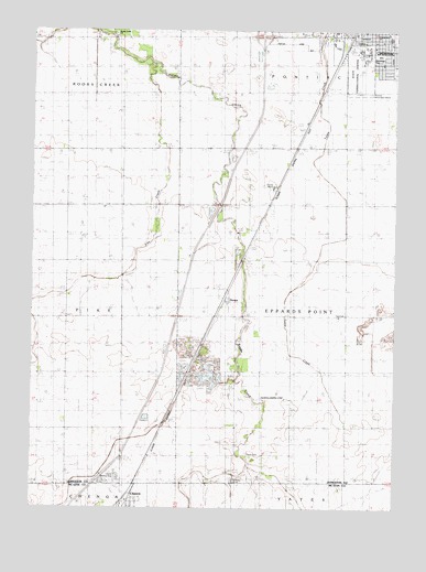
Southwest Pontiac, IL USGS Topographic Map
Click on map above to begin viewing in our Map Viewer.

This topographic map contains these locations and features:
Feature Name Type Latitude Longitude GNIS ID View Map
Calvary Catholic CemeteryCemeteryN40.7573°W88.6798°1719381View Map
Center School (historical)SchoolN40.8023°W88.6431°405825View Map
Dillon QuarryMineN40.7931°W88.6278°2043876View Map
East QuarryMineN40.7889°W88.6923°1985972View Map
Eppards Point Church (historical)ChurchN40.8284°W88.6995°408047View Map
Eppards Point TownhallBuildingN40.8009°W88.6423°1719389View Map
Fairview School (historical)SchoolN40.7711°W88.6817°408224View Map
Hancock School (historical)SchoolN40.7717°W88.7201°409733View Map
Harris Landing Strip (historical)AirportN40.7584°W88.7215°1719394View Map
Holmes School (historical)SchoolN40.8306°W88.6431°410409View Map
Humiston ParkParkN40.8686°W88.6312°1719396View Map
Illinois State Police Department District 6BuildingN40.8714°W88.6410°2757168View Map
Interchange 197CrossingN40.8734°W88.6715°1737610View Map
Lammatch School (historical)SchoolN40.8009°W88.7195°411783View Map
Laycock School (historical)SchoolN40.8600°W88.6773°411878View Map
Lincoln Elementary SchoolSchoolN40.8742°W88.6281°1719400View Map
Livingston County HomeBuildingN40.8342°W88.6673°1719402View Map
Livingston County JailBuildingN40.8713°W88.6397°2757167View Map
Livingston County Sheriff's OfficeBuildingN40.8709°W88.6396°2756905View Map
McDowell QuarryMineN40.7953°W88.6264°2043877View Map
OcoyaPopulated PlaceN40.8050°W88.6840°423031View Map
Ocoya School (historical)SchoolN40.7998°W88.6812°414954View Map
Order of Saint Francis Saint James Hospital - John W Albrecht Medical CenterHospitalN40.8707°W88.6795°2662325View Map
Payne CemeteryCemeteryN40.7642°W88.6758°415472View Map
Pike CreekStreamN40.8653°W88.7092°415663View Map
Pleasant View School (historical)SchoolN40.8592°W88.7201°415938View Map
Pontiac Correctional CenterLocaleN40.8661°W88.6381°1737645View Map
Pontiac Correctional CenterBuildingN40.8707°W88.6360°1719419View Map
Pontiac Southside CemeteryCemeteryN40.8734°W88.6256°1719417View Map
Raymond Schultz Round BarnBuildingN40.8408°W88.6411°2129796View Map
Reeds School (historical)SchoolN40.8298°W88.6806°416495View Map
Rook's Creek CemeteryCemeteryN40.8739°W88.7222°1737659View Map
Rooks Creek School (historical)SchoolN40.8736°W88.7215°416911View Map
Rooks Creek United Methodist ChurchChurchN40.8734°W88.7217°1719413View Map
Seeman Airport (historical)AirportN40.7786°W88.6662°427139View Map
Sunnydale School (historical)SchoolN40.8278°W88.7201°419389View Map
Township of Eppards PointCivilN40.8007°W88.6421°428974View Map
Turtle Creek School (historical)SchoolN40.7723°W88.6428°419960View Map

Note: Coordinates in the location and feature list above are referenced to NAD83 datum.


Copyright (C) 2008-2025 Ryan Niemi / Sunset Dynamics ... All Rights Reserved