TopoQuest Logo
Do you find TopoQuest useful?
Help keep TopoQuest running and adding new maps/features by donating!
Bitcoin:  19c7KJd3qBynnjoSw5npx9KScwjBe4ifkT
Litecoin:  LXs6TkuXGGXo1vDsWCkWVdjQX94eUKd6ui
Home View Maps Find Maps Find Places Resources & Links


Long Point, Illinois Topographic Map

USGS Map Title: Long Point, IL
USGS Map MRC: 41088A8
DRG (GeoTIFF) Download: o41088a8.tif


Neighboring USGS Topographic Map Quads:


  Tonica, IL  
41089B1
 

  Leonore, IL  
41088B8
 

  Streator North, IL  
41088B7
 

  Wenona, IL  
41089A1
 

  Long Point, IL  
41088A8
 

  Streator South, IL  
41088A7
 

  Minonk, IL  
40089H1
 

  Dana, IL  
40088H8
 

  Flanagan North, IL  
40088H7


Map MRC Location:

N42°
W89°
N42°
W88°
H8 H7 H6 H5 H4 H3 H2 H1
G8 G7 G6 G5 G4 G3 G2 G1
F8 F7 F6 F5 F4 F3 F2 F1
E8 E7 E6 E5 E4 E3 E2 E1
D8 D7 D6 D5 D4 D3 D2 D1
C8 C7 C6 C5 C4 C3 C2 C1
B8 B7 B6 B5 B4 B3 B2 B1
A8 A7 A6 A5 A4 A3 A2 A1
N41°
W89°
N41°
W88°

Long Point, IL USGS 1:24K Topographic Map Preview:
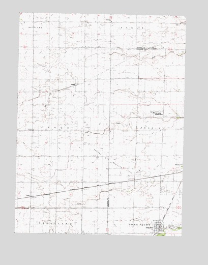
Long Point, IL USGS Topographic Map
Click on map above to begin viewing in our Map Viewer.

This topographic map contains these locations and features:
Feature Name Type Latitude Longitude GNIS ID View Map
Ancona CemeteryCemeteryN41.0375°W88.8801°1737536View Map
Ancona Gas Storage FieldOilfieldN41.0414°W88.9290°1737537View Map
Annunciation ChurchChurchN41.1209°W88.9309°417594View Map
Buffalo School (historical)SchoolN41.0289°W88.9490°405168View Map
Frings AirportAirportN41.0240°W88.9866°427445View Map
GarfieldPopulated PlaceN41.0850°W88.9562°408890View Map
Garretson Field (historical)AirportN41.0223°W88.9254°427474View Map
Hoarty School (historical)SchoolN41.1209°W88.9306°410326View Map
Koontz School (historical)SchoolN41.0895°W88.9115°411607View Map
LeedsPopulated PlaceN41.0209°W88.9881°422905View Map
Long PointPopulated PlaceN41.0048°W88.8917°412586View Map
Long Point CemeteryCemeteryN41.0059°W88.8839°1737617View Map
Long Point Community Fire Protection DistrictBuildingN41.0061°W88.8920°2681773View Map
Long Point Post OfficePost OfficeN41.0050°W88.8942°1737618View Map
Modine School (historical)SchoolN41.0292°W88.9887°413699View Map
Moore School (historical)SchoolN41.0875°W88.9876°413786View Map
Mud Lane School (historical)SchoolN41.0675°W88.8765°414193View Map
MunsterPopulated PlaceN41.1056°W88.9029°423009View Map
Nelson School (historical)SchoolN41.0006°W88.9879°414357View Map
Osage Center School (historical)SchoolN41.0592°W88.9892°415188View Map
Osage Township HallBuildingN41.0586°W88.9890°1719755View Map
Prairie Creek School (historical)SchoolN41.0295°W88.9115°416132View Map
Scheuer School (historical)SchoolN41.0573°W88.9487°418079View Map
Seipp School (historical)SchoolN41.1206°W88.9895°418189View Map
Township of OsageCivilN41.0599°W88.9892°429507View Map
Village of Long PointCivilN41.0053°W88.8930°2398472View Map

Note: Coordinates in the location and feature list above are referenced to NAD83 datum.


Copyright (C) 2008-2025 Ryan Niemi / Sunset Dynamics ... All Rights Reserved