TopoQuest Logo
Do you find TopoQuest useful?
Help keep TopoQuest running and adding new maps/features by donating!
Bitcoin:  19c7KJd3qBynnjoSw5npx9KScwjBe4ifkT
Litecoin:  LXs6TkuXGGXo1vDsWCkWVdjQX94eUKd6ui
Home View Maps Find Maps Find Places Resources & Links


Floyd, Virginia Topographic Map

USGS Map Title: Floyd, VA
USGS Map MRC: 36080H3
DRG (GeoTIFF) Download: o36080h3.tif


Neighboring USGS Topographic Map Quads:


  Riner, VA  
37080A4
 

  Pilot, VA  
37080A3
 

  Check, VA  
37080A2
 

  Alum Ridge, VA  
36080H4
 

  Floyd, VA  
36080H3
 

  Endicott, VA  
36080H2
 

  Willis, VA  
36080G4
 

  Woolwine, VA  
36080G3
 

  Charity, VA  
36080G2


Map MRC Location:

N37°
W81°
N37°
W80°
H8 H7 H6 H5 H4 H3 H2 H1
G8 G7 G6 G5 G4 G3 G2 G1
F8 F7 F6 F5 F4 F3 F2 F1
E8 E7 E6 E5 E4 E3 E2 E1
D8 D7 D6 D5 D4 D3 D2 D1
C8 C7 C6 C5 C4 C3 C2 C1
B8 B7 B6 B5 B4 B3 B2 B1
A8 A7 A6 A5 A4 A3 A2 A1
N36°
W81°
N36°
W80°

Floyd, VA USGS 1:24K Topographic Map Preview:
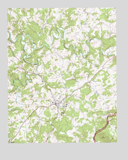
Floyd, VA USGS Topographic Map
Click on map above to begin viewing in our Map Viewer.

This topographic map contains these locations and features:
Feature Name Type Latitude Longitude GNIS ID View Map
Beaver CreekStreamN36.9721°W80.3717°1462930View Map
Beaver Creek ChurchChurchN36.9504°W80.3742°1494345View Map
Blue Mountain SchoolSchoolN36.9237°W80.3075°2498422View Map
Camp Bethel United Methodist ChurchChurchN36.9815°W80.3345°1494346View Map
Camp CreekLocaleN36.9818°W80.3342°1464316View Map
Camp CreekStreamN36.9707°W80.3470°1464319View Map
Conner Dairy FarmsLocaleN36.9078°W80.2961°2675367View Map
Court House DistrictCivilN36.9250°W80.3455°1927161View Map
Dodd CreekStreamN36.9385°W80.3400°1465852View Map
Falling Branch ChurchChurchN36.8943°W80.3564°1466450View Map
FloydPopulated PlaceN36.9112°W80.3201°1498479View Map
Floyd Baptist ChurchChurchN36.9132°W80.3142°1494352View Map
Floyd Church of the NazareneChurchN36.9143°W80.3212°1494353View Map
Floyd CountyCivilN36.9316°W80.3626°1494354View Map
Floyd County CourthouseBuildingN36.9115°W80.3201°1494355View Map
Floyd County High SchoolSchoolN36.9088°W80.3078°1494357View Map
Floyd County Life Saving and First Aid Squad Station 1BuildingN36.9220°W80.2988°2721147View Map
Floyd County Sheriff's OfficeBuildingN36.9117°W80.3199°2767049View Map
Floyd County Volunteer Fire Department 1BuildingN36.9096°W80.3173°2721089View Map
Floyd Elementary SchoolSchoolN36.9105°W80.3077°1494358View Map
Floyd Post OfficePost OfficeN36.9163°W80.3096°1494359View Map
Floyd Speedway (historical)LocaleN36.9274°W80.3206°1494360View Map
Floyd Town HallBuildingN36.9099°W80.3173°1494361View Map
Floyd United Methodist ChurchChurchN36.9118°W80.3150°1494362View Map
Great Oaks Country ClubLocaleN36.9324°W80.2767°1491160View Map
Huckleberry CreekStreamN36.9257°W80.3645°1468344View Map
Jacksonville Academy (historical)SchoolN36.9087°W80.3078°1494365View Map
Jacksonville CemeteryCemeteryN36.9065°W80.3184°1468615View Map
Jessie Peterman Memorial LibraryBuildingN36.9104°W80.3234°1494366View Map
Little River DistrictCivilN36.9688°W80.2699°1927377View Map
Middle CreekStreamN36.9693°W80.2675°1470397View Map
New Haven ChurchChurchN36.9001°W80.2653°1471424View Map
Oldfield CreekStreamN36.9585°W80.2984°1471891View Map
Pine CreekStreamN36.9543°W80.2937°1472335View Map
Pine Creek ChurchChurchN36.9121°W80.2773°1472337View Map
Pine Creek ChurchChurchN36.9460°W80.2737°1472338View Map
PoffPopulated PlaceN36.9379°W80.3131°1477633View Map
Red Oak Grove ChurchChurchN36.9846°W80.2870°1473060View Map
Scott DamDamN36.9451°W80.3298°1489769View Map
Shelors MillPopulated PlaceN36.8757°W80.3734°1477743View Map
Shooting Creek QuarryMineN36.9047°W80.2589°2724879View Map
Simmons CreekStreamN36.9654°W80.3728°1474607View Map
Stockers KnobSummitN36.9015°W80.3117°1495135View Map
Terrys CreekStreamN36.9579°W80.2895°1475546View Map
The HaycocksSummitN36.8779°W80.2620°1495146View Map
The Presbyterian Church of FloydChurchN36.9135°W80.3153°1494377View Map
Town of FloydCivilN36.9118°W80.3184°2390186View Map
West Fork Dodd CreekStreamN36.8879°W80.3220°1476482View Map
West Fork Little RiverStreamN36.9712°W80.3578°1476486View Map
WGFC-AM (Floyd)TowerN36.9260°W80.2759°1498933View Map
Zion ChurchChurchN36.9074°W80.3176°1474386View Map
Zion ChurchChurchN36.9254°W80.3100°1474388View Map

Note: Coordinates in the location and feature list above are referenced to NAD83 datum.


Copyright (C) 2008-2025 Ryan Niemi / Sunset Dynamics ... All Rights Reserved