TopoQuest Logo
Do you find TopoQuest useful?
Help keep TopoQuest running and adding new maps/features by donating!
Bitcoin:  19c7KJd3qBynnjoSw5npx9KScwjBe4ifkT
Litecoin:  LXs6TkuXGGXo1vDsWCkWVdjQX94eUKd6ui
Home View Maps Find Maps Find Places Resources & Links


Alum Ridge, Virginia Topographic Map

USGS Map Title: Alum Ridge, VA
USGS Map MRC: 36080H4
DRG (GeoTIFF) Download: o36080h4.tif


Neighboring USGS Topographic Map Quads:


  Radford South, VA  
37080A5
 

  Riner, VA  
37080A4
 

  Pilot, VA  
37080A3
 

  Indian Valley, VA  
36080H5
 

  Alum Ridge, VA  
36080H4
 

  Floyd, VA  
36080H3
 

  Dugspur, VA  
36080G5
 

  Willis, VA  
36080G4
 

  Woolwine, VA  
36080G3


Map MRC Location:

N37°
W81°
N37°
W80°
H8 H7 H6 H5 H4 H3 H2 H1
G8 G7 G6 G5 G4 G3 G2 G1
F8 F7 F6 F5 F4 F3 F2 F1
E8 E7 E6 E5 E4 E3 E2 E1
D8 D7 D6 D5 D4 D3 D2 D1
C8 C7 C6 C5 C4 C3 C2 C1
B8 B7 B6 B5 B4 B3 B2 B1
A8 A7 A6 A5 A4 A3 A2 A1
N36°
W81°
N36°
W80°

Alum Ridge, VA USGS 1:24K Topographic Map Preview:
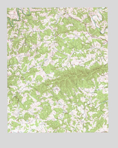
Alum Ridge, VA USGS Topographic Map
Click on map above to begin viewing in our Map Viewer.

This topographic map contains these locations and features:
Feature Name Type Latitude Longitude GNIS ID View Map
Alum RidgeLocaleN36.9429°W80.4598°1462433View Map
Alum Ridge AirportAirportN36.9733°W80.4914°1498670View Map
Alum Ridge ChurchChurchN36.9590°W80.4689°1462434View Map
Alum Ridge School (historical)SchoolN36.9535°W80.4434°1494343View Map
Beaver Creek ChurchChurchN36.9479°W80.4070°1462934View Map
CarthagePopulated PlaceN36.9676°W80.4959°1492722View Map
Deer Run AirportAirportN36.9937°W80.4554°1498671View Map
Dobbins CreekStreamN36.8876°W80.4073°1465842View Map
DuncanPopulated PlaceN36.9121°W80.4898°1477283View Map
Duncan CemeteryCemeteryN36.9523°W80.4951°1494351View Map
Duncan Chapel ChurchChurchN36.9149°W80.4856°1466042View Map
Duncan FarmLocaleN36.9508°W80.4672°2675432View Map
Earls BranchStreamN36.9590°W80.3826°1466084View Map
Greasy Creek ChurchChurchN36.8840°W80.4545°1467420View Map
Howell CreekStreamN36.9032°W80.3837°1468333View Map
Laurel BranchPopulated PlaceN36.9143°W80.3928°1493180View Map
Laurel BranchStreamN36.9890°W80.4845°1469159View Map
Laurel Branch ChurchChurchN36.9190°W80.3909°1494367View Map
Lost Bent CreekStreamN36.9832°W80.4920°1469866View Map
Mannon CemeteryCemeteryN36.9701°W80.3942°1494369View Map
Pleasant Valley ChurchChurchN36.9471°W80.4523°1472508View Map
Reedsville ChurchChurchN36.9187°W80.4403°1473099View Map
Sidney CreekStreamN36.9996°W80.4667°1474577View Map
Sowers CemeteryCemeteryN36.9462°W80.4075°1474925View Map
Spurlock CreekStreamN36.9032°W80.4087°1475036View Map
Wangle JunctionPopulated PlaceN36.9776°W80.4673°1477856View Map
West Fork Church (historical)ChurchN36.8757°W80.3778°1494379View Map
White Oak Grove Baptist ChurchChurchN36.9937°W80.3975°1476611View Map
White Rock CemeteryCemeteryN36.9690°W80.4964°1476633View Map
Wills RidgeRidgeN36.9332°W80.4048°1476803View Map

Note: Coordinates in the location and feature list above are referenced to NAD83 datum.


Copyright (C) 2008-2024 Ryan Niemi / Sunset Dynamics ... All Rights Reserved