TopoQuest Logo
Do you find TopoQuest useful?
Help keep TopoQuest running and adding new maps/features by donating!
Bitcoin:  19c7KJd3qBynnjoSw5npx9KScwjBe4ifkT
Litecoin:  LXs6TkuXGGXo1vDsWCkWVdjQX94eUKd6ui
Home View Maps Find Maps Find Places Resources & Links


Floyd, Michigan Topographic Map

USGS Map Title: Floyd, MI
USGS Map MRC: 43084E4
DRG (GeoTIFF) Download: o43084e4.tif


Neighboring USGS Topographic Map Quads:


  Alamando, MI  
43084F5
 

  Sanford, MI  
43084F4
 

  Averill, MI  
43084F3
 

  Pleasant Valley, MI  
43084E5
 

  Floyd, MI  
43084E4
 

  Gordonville, MI  
43084E3
 

  Saint Louis, MI  
43084D5
 

  Breckenridge, MI  
43084D4
 

  Merrill, MI  
43084D3


Map MRC Location:

N44°
W85°
N44°
W84°
H8 H7 H6 H5 H4 H3 H2 H1
G8 G7 G6 G5 G4 G3 G2 G1
F8 F7 F6 F5 F4 F3 F2 F1
E8 E7 E6 E5 E4 E3 E2 E1
D8 D7 D6 D5 D4 D3 D2 D1
C8 C7 C6 C5 C4 C3 C2 C1
B8 B7 B6 B5 B4 B3 B2 B1
A8 A7 A6 A5 A4 A3 A2 A1
N43°
W85°
N43°
W84°

Floyd, MI USGS 1:24K Topographic Map Preview:
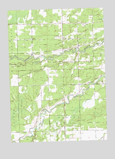
Floyd, MI USGS Topographic Map
Click on map above to begin viewing in our Map Viewer.

This topographic map contains these locations and features:
Feature Name Type Latitude Longitude GNIS ID View Map
Baker DrainCanalN43.5839°W84.3836°620478View Map
Brue DrainCanalN43.5089°W84.4544°622129View Map
Bush CreekStreamN43.5123°W84.4678°622347View Map
Dowd DrainCanalN43.5095°W84.3831°624848View Map
FloydPopulated PlaceN43.5892°W84.4092°1617563View Map
Floyd Church of GodChurchN43.5883°W84.4100°2544162View Map
Floyd Elementary SchoolSchoolN43.5903°W84.4083°2544619View Map
Floyd Post Office (historical)Post OfficeN43.5892°W84.4092°2544217View Map
Hoxie DrainCanalN43.5836°W84.4033°628728View Map
Huber DrainCanalN43.5761°W84.3889°628752View Map
Knapp Cutoff DrainCanalN43.6139°W84.4236°629802View Map
Kneeland DrainCanalN43.5228°W84.3775°629813View Map
Lawson DrainCanalN43.5914°W84.4461°630220View Map
Lee Township CemeteryCemeteryN43.5897°W84.4300°2544228View Map
Lee Township Fire DepartmentBuildingN43.5963°W84.4287°2626744View Map
Little Salt CreekStreamN43.5845°W84.4139°630756View Map
Midland ChurchChurchN43.6106°W84.3975°632284View Map
Midland Missionary ChurchChurchN43.5973°W84.4689°632285View Map
PorterPopulated PlaceN43.5186°W84.4664°1617803View Map
Porter Free Methodist ChurchChurchN43.5183°W84.4667°2546878View Map
Porter Oil FieldOilfieldN43.5061°W84.4525°1623581View Map
Porter Post Office (historical)Post OfficeN43.5186°W84.4664°2544199View Map
Porter Township CemeteryCemeteryN43.5403°W84.4306°2544229View Map
River Ridge CampgroundLocaleN43.5297°W84.4500°2544152View Map
Saint ElmoPopulated PlaceN43.5836°W84.4700°1617833View Map
Saint Elmo Post Office (historical)Post OfficeN43.5836°W84.4700°2544196View Map
Salt CreekStreamN43.5806°W84.4553°637135View Map
Sucker CreekStreamN43.5353°W84.4300°639001View Map
Township of LeeCivilN43.5968°W84.4289°1626600View Map
Township of PorterCivilN43.5097°W84.4293°1626930View Map
Turkey CreekStreamN43.5731°W84.4344°1615175View Map
Wilson DrainCanalN43.5748°W84.3775°1616572View Map

Note: Coordinates in the location and feature list above are referenced to NAD83 datum.


Copyright (C) 2008-2025 Ryan Niemi / Sunset Dynamics ... All Rights Reserved