TopoQuest Logo
Do you find TopoQuest useful?
Help keep TopoQuest running and adding new maps/features by donating!
Bitcoin:  19c7KJd3qBynnjoSw5npx9KScwjBe4ifkT
Litecoin:  LXs6TkuXGGXo1vDsWCkWVdjQX94eUKd6ui
Home View Maps Find Maps Find Places Resources & Links


Gordonville, Michigan Topographic Map

USGS Map Title: Gordonville, MI
USGS Map MRC: 43084E3
DRG (GeoTIFF) Download: o43084e3.tif


Neighboring USGS Topographic Map Quads:


  Sanford, MI  
43084F4
 

  Averill, MI  
43084F3
 

  Midland North, MI  
43084F2
 

  Floyd, MI  
43084E4
 

  Gordonville, MI  
43084E3
 

  Midland South, MI  
43084E2
 

  Breckenridge, MI  
43084D4
 

  Merrill, MI  
43084D3
 

  Hemlock, MI  
43084D2


Map MRC Location:

N44°
W85°
N44°
W84°
H8 H7 H6 H5 H4 H3 H2 H1
G8 G7 G6 G5 G4 G3 G2 G1
F8 F7 F6 F5 F4 F3 F2 F1
E8 E7 E6 E5 E4 E3 E2 E1
D8 D7 D6 D5 D4 D3 D2 D1
C8 C7 C6 C5 C4 C3 C2 C1
B8 B7 B6 B5 B4 B3 B2 B1
A8 A7 A6 A5 A4 A3 A2 A1
N43°
W85°
N43°
W84°

Gordonville, MI USGS 1:24K Topographic Map Preview:
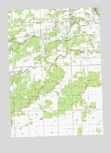
Gordonville, MI USGS Topographic Map
Click on map above to begin viewing in our Map Viewer.

This topographic map contains these locations and features:
Feature Name Type Latitude Longitude GNIS ID View Map
Alden B Dow Museum of ScienceBuildingN43.6244°W84.2506°2544158View Map
Arbury ParkParkN43.6161°W84.2506°2544097View Map
Barnes Post Office (historical)Post OfficeN43.5889°W84.3306°2544224View Map
Bullock Creek ChurchChurchN43.5678°W84.2761°622243View Map
Bullock Creek High SchoolSchoolN43.5695°W84.2939°622244View Map
Bullock Creek Junior High SchoolSchoolN43.5931°W84.2939°622245View Map
Chippewa Nature CenterParkN43.6069°W84.2839°2544145View Map
Chippewassee ParkParkN43.6119°W84.2567°2544110View Map
Chippewassee SchoolSchoolN43.6167°W84.2839°623230View Map
Chippewassee School ParkParkN43.6172°W84.2833°2544108View Map
Country Side Mobile Home ParkPopulated PlaceN43.6142°W84.3706°2544184View Map
Crane Post Office (historical)Post OfficeN43.5694°W84.2681°2544219View Map
Currie Municipal Golf CourseLocaleN43.6144°W84.2594°2544186View Map
Daniel Band ChurchChurchN43.5617°W84.3494°624297View Map
Dice CornersPopulated PlaceN43.6125°W84.3694°624652View Map
Dice DrainCanalN43.5989°W84.3522°624653View Map
Dow GardensParkN43.6242°W84.2536°2544077View Map
Duncan DrainCanalN43.5586°W84.3011°624984View Map
Emerson ParkParkN43.6192°W84.2564°625565View Map
Faith Christian Assembly ChurchChurchN43.6125°W84.2886°2542611View Map
Faith Wesleyan ChurchChurchN43.5939°W84.3694°2542604View Map
Franklin DrainCanalN43.5061°W84.2642°626413View Map
Freeland DrainCanalN43.5270°W84.2761°626456View Map
Frost DrainCanalN43.5781°W84.3378°626525View Map
GordonvillePopulated PlaceN43.5678°W84.3694°1617591View Map
Gordonville Post Office (historical)Post OfficeN43.5678°W84.3694°2544216View Map
Gordonville United Methodist ChurchChurchN43.5683°W84.3672°2544164View Map
Grace Bible ChurchChurchN43.6128°W84.2861°2544163View Map
Homer CemeteryCemeteryN43.5972°W84.3231°2544617View Map
Homer ChapelChurchN43.5972°W84.3242°628510View Map
Homer ChurchChurchN43.5972°W84.3303°628511View Map
Homer Township Fire DepartmentBuildingN43.6054°W84.3314°2626722View Map
Knapp DrainCanalN43.6234°W84.3694°629803View Map
Midland Mennonite ChurchChurchN43.5753°W84.2672°632283View Map
Mount Haley ChurchChurchN43.5489°W84.3305°632792View Map
Nease Memorial ChurchChurchN43.6114°W84.3136°633251View Map
Pine RiverStreamN43.6017°W84.2925°634984View Map
Pine River SchoolSchoolN43.5959°W84.2942°634994View Map
Pine SchoolSchoolN43.5981°W84.2914°634998View Map
Prairie CreekStreamN43.6214°W84.2903°635388View Map
Revere ParkParkN43.6217°W84.2542°2544095View Map
Riverside Golfside ParkParkN43.6139°W84.2517°2544109View Map
Saint Patrick CemeteryCemeteryN43.5178°W84.3311°636967View Map
Snake CreekStreamN43.6220°W84.2580°638187View Map
Thrune ParkParkN43.6200°W84.2533°2544096View Map
Township of HomerCivilN43.6099°W84.3329°1626486View Map
Township of Mount HaleyCivilN43.5251°W84.3303°1626773View Map
Towsley Dike ParkParkN43.6089°W84.2506°2544111View Map
Trinity ChurchChurchN43.5886°W84.2672°1615080View Map
Upper Bridge Historical MarkerParkN43.6178°W84.2519°2544684View Map
Wayne CemeteryCemeteryN43.5642°W84.3733°1615902View Map
Windover SchoolSchoolN43.6109°W84.3311°1616621View Map

Note: Coordinates in the location and feature list above are referenced to NAD83 datum.


Copyright (C) 2008-2025 Ryan Niemi / Sunset Dynamics ... All Rights Reserved