TopoQuest Logo
Do you find TopoQuest useful?
Help keep TopoQuest running and adding new maps/features by donating!
Bitcoin:  19c7KJd3qBynnjoSw5npx9KScwjBe4ifkT
Litecoin:  LXs6TkuXGGXo1vDsWCkWVdjQX94eUKd6ui
Home View Maps Find Maps Find Places Resources & Links


Merrill, Michigan Topographic Map

USGS Map Title: Merrill, MI
USGS Map MRC: 43084D3
DRG (GeoTIFF) Download: o43084d3.tif


Neighboring USGS Topographic Map Quads:


  Floyd, MI  
43084E4
 

  Gordonville, MI  
43084E3
 

  Midland South, MI  
43084E2
 

  Breckenridge, MI  
43084D4
 

  Merrill, MI  
43084D3
 

  Hemlock, MI  
43084D2
 

  Rathbone, MI  
43084C4
 

  Lakefield, MI  
43084C3
 

  Saint Charles, MI  
43084C2


Map MRC Location:

N44°
W85°
N44°
W84°
H8 H7 H6 H5 H4 H3 H2 H1
G8 G7 G6 G5 G4 G3 G2 G1
F8 F7 F6 F5 F4 F3 F2 F1
E8 E7 E6 E5 E4 E3 E2 E1
D8 D7 D6 D5 D4 D3 D2 D1
C8 C7 C6 C5 C4 C3 C2 C1
B8 B7 B6 B5 B4 B3 B2 B1
A8 A7 A6 A5 A4 A3 A2 A1
N43°
W85°
N43°
W84°

Merrill, MI USGS 1:24K Topographic Map Preview:
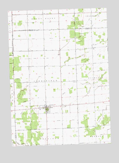
Merrill, MI USGS Topographic Map
Click on map above to begin viewing in our Map Viewer.

This topographic map contains these locations and features:
Feature Name Type Latitude Longitude GNIS ID View Map
Congregational Christian ChurchChurchN43.4083°W84.3300°2558777View Map
Corbat DrainCanalN43.4800°W84.3700°623819View Map
Greison DrainCanalN43.4342°W84.3608°627412View Map
Handy CreekStreamN43.4306°W84.2719°627718View Map
IvaPopulated PlaceN43.4634°W84.2694°629142View Map
Iva Post Office (historical)Post OfficeN43.4633°W84.2694°2558491View Map
JamLocaleN43.4964°W84.3297°629197View Map
Jam Post Office (historical)Post OfficeN43.4964°W84.3297°2544212View Map
Jonesfield - Lakefield Fire DepartmentBuildingN43.4110°W84.3315°2558778View Map
Jonesfield Township HallBuildingN43.4111°W84.3331°2558780View Map
Kennedy DrainCanalN43.4731°W84.3367°629585View Map
Lake of Dreams CampgroundLocaleN43.3986°W84.3500°2558776View Map
Meridian StationLocaleN43.4117°W84.3700°2558445View Map
MerrillPopulated PlaceN43.4097°W84.3289°632127View Map
Merrill ChurchChurchN43.4586°W84.3100°632128View Map
Merrill District LibraryBuildingN43.4097°W84.3331°2558781View Map
Merrill Elementary SchoolSchoolN43.4086°W84.3331°2558786View Map
Merrill High SchoolSchoolN43.4083°W84.3378°2558785View Map
Merrill Middle SchoolSchoolN43.4083°W84.3386°2558787View Map
Merrill Post OfficePost OfficeN43.4083°W84.3306°2558783View Map
Merrill StationLocaleN43.4117°W84.3328°2558782View Map
Merrill Village Sheriff's Office Sub StationBuildingN43.4101°W84.3314°2558779View Map
Mount Haley DrainCanalN43.4956°W84.3180°632793View Map
Price DrainCanalN43.3847°W84.3197°635448View Map
Randall Post Office (historical)Post OfficeN43.4128°W84.2722°2558478View Map
RyanPopulated PlaceN43.4736°W84.3694°1617831View Map
Sacred Heart ChurchChurchN43.4067°W84.3300°2558784View Map
Saint Patrick Ryan ChurchChurchN43.4739°W84.3703°2543008View Map
Stanton DrainCanalN43.4886°W84.3319°638728View Map
Township of JonesfieldCivilN43.4357°W84.3303°1626543View Map
Village of MerrillCivilN43.4091°W84.3346°2399319View Map
West's Mill Post Office (historical)Post OfficeN43.4086°W84.3694°2558449View Map
Whitmore DrainCanalN43.4417°W84.2533°1616384View Map
Wilson DrainCanalN43.4089°W84.3125°1616567View Map
Wright DrainCanalN43.4814°W84.3005°1616839View Map
Zeitler Airport (historical)AirportN43.4900°W84.3650°1624041View Map
Zion Lutheran ChurchChurchN43.4633°W84.2681°2558804View Map
Zion Lutheran SchoolSchoolN43.4633°W84.2675°2558805View Map

Note: Coordinates in the location and feature list above are referenced to NAD83 datum.


Copyright (C) 2008-2025 Ryan Niemi / Sunset Dynamics ... All Rights Reserved