TopoQuest Logo
Do you find TopoQuest useful?
Help keep TopoQuest running and adding new maps/features by donating!
Bitcoin:  19c7KJd3qBynnjoSw5npx9KScwjBe4ifkT
Litecoin:  LXs6TkuXGGXo1vDsWCkWVdjQX94eUKd6ui
Home View Maps Find Maps Find Places Resources & Links


Floyd Lake, Michigan Topographic Map

USGS Map Title: Floyd Lake, MI
USGS Map MRC: 44083C6
DRG (GeoTIFF) Download: o44083c6.tif


Neighboring USGS Topographic Map Quads:


  Hale, MI  
44083D7
 

  Loud Dam, MI  
44083D6
 

  Sid Town, MI  
44083D5
 

  Hale SE, MI  
44083C7
 

  Floyd Lake, MI  
44083C6
 

  Tawas City, MI  
44083C5
 

  Whittemore, MI  
44083B7
 

  National City, MI  
44083B6
 

  Alabaster, MI  
44083B5


Map MRC Location:

N45°
W84°
N45°
W83°
H8 H7 H6 H5 H4 H3 H2 H1
G8 G7 G6 G5 G4 G3 G2 G1
F8 F7 F6 F5 F4 F3 F2 F1
E8 E7 E6 E5 E4 E3 E2 E1
D8 D7 D6 D5 D4 D3 D2 D1
C8 C7 C6 C5 C4 C3 C2 C1
B8 B7 B6 B5 B4 B3 B2 B1
A8 A7 A6 A5 A4 A3 A2 A1
N44°
W84°
N44°
W83°

Floyd Lake, MI USGS 1:24K Topographic Map Preview:
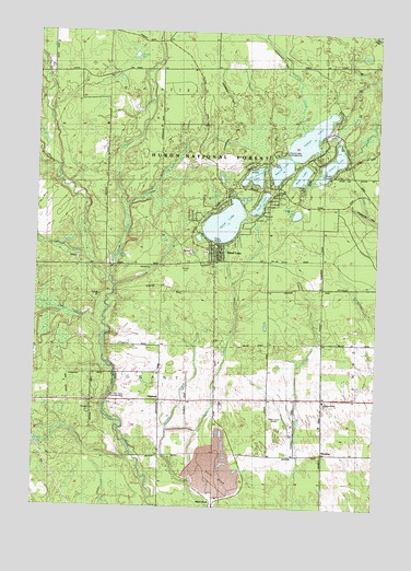
Floyd Lake, MI USGS Topographic Map
Click on map above to begin viewing in our Map Viewer.

This topographic map contains these locations and features:
Feature Name Type Latitude Longitude GNIS ID View Map
Au Gres River Roadside ParkParkN44.2786°W83.7169°1617111View Map
Bass LakeLakeN44.3375°W83.6531°620698View Map
Chappell LakeLakeN44.3273°W83.6546°623104View Map
Cooper CreekStreamN44.2950°W83.7261°623785View Map
Edson Post Office (historical)Post OfficeN44.2792°W83.6542°2514215View Map
Floyd LakeLakeN44.3301°W83.6680°626196View Map
Graham CreekStreamN44.3492°W83.6522°627068View Map
Grant Township Volunteer Fire DepartmentBuildingN44.3336°W83.6811°2626829View Map
Guiley CreekStreamN44.3106°W83.7230°627502View Map
Guiley PondLakeN44.3156°W83.7208°627503View Map
Hale CreekStreamN44.3445°W83.7472°1620108View Map
HemlockPopulated PlaceN44.2781°W83.7039°1617110View Map
Hemlock Road ChurchChurchN44.2784°W83.6439°628093View Map
Indian LakeLakeN44.3473°W83.6502°628991View Map
Iosco Post Office (historical)Post OfficeN44.3311°W83.6811°2514210View Map
Island LakeLakeN44.3406°W83.6418°629108View Map
Little Island LakeLakeN44.3363°W83.6707°630647View Map
Manary CreekStreamN44.2561°W83.6925°631373View Map
MeadowPopulated PlaceN44.2645°W83.6436°1617109View Map
Mitchell CreekStreamN44.3167°W83.7308°632511View Map
Ogemaw Post Office (historical)Post OfficeN44.3156°W83.6661°2514209View Map
Picket CreekStreamN44.3284°W83.7164°634804View Map
Pine Top Rest CemeteryCemeteryN44.2929°W83.6497°2514225View Map
Pioneer CemeteryCemeteryN44.3131°W83.6953°1617108View Map
Pioneer Cemetery Historical MarkerParkN44.3139°W83.6953°2514234View Map
Round LakeLakeN44.3393°W83.6606°636304View Map
Round Lake CampgroundLocaleN44.3436°W83.6611°1617112View Map
Sand LakeLakeN44.3250°W83.6810°637188View Map
Sand LakePopulated PlaceN44.3192°W83.6847°637195View Map
Sand Lake Census Designated PlaceCensusN44.3276°W83.6711°2628671View Map
Smith CreekStreamN44.3097°W83.7236°1621651View Map
Tawas QuarryMineN44.2617°W83.6894°2725184View Map
Township of GrantCivilN44.2924°W83.7039°1626380View Map
Vaughn CreekStreamN44.3286°W83.7169°1615528View Map
Vaughn LakeLakeN44.3688°W83.7146°1615529View Map
WDBI-FM (Tawas City)TowerN44.2742°W83.6616°1625513View Map
White RockPopulated PlaceN44.2525°W83.6839°1617940View Map

Note: Coordinates in the location and feature list above are referenced to NAD83 datum.


Copyright (C) 2008-2024 Ryan Niemi / Sunset Dynamics ... All Rights Reserved