TopoQuest Logo
Do you find TopoQuest useful?
Help keep TopoQuest running and adding new maps/features by donating!
Bitcoin:  19c7KJd3qBynnjoSw5npx9KScwjBe4ifkT
Litecoin:  LXs6TkuXGGXo1vDsWCkWVdjQX94eUKd6ui
Home View Maps Find Maps Find Places Resources & Links


National City, Michigan Topographic Map

USGS Map Title: National City, MI
USGS Map MRC: 44083B6
DRG (GeoTIFF) Download: o44083b6.tif


Neighboring USGS Topographic Map Quads:


  Hale SE, MI  
44083C7
 

  Floyd Lake, MI  
44083C6
 

  Tawas City, MI  
44083C5
 

  Whittemore, MI  
44083B7
 

  National City, MI  
44083B6
 

  Alabaster, MI  
44083B5
 

  Omer, MI  
44083A7
 

  Au Gres, MI  
44083A6
 

  Point Lookout, MI  
44083A5


Map MRC Location:

N45°
W84°
N45°
W83°
H8 H7 H6 H5 H4 H3 H2 H1
G8 G7 G6 G5 G4 G3 G2 G1
F8 F7 F6 F5 F4 F3 F2 F1
E8 E7 E6 E5 E4 E3 E2 E1
D8 D7 D6 D5 D4 D3 D2 D1
C8 C7 C6 C5 C4 C3 C2 C1
B8 B7 B6 B5 B4 B3 B2 B1
A8 A7 A6 A5 A4 A3 A2 A1
N44°
W84°
N44°
W83°

National City, MI USGS 1:24K Topographic Map Preview:
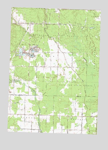
National City, MI USGS Topographic Map
Click on map above to begin viewing in our Map Viewer.

This topographic map contains these locations and features:
Feature Name Type Latitude Longitude GNIS ID View Map
Bear CreekStreamN44.1428°W83.6328°620833View Map
County Line DrainStreamN44.1606°W83.7125°623889View Map
Elm CreekStreamN44.1697°W83.7119°1619847View Map
Kelchner DrainStreamN44.1506°W83.7066°629510View Map
McIvorPopulated PlaceN44.2345°W83.6830°631927View Map
McIvor Post Office (historical)Post OfficeN44.2344°W83.6831°2514208View Map
McIvor Station (historical)LocaleN44.2347°W83.6833°2513902View Map
McMullen DrainStreamN44.1772°W83.6466°632001View Map
Messer SwampSwampN44.2309°W83.6358°632158View Map
National CityPopulated PlaceN44.2342°W83.7233°633225View Map
National City Post OfficePost OfficeN44.2339°W83.7233°2513907View Map
National City StationLocaleN44.2339°W83.7222°2513905View Map
Parent DrainStreamN44.1772°W83.6466°634364View Map
Saddler CreekStreamN44.2206°W83.6503°636484View Map
Sand CreekStreamN44.2072°W83.6480°637170View Map
Scott DrainStreamN44.1281°W83.7044°637467View Map
Sherman SchoolSchoolN44.2050°W83.6997°637772View Map
Sherman TownhallLocaleN44.2059°W83.6930°1618623View Map
Sherrit DrainStreamN44.1697°W83.7119°637776View Map
Stowell DrainStreamN44.1492°W83.6397°638933View Map
Township of ShermanCivilN44.2055°W83.7030°1627072View Map
TurtlePopulated PlaceN44.1909°W83.7425°1617904View Map
Turtle Post Office (historical)Post OfficeN44.1908°W83.7425°2514211View Map

Note: Coordinates in the location and feature list above are referenced to NAD83 datum.


Copyright (C) 2008-2025 Ryan Niemi / Sunset Dynamics ... All Rights Reserved