TopoQuest Logo
Do you find TopoQuest useful?
Help keep TopoQuest running and adding new maps/features by donating!
Bitcoin:  19c7KJd3qBynnjoSw5npx9KScwjBe4ifkT
Litecoin:  LXs6TkuXGGXo1vDsWCkWVdjQX94eUKd6ui
Home View Maps Find Maps Find Places Resources & Links


Alabaster, Michigan Topographic Map

USGS Map Title: Alabaster, MI
USGS Map MRC: 44083B5
DRG (GeoTIFF) Download: o44083b5.tif


Neighboring USGS Topographic Map Quads:


  Floyd Lake, MI  
44083C6
 

  Tawas City, MI  
44083C5
 

  East Tawas, MI  
44083C4
 

  National City, MI  
44083B6
 

  Alabaster, MI  
44083B5


  Au Gres, MI  
44083A6
 

  Point Lookout, MI  
44083A5
 

  Charity Island, MI  
44083A4


Map MRC Location:

N45°
W84°
N45°
W83°
H8 H7 H6 H5 H4 H3 H2 H1
G8 G7 G6 G5 G4 G3 G2 G1
F8 F7 F6 F5 F4 F3 F2 F1
E8 E7 E6 E5 E4 E3 E2 E1
D8 D7 D6 D5 D4 D3 D2 D1
C8 C7 C6 C5 C4 C3 C2 C1
B8 B7 B6 B5 B4 B3 B2 B1
A8 A7 A6 A5 A4 A3 A2 A1
N44°
W84°
N44°
W83°

Alabaster, MI USGS 1:24K Topographic Map Preview:
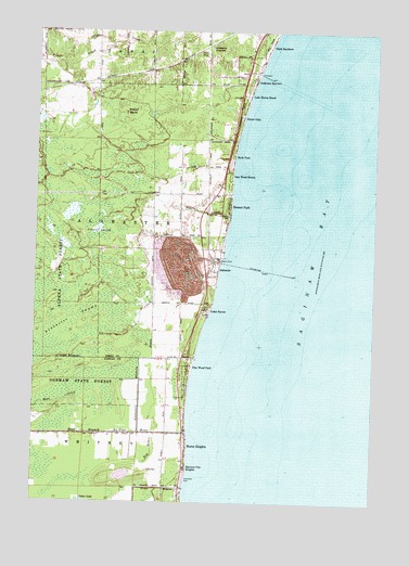
Alabaster, MI USGS Topographic Map
Click on map above to begin viewing in our Map Viewer.

This topographic map contains these locations and features:
Feature Name Type Latitude Longitude GNIS ID View Map
AlabasterPopulated PlaceN44.1864°W83.5580°619883View Map
Alabaster Bible ChurchChurchN44.1917°W83.5569°2513810View Map
Alabaster Historical MarkerParkN44.1903°W83.5567°2514238View Map
Alabaster JunctionPopulated PlaceN44.2459°W83.5636°1617406View Map
Alabaster Post Office (historical)Post OfficeN44.1864°W83.5581°2514217View Map
Alabaster StationLocaleN44.1903°W83.5597°2513937View Map
Alabaster SwampSwampN44.1739°W83.6105°619884View Map
Alabaster Township CemeteryCemeteryN44.2011°W83.5540°1618618View Map
Alabaster Whitney DrainStreamN44.1434°W83.5861°619885View Map
Anderson BayviewPopulated PlaceN44.2367°W83.5453°620086View Map
Au Gres - Sims - Whitney Fire Department WhitneyBuildingN44.1294°W83.5708°2626805View Map
Benson ParkPopulated PlaceN44.2036°W83.5544°621127View Map
Brown's Landing RV ParkLocaleN44.1633°W83.5672°2496857View Map
Cedar HavenPopulated PlaceN44.1761°W83.5625°622912View Map
Clark BayshorePopulated PlaceN44.2461°W83.5400°623344View Map
Crowell SwampSwampN44.1961°W83.6016°624145View Map
Dime DrainStreamN44.1289°W83.5691°624683View Map
East Branch Au Gres RiverStreamN44.1439°W83.5675°625123View Map
Harmon City HeightsPopulated PlaceN44.1336°W83.5691°627808View Map
Huron HeightsPopulated PlaceN44.1400°W83.5691°628863View Map
Huron OaksPopulated PlaceN44.2270°W83.5500°628871View Map
Hyde ParkPopulated PlaceN44.2170°W83.5528°628906View Map
Ipperwash ScarpBarN44.1506°W83.6125°1625561View Map
Kendall MarshSwampN44.2272°W83.5911°629578View Map
Lake Huron BeachPopulated PlaceN44.2331°W83.5475°629977View Map
Mason CreekStreamN44.1995°W83.5539°631700View Map
Oak Wood ShoresPopulated PlaceN44.2117°W83.5536°633864View Map
Pine Wood ParkPopulated PlaceN44.1611°W83.5680°635003View Map
Proper CreekStreamN44.2467°W83.5950°635475View Map
Ray DrainStreamN44.1434°W83.5805°635679View Map
Singing Bridge Golf CourseLocaleN44.1389°W83.5750°2496858View Map
Township of AlabasterCivilN44.2013°W83.5977°1625808View Map
U S Gypsum CompanyLocaleN44.1845°W83.5580°1618619View Map
Whitney Township ParkParkN44.1309°W83.5697°1618622View Map

Note: Coordinates in the location and feature list above are referenced to NAD83 datum.


Copyright (C) 2008-2025 Ryan Niemi / Sunset Dynamics ... All Rights Reserved