TopoQuest Logo
Do you find TopoQuest useful?
Help keep TopoQuest running and adding new maps/features by donating!
Bitcoin:  19c7KJd3qBynnjoSw5npx9KScwjBe4ifkT
Litecoin:  LXs6TkuXGGXo1vDsWCkWVdjQX94eUKd6ui
Home View Maps Find Maps Find Places Resources & Links


Whittemore, Michigan Topographic Map

USGS Map Title: Whittemore, MI
USGS Map MRC: 44083B7
DRG (GeoTIFF) Download: o44083b7.tif


Neighboring USGS Topographic Map Quads:


  Sage Lake, MI  
44083C8
 

  Hale SE, MI  
44083C7
 

  Floyd Lake, MI  
44083C6
 

  Prescott, MI  
44083B8
 

  Whittemore, MI  
44083B7
 

  National City, MI  
44083B6
 

  Omer SW, MI  
44083A8
 

  Omer, MI  
44083A7
 

  Au Gres, MI  
44083A6


Map MRC Location:

N45°
W84°
N45°
W83°
H8 H7 H6 H5 H4 H3 H2 H1
G8 G7 G6 G5 G4 G3 G2 G1
F8 F7 F6 F5 F4 F3 F2 F1
E8 E7 E6 E5 E4 E3 E2 E1
D8 D7 D6 D5 D4 D3 D2 D1
C8 C7 C6 C5 C4 C3 C2 C1
B8 B7 B6 B5 B4 B3 B2 B1
A8 A7 A6 A5 A4 A3 A2 A1
N44°
W84°
N44°
W83°

Whittemore, MI USGS 1:24K Topographic Map Preview:
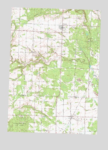
Whittemore, MI USGS Topographic Map
Click on map above to begin viewing in our Map Viewer.

This topographic map contains these locations and features:
Feature Name Type Latitude Longitude GNIS ID View Map
Buchanan CreekStreamN44.2000°W83.8322°622187View Map
Burleigh - Reno - Whittemore Fire DepartmentBuildingN44.2271°W83.8026°2627067View Map
Burleigh CemeteryCemeteryN44.2020°W83.8428°622283View Map
Cedar Valley CemeteryCemeteryN44.1411°W83.8564°622959View Map
City of WhittemoreCivilN44.2337°W83.8032°1627270View Map
Crainer CreekStreamN44.1906°W83.8569°623954View Map
Good News Ministries Lutheran ChurchChurchN44.1897°W83.8031°2513825View Map
Hall CreekStreamN44.2153°W83.7930°627640View Map
Johnson CreekStreamN44.1950°W83.7628°629327View Map
Johnson Creek CemeteryCemeteryN44.2042°W83.8041°629328View Map
Mongo CreekStreamN44.1956°W83.7633°632567View Map
Renaissance Fellowship ChurchChurchN44.1425°W83.7894°2515069View Map
Saint James Catholic ChurchChurchN44.2333°W83.8008°2513826View Map
Township of BurleighCivilN44.2042°W83.8241°1626003View Map
TurnerPopulated PlaceN44.1425°W83.7878°1615180View Map
Turner Post OfficePost OfficeN44.1425°W83.7878°2515112View Map
Turner StationLocaleN44.1417°W83.7872°2515113View Map
Village of TurnerCivilN44.1422°W83.7875°2400008View Map
Whitney CreekStreamN44.1920°W83.8533°1616391View Map
WhittemorePopulated PlaceN44.2336°W83.8030°1616402View Map
Whittemore Baptist ChurchChurchN44.2361°W83.8028°2513828View Map
Whittemore Branch LibraryBuildingN44.2317°W83.8028°2513822View Map
Whittemore City HallBuildingN44.2292°W83.8028°2513823View Map
Whittemore Post OfficePost OfficeN44.2322°W83.8028°2513821View Map
Whittemore SpeedwayLocaleN44.2300°W83.7994°2513820View Map
Whittemore Station (historical)LocaleN44.2336°W83.8031°2513824View Map
Whittemore United Methodist ChurchChurchN44.2292°W83.7981°2513827View Map

Note: Coordinates in the location and feature list above are referenced to NAD83 datum.


Copyright (C) 2008-2025 Ryan Niemi / Sunset Dynamics ... All Rights Reserved