TopoQuest Logo
Do you find TopoQuest useful?
Help keep TopoQuest running and adding new maps/features by donating!
Bitcoin:  19c7KJd3qBynnjoSw5npx9KScwjBe4ifkT
Litecoin:  LXs6TkuXGGXo1vDsWCkWVdjQX94eUKd6ui
Home View Maps Find Maps Find Places Resources & Links


Foraker, Indiana Topographic Map

USGS Map Title: Foraker, IN
USGS Map MRC: 41085E8
DRG (GeoTIFF) Download: o41085e8.tif


Neighboring USGS Topographic Map Quads:


  Osceola, IN  
41086F1
 

  Elkhart, IN  
41085F8
 

  Bristol, IN  
41085F7
 

  Wakarusa, IN  
41086E1
 

  Foraker, IN  
41085E8
 

  Goshen, IN  
41085E7
 

  Nappanee West, IN  
41086D1
 

  Nappanee East, IN  
41085D8
 

  Milford, IN  
41085D7


Map MRC Location:

N42°
W86°
N42°
W85°
H8 H7 H6 H5 H4 H3 H2 H1
G8 G7 G6 G5 G4 G3 G2 G1
F8 F7 F6 F5 F4 F3 F2 F1
E8 E7 E6 E5 E4 E3 E2 E1
D8 D7 D6 D5 D4 D3 D2 D1
C8 C7 C6 C5 C4 C3 C2 C1
B8 B7 B6 B5 B4 B3 B2 B1
A8 A7 A6 A5 A4 A3 A2 A1
N41°
W86°
N41°
W85°

Foraker, IN USGS 1:24K Topographic Map Preview:
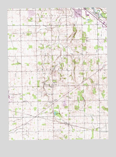
Foraker, IN USGS Topographic Map
Click on map above to begin viewing in our Map Viewer.

This topographic map contains these locations and features:
Feature Name Type Latitude Longitude GNIS ID View Map
Angelmyer Loucke DitchCanalN41.5434°W85.9931°430178View Map
Bashor Childrens HomeSchoolN41.5939°W85.9008°430556View Map
Bethel ChurchChurchN41.5731°W85.9836°430909View Map
Bull CemeteryCemeteryN41.5082°W85.9763°431785View Map
Burkett CemeteryCemeteryN41.6175°W85.9181°431835View Map
Christner Gravel PitMineN41.5342°W85.9297°2635779View Map
Concord Township Fire Department Station 2BuildingN41.6236°W85.9658°2626013View Map
Davidhizer DitchCanalN41.5075°W85.9942°433334View Map
Doering DitchCanalN41.5139°W85.9811°433605View Map
Ebenezer ChurchChurchN41.5370°W85.9417°433982View Map
Fetters Martin DitchCanalN41.5787°W85.9539°434466View Map
ForakerPopulated PlaceN41.5159°W85.9242°434635View Map
Foraker Fire DepartmentBuildingN41.5158°W85.9253°2625757View Map
Fulmer DitchCanalN41.6106°W85.9592°434895View Map
German ChurchChurchN41.5364°W85.9814°435042View Map
Goshen Fire Department Reliance Road StationBuildingN41.6099°W85.8868°2626100View Map
Harrison Elementary SchoolSchoolN41.5542°W85.9428°435801View Map
Harrison Township Fire Department Station 1BuildingN41.5793°W85.9255°2701465View Map
Harrison Township Volunteer Fire Department Station 1BuildingN41.5793°W85.9255°2625711View Map
Harrison Township Volunteer Fire Department Station 2BuildingN41.5362°W85.9635°2626568View Map
Hoke DitchCanalN41.6023°W85.9700°436303View Map
Inbody ChurchChurchN41.5517°W85.8878°436722View Map
Kauffman DitchCanalN41.5203°W85.9383°437174View Map
Kehr DitchCanalN41.5259°W85.9506°437196View Map
Leedy DitchCanalN41.5881°W85.8861°437743View Map
Little Yellow CreekStreamN41.5881°W85.9297°438179View Map
Martin Dairy FarmsLocaleN41.5278°W85.9267°2708005View Map
MidwayPopulated PlaceN41.6187°W85.8906°439125View Map
Miller CemeteryCemeteryN41.5544°W85.9551°439193View Map
New Miller DitchCanalN41.6173°W85.9078°440087View Map
Old Fundamental ChurchChurchN41.5514°W85.9472°440560View Map
Owl CreekStreamN41.5928°W85.9361°440805View Map
Quint DairyLocaleN41.5003°W85.9414°2708699View Map
Saint Johns ChurchChurchN41.5806°W85.9053°442600View Map
Shaffer DitchCanalN41.6056°W85.9139°443263View Map
SouthwestPopulated PlaceN41.5367°W85.9439°443890View Map
Stutsman CemeteryCemeteryN41.5967°W85.9008°444307View Map
Swoveland DitchCanalN41.5123°W85.8932°2612637View Map
Township of HarrisonCivilN41.5654°W85.9443°453385View Map
WCMR-AM (Elkhart)TowerN41.6217°W85.9603°448409View Map
Weaver Dairy FarmLocaleN41.5417°W85.9583°2708006View Map
Weaver DitchCanalN41.5067°W85.9156°445603View Map
Wenger CemeteryCemeteryN41.5873°W85.9458°445675View Map
WFRN-FM (Elkhart)TowerN41.6217°W85.9603°449024View Map
Wisler ChurchChurchN41.5500°W85.9444°446212View Map
WWCA-AM (Gary)TowerN41.5273°W85.9603°448406View Map
Yellow Creek Brick CemeteryCemeteryN41.5519°W85.9448°436302View Map
Yellow Creek CemeteryCemeteryN41.5568°W85.9440°446381View Map
Yellow Creek ChurchChurchN41.5434°W85.9442°446382View Map
Yellow Creek ChurchChurchN41.5525°W85.9444°446383View Map
Yellow Creek FarmLocaleN41.5647°W85.9481°2708008View Map
Yellow Creek LakeLakeN41.5253°W85.9413°446385View Map
Zimmerman GreenhouseBuildingN41.5447°W85.9447°2708003View Map

Note: Coordinates in the location and feature list above are referenced to NAD83 datum.


Copyright (C) 2008-2024 Ryan Niemi / Sunset Dynamics ... All Rights Reserved