TopoQuest Logo
Do you find TopoQuest useful?
Help keep TopoQuest running and adding new maps/features by donating!
Bitcoin:  19c7KJd3qBynnjoSw5npx9KScwjBe4ifkT
Litecoin:  LXs6TkuXGGXo1vDsWCkWVdjQX94eUKd6ui
Home View Maps Find Maps Find Places Resources & Links


Forbes, Missouri Topographic Map

USGS Map Title: Forbes, MO
USGS Map MRC: 39095H1
DRG (GeoTIFF) Download: o39095h1.tif


Neighboring USGS Topographic Map Quads:


  Kimsey Creek, MO  
40095A2
 

  New Point, MO  
40095A1
 

  Fillmore, MO  
40094A8
 

  Oregon, MO  
39095H2
 

  Forbes, MO  
39095H1
 

  Amazonia, MO  
39094H8
 

  Sparks, KS  
39095G2
 

  Troy, KS  
39095G1
 

  Wathena, KS  
39094G8


Map MRC Location:

N40°
W96°
N40°
W95°
H8 H7 H6 H5 H4 H3 H2 H1
G8 G7 G6 G5 G4 G3 G2 G1
F8 F7 F6 F5 F4 F3 F2 F1
E8 E7 E6 E5 E4 E3 E2 E1
D8 D7 D6 D5 D4 D3 D2 D1
C8 C7 C6 C5 C4 C3 C2 C1
B8 B7 B6 B5 B4 B3 B2 B1
A8 A7 A6 A5 A4 A3 A2 A1
N39°
W96°
N39°
W95°

Forbes, MO USGS 1:24K Topographic Map Preview:
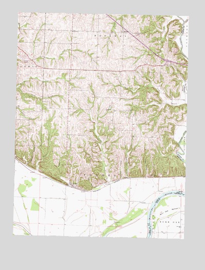
Forbes, MO USGS Topographic Map
Click on map above to begin viewing in our Map Viewer.

This topographic map contains these locations and features:
Feature Name Type Latitude Longitude GNIS ID View Map
Barrett HollowValleyN39.9142°W95.1166°713698View Map
Brodback CemeteryCemeteryN39.9830°W95.0850°714735View Map
Burr Oak SchoolSchoolN39.8814°W95.0027°472816View Map
Culp School (historical)SchoolN39.9469°W95.1244°734322View Map
Dyer BranchStreamN39.9019°W95.0672°717223View Map
Easter CreekStreamN39.8944°W95.0236°717356View Map
ForbesPopulated PlaceN39.9028°W95.0828°718056View Map
Forbes CemeteryCemeteryN39.9150°W95.0872°718059View Map
Forbes CreekStreamN39.8906°W95.0264°718060View Map
Frank Milne DamDamN39.9167°W95.1053°761692View Map
Hicks HollowValleyN39.9089°W95.0294°719499View Map
Highland CemeteryCemeteryN39.9464°W95.0433°719563View Map
Highland School (historical)SchoolN39.9467°W95.0555°719581View Map
Lincoln CreekStreamN39.9950°W95.0041°721079View Map
Markt Air Strip Airport (historical)AirportN39.9681°W95.0670°758836View Map
Mayflower School (historical)SchoolN39.9711°W95.0383°734324View Map
McWilliams CreekStreamN39.9003°W95.0164°722176View Map
Meade CreekStreamN39.9981°W95.0053°722179View Map
Milne LakeReservoirN39.9167°W95.1053°761693View Map
Monarch School (historical)SchoolN39.9508°W95.0116°722517View Map
Oak Grove School (historical)SchoolN39.9169°W95.0416°734325View Map
Pierce School (historical)SchoolN39.9322°W95.0866°734323View Map
Pullen BranchStreamN39.8953°W95.0441°724988View Map
RichvillePopulated PlaceN39.9897°W95.0478°741197View Map
Riverbreaks Conservation AreaParkN39.9306°W95.1203°2093188View Map
Thorp BranchStreamN39.9581°W95.1247°727620View Map
Township of ForbesCivilN39.9165°W95.0659°766764View Map
Whales CreekStreamN39.8883°W95.0580°728672View Map
White School (historical)SchoolN39.9569°W95.0869°734321View Map
Wood School (historical)SchoolN39.9908°W95.0866°734320View Map
Woodville ChurchChurchN39.9900°W95.0853°729134View Map

Note: Coordinates in the location and feature list above are referenced to NAD83 datum.


Copyright (C) 2008-2025 Ryan Niemi / Sunset Dynamics ... All Rights Reserved