TopoQuest Logo
Do you find TopoQuest useful?
Help keep TopoQuest running and adding new maps/features by donating!
Bitcoin:  19c7KJd3qBynnjoSw5npx9KScwjBe4ifkT
Litecoin:  LXs6TkuXGGXo1vDsWCkWVdjQX94eUKd6ui
Home View Maps Find Maps Find Places Resources & Links


Fillmore, Missouri Topographic Map

USGS Map Title: Fillmore, MO
USGS Map MRC: 40094A8
DRG (GeoTIFF) Download: o40094a8.tif


Neighboring USGS Topographic Map Quads:


  Maitland, MO  
40095B1
 

  Bolckow NW, MO  
40094B8
 

  Barnard, MO  
40094B7
 

  New Point, MO  
40095A1
 

  Fillmore, MO  
40094A8
 

  Bolckow, MO  
40094A7
 

  Forbes, MO  
39095H1
 

  Amazonia, MO  
39094H8
 

  Savannah, MO  
39094H7


Map MRC Location:

N41°
W95°
N41°
W94°
H8 H7 H6 H5 H4 H3 H2 H1
G8 G7 G6 G5 G4 G3 G2 G1
F8 F7 F6 F5 F4 F3 F2 F1
E8 E7 E6 E5 E4 E3 E2 E1
D8 D7 D6 D5 D4 D3 D2 D1
C8 C7 C6 C5 C4 C3 C2 C1
B8 B7 B6 B5 B4 B3 B2 B1
A8 A7 A6 A5 A4 A3 A2 A1
N40°
W95°
N40°
W94°

Fillmore, MO USGS 1:24K Topographic Map Preview:
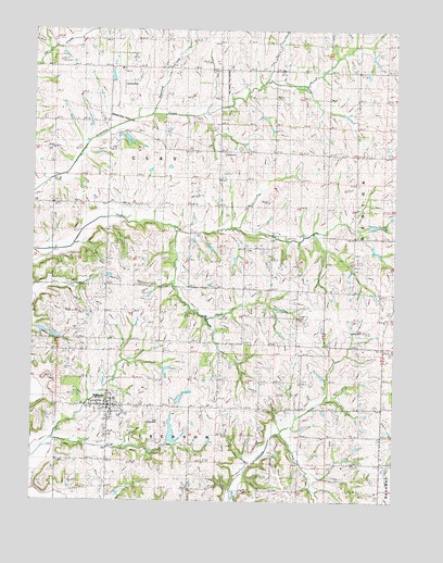
Fillmore, MO USGS Topographic Map
Click on map above to begin viewing in our Map Viewer.

This topographic map contains these locations and features:
Feature Name Type Latitude Longitude GNIS ID View Map
Antioch ChurchChurchN40.0939°W94.9939°713343View Map
Arapahoe School (historical)SchoolN40.1003°W94.9550°713365View Map
Carr School (historical)SchoolN40.0419°W94.8911°715429View Map
City of FillmoreCivilN40.0253°W94.9731°2394765View Map
Cole LakeReservoirN40.0178°W94.9517°762440View Map
Cole Lake DamDamN40.0150°W94.9519°762439View Map
Cole Landing Strip (historical)AirportN40.0205°W94.9564°741834View Map
Dysart LakeReservoirN40.0960°W94.9676°761722View Map
Dysart Lake DamDamN40.0967°W94.9686°761721View Map
FillmorePopulated PlaceN40.0253°W94.9736°717912View Map
Fillmore CemeteryCemeteryN40.0181°W94.9745°2681279View Map
Fillmore Fire Protection DistrictBuildingN40.0253°W94.9740°2621559View Map
Fillmore Post OfficePost OfficeN40.0250°W94.9734°2782625View Map
Fleming SchoolSchoolN40.0700°W94.8872°718012View Map
Furst Landing Strip (historical)AirportN40.0467°W94.8836°741833View Map
Gravel Wall School (historical)SchoolN40.0636°W94.9277°718746View Map
Housman School (historical)SchoolN40.1083°W94.9164°719896View Map
Lazy W Farms Airport (historical)AirportN40.1083°W94.9711°758681View Map
Newland CreekStreamN40.1025°W94.9594°723336View Map
Nida (historical)Populated PlaceN40.0103°W94.8922°740184View Map
North Andrew Elementary SchoolSchoolN40.0389°W94.8767°2545360View Map
North Andrew High SchoolSchoolN40.0392°W94.8762°2545368View Map
North Andrew Middle SchoolSchoolN40.0387°W94.8773°2545112View Map
North Star School (historical)SchoolN40.0575°W94.9797°723499View Map
Parker (historical)LocaleN40.1150°W95.0000°740185View Map
Parker Post OfficePost OfficeN40.1150°W95.0000°759702View Map
Prairie Temple Church (historical)ChurchN40.0925°W94.8902°724883View Map
RankinPopulated PlaceN40.0672°W94.9177°759703View Map
Smith LakeReservoirN40.0732°W94.8826°762746View Map
Smith Lake DamDamN40.0733°W94.8852°762745View Map
Stone Church School (historical)SchoolN40.0033°W94.9736°727133View Map
Township of ClayCivilN40.0864°W94.9704°766221View Map
Township of JacksonCivilN40.0051°W94.9436°766223View Map
Union SchoolSchoolN40.0167°W94.8889°728046View Map
Wade School (historical)SchoolN40.0794°W94.9928°730241View Map
West Star School (historical)SchoolN40.0244°W94.9355°728629View Map

Note: Coordinates in the location and feature list above are referenced to NAD83 datum.


Copyright (C) 2008-2025 Ryan Niemi / Sunset Dynamics ... All Rights Reserved