TopoQuest Logo
Do you find TopoQuest useful?
Help keep TopoQuest running and adding new maps/features by donating!
Bitcoin:  19c7KJd3qBynnjoSw5npx9KScwjBe4ifkT
Litecoin:  LXs6TkuXGGXo1vDsWCkWVdjQX94eUKd6ui
Home View Maps Find Maps Find Places Resources & Links


Forest Glen, California Topographic Map

USGS Map Title: Forest Glen, CA
USGS Map MRC: 40123C3
DRG (GeoTIFF) Download: o40123c3.tif


Neighboring USGS Topographic Map Quads:


  Sportshaven, CA  
40123D4
 

  Naufus Creek, CA  
40123D3
 

  Dubakella Mountain, CA  
40123D1
 

  Ruth Lake, CA  
40123C4
 

  Forest Glen, CA  
40123C3
 

  Pony Buck Peak, CA  
40123C1
 

  Zenia, CA  
40123B4
 

  Shannon Butte, CA  
40123B3
 

  Black Rock Mountain, CA  
40123B1


Map MRC Location:

N41°
W124°
N41°
W123°
H8 H7 H6 H5 H4 H3 H2 H1
G8 G7 G6 G5 G4 G3 G2 G1
F8 F7 F6 F5 F4 F3 F2 F1
E8 E7 E6 E5 E4 E3 E2 E1
D8 D7 D6 D5 D4 D3 D2 D1
C8 C7 C6 C5 C4 C3 C2 C1
B8 B7 B6 B5 B4 B3 B2 B1
A8 A7 A6 A5 A4 A3 A2 A1
N40°
W124°
N40°
W123°

Forest Glen, CA USGS 1:24K Topographic Map Preview:
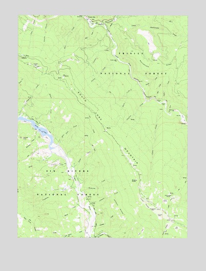
Forest Glen, CA USGS Topographic Map
Click on map above to begin viewing in our Map Viewer.

This topographic map contains these locations and features:
Feature Name Type Latitude Longitude GNIS ID View Map
Anada CreekStreamN40.2879°W123.3367°256232View Map
Barnes CreekStreamN40.2690°W123.3292°256537View Map
Bee Tree FlatFlatN40.3218°W123.2597°256786View Map
Blue Slide CreekStreamN40.3007°W123.3472°257280View Map
Cable CreekStreamN40.3215°W123.2675°257808View Map
Charlton CreekStreamN40.3274°W123.2817°258223View Map
Chinquapin ButteSummitN40.2726°W123.2617°258325View Map
Choptoy CreekStreamN40.3179°W123.3747°258346View Map
Clover GulchValleyN40.2904°W123.3414°258476View Map
Collins CreekStreamN40.3576°W123.3036°258596View Map
Cutler ThickerAreaN40.2707°W123.2831°259002View Map
Dashields CreekStreamN40.2754°W123.3284°259070View Map
Deep Hollow CreekStreamN40.2543°W123.3217°259193View Map
Devils ElbowBendN40.3199°W123.2642°259308View Map
Double Cabin FlatFlatN40.3488°W123.3039°259506View Map
Farley CreekStreamN40.3507°W123.3034°260051View Map
Fern CampgroundLocaleN40.3404°W123.3425°260081View Map
Forest GlenPopulated PlaceN40.3732°W123.3253°1656025View Map
Forest Glen Post Office (historical)Post OfficeN40.3732°W123.3253°1940066View Map
Glen CreekStreamN40.3740°W123.3286°260598View Map
Hall GateBendN40.3704°W123.3170°261023View Map
Hell Gate Recreation SiteLocaleN40.3701°W123.3150°1655233View Map
Hobart CreekStreamN40.3115°W123.3584°261377View Map
Hobart Creek Recreation SiteLocaleN40.3124°W123.3592°1655231View Map
Hoffman FlatFlatN40.3246°W123.2686°261390View Map
Holly CreekStreamN40.2993°W123.3517°261424View Map
Horse PastureFlatN40.2718°W123.2670°261499View Map
Horse Ridge LookoutLocaleN40.2601°W123.2631°275164View Map
Joe BasinBasinN40.2568°W123.2586°261956View Map
Johnson CreekStreamN40.2679°W123.3259°261969View Map
Johnson GladesFlatN40.2674°W123.3014°261979View Map
Jonathan CreekStreamN40.2568°W123.3175°261994View Map
La Flume BasinBasinN40.2640°W123.2709°262252View Map
Little Rattlesnake CreekStreamN40.3732°W123.3042°262695View Map
Long GladeFlatN40.2532°W123.2847°262829View Map
Marie CreekStreamN40.3368°W123.2872°263208View Map
Marshall CreekStreamN40.3090°W123.3611°263226View Map
Marshall RockPillarN40.3060°W123.3725°263231View Map
Montgomery BasinBasinN40.2671°W123.2761°263767View Map
Mud CreekStreamN40.3676°W123.3217°263920View Map
Peyton CreekStreamN40.3263°W123.2697°264675View Map
Pickett PeakSummitN40.3454°W123.3631°264703View Map
Pickett Peak CampgroundLocaleN40.3510°W123.3736°264704View Map
Pickett peak LookoutLocaleN40.3457°W123.3634°275163View Map
Rattlesnake CreekStreamN40.3696°W123.3128°265207View Map
Rattlesnake PointCapeN40.3282°W123.2797°265227View Map
Rattlesnake RidgeRidgeN40.3460°W123.2747°267163View Map
Rough Gulch TrailTrailN40.2757°W123.2597°265593View Map
Rowski CreekStreamN40.3349°W123.2856°265635View Map
RuthPopulated PlaceN40.2696°W123.3214°1656270View Map
Ruth Census Designated PlaceCensusN40.2943°W123.3483°2628787View Map
Ruth Hayfork TrailTrailN40.3074°W123.3222°265696View Map
Scott FlatFlatN40.3646°W123.3086°265940View Map
Silver Creek Ranch AirportAirportN40.3166°W123.2532°1653453View Map
Silver FlatFlatN40.3174°W123.2536°266185View Map
Southern Trinity Area Rescue SubstationBuildingN40.2520°W123.3110°2662210View Map
Spot CreekStreamN40.3285°W123.2750°267580View Map
Stockton FlatFlatN40.3274°W123.2711°267759View Map
Taylor FlatFlatN40.3690°W123.3211°268103View Map
Terral RanchLocaleN40.3263°W123.3706°1665697View Map
Tompkins CreekStreamN40.2782°W123.3322°268347View Map
Wiregrass SpringsSpringN40.2835°W123.2909°269257View Map

Note: Coordinates in the location and feature list above are referenced to NAD83 datum.


Copyright (C) 2008-2025 Ryan Niemi / Sunset Dynamics ... All Rights Reserved