TopoQuest Logo
Do you find TopoQuest useful?
Help keep TopoQuest running and adding new maps/features by donating!
Bitcoin:  19c7KJd3qBynnjoSw5npx9KScwjBe4ifkT
Litecoin:  LXs6TkuXGGXo1vDsWCkWVdjQX94eUKd6ui
Home View Maps Find Maps Find Places Resources & Links


Zenia, California Topographic Map

USGS Map Title: Zenia, CA
USGS Map MRC: 40123B4
DRG (GeoTIFF) Download: o40123b4.tif


Neighboring USGS Topographic Map Quads:


  Black Lassic, CA  
40123C5
 

  Ruth Lake, CA  
40123C4
 

  Forest Glen, CA  
40123C3
 

  Alderpoint, CA  
40123B5
 

  Zenia, CA  
40123B4
 

  Shannon Butte, CA  
40123B3
 

  Jewett Rock, CA  
40123A5
 

  Lake Mountain, CA  
40123A4
 

  Long Ridge, CA  
40123A3


Map MRC Location:

N41°
W124°
N41°
W123°
H8 H7 H6 H5 H4 H3 H2 H1
G8 G7 G6 G5 G4 G3 G2 G1
F8 F7 F6 F5 F4 F3 F2 F1
E8 E7 E6 E5 E4 E3 E2 E1
D8 D7 D6 D5 D4 D3 D2 D1
C8 C7 C6 C5 C4 C3 C2 C1
B8 B7 B6 B5 B4 B3 B2 B1
A8 A7 A6 A5 A4 A3 A2 A1
N40°
W124°
N40°
W123°

Zenia, CA USGS 1:24K Topographic Map Preview:
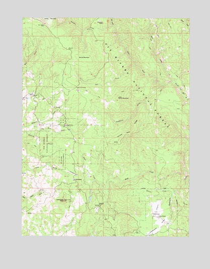
Zenia, CA USGS Topographic Map
Click on map above to begin viewing in our Map Viewer.

This topographic map contains these locations and features:
Feature Name Type Latitude Longitude GNIS ID View Map
Atkinson Historical SiteLocaleN40.1676°W123.3920°275995View Map
Atkinson SpringSpringN40.1993°W123.4084°276002View Map
Bar CreekStreamN40.2449°W123.4334°266413View Map
Bear Lake (historical)ReservoirN40.2382°W123.4722°1665559View Map
Bear Lake CampLocaleN40.2321°W123.4667°218859View Map
Bear SpringSpringN40.2385°W123.4750°276000View Map
Bear Wallow CampLocaleN40.2454°W123.4850°218901View Map
Bear Wallow SpringSpringN40.2474°W123.4925°275999View Map
Bluff CreekStreamN40.1632°W123.3795°219541View Map
Bollman LakeLakeN40.1462°W123.4499°275997View Map
Bradburn CreekStreamN40.2114°W123.3956°219756View Map
Clover School (historical)SchoolN40.1360°W123.3992°221246View Map
Double Gate RidgeRidgeN40.1840°W123.4203°222546View Map
East Fork North Fork Eel RiverStreamN40.2135°W123.3872°252114View Map
French LakeLakeN40.1801°W123.4614°276003View Map
Hell'er High Water AirportAirportN40.1385°W123.4014°1654139View Map
Hoaglin-Zenia Elementary SchoolSchoolN40.1885°W123.4681°225373View Map
KettenpomPopulated PlaceN40.1574°W123.4609°252711View Map
Kettenpom PeakSummitN40.1454°W123.4697°226543View Map
Kettenpom Peak LookoutTowerN40.1451°W123.4697°275996View Map
Kettenpom ValleyValleyN40.1376°W123.3895°226544View Map
Little Round MountainSummitN40.2032°W123.4295°227352View Map
Panther CreekStreamN40.2449°W123.4331°230299View Map
Panther RockPillarN40.2471°W123.4409°230313View Map
Peak School (historical)SchoolN40.1390°W123.4964°1732927View Map
Robbers RoostSummitN40.1421°W123.4434°231671View Map
Round MountainSummitN40.2265°W123.4572°1659554View Map
Salt CreekStreamN40.2229°W123.4175°232302View Map
Shannon RanchLocaleN40.1382°W123.4025°232861View Map
West Fork North Fork Eel RiverStreamN40.2135°W123.3872°1966467View Map
Wilson CreekStreamN40.1504°W123.3872°237961View Map
Yew Wood CreekStreamN40.1846°W123.4984°238257View Map
ZeniaPopulated PlaceN40.2054°W123.4920°252841View Map
Zenia Guard StationLocaleN40.2101°W123.4606°238313View Map
Zenia Kettenpom Volunteer Fire DepartmentBuildingN40.1729°W123.4629°2621977View Map
Zenia Post OfficePost OfficeN40.2053°W123.4914°2760075View Map

Note: Coordinates in the location and feature list above are referenced to NAD83 datum.


Copyright (C) 2008-2025 Ryan Niemi / Sunset Dynamics ... All Rights Reserved