TopoQuest Logo
Do you find TopoQuest useful?
Help keep TopoQuest running and adding new maps/features by donating!
Bitcoin:  19c7KJd3qBynnjoSw5npx9KScwjBe4ifkT
Litecoin:  LXs6TkuXGGXo1vDsWCkWVdjQX94eUKd6ui
Home View Maps Find Maps Find Places Resources & Links


Shannon Butte, California Topographic Map

USGS Map Title: Shannon Butte, CA
USGS Map MRC: 40123B3
DRG (GeoTIFF) Download: o40123b3.tif


Neighboring USGS Topographic Map Quads:


  Ruth Lake, CA  
40123C4
 

  Forest Glen, CA  
40123C3
 

  Pony Buck Peak, CA  
40123C1
 

  Zenia, CA  
40123B4
 

  Shannon Butte, CA  
40123B3
 

  Black Rock Mountain, CA  
40123B1
 

  Lake Mountain, CA  
40123A4
 

  Long Ridge, CA  
40123A3
 

  Four Corners Rock, CA  
40123A1


Map MRC Location:

N41°
W124°
N41°
W123°
H8 H7 H6 H5 H4 H3 H2 H1
G8 G7 G6 G5 G4 G3 G2 G1
F8 F7 F6 F5 F4 F3 F2 F1
E8 E7 E6 E5 E4 E3 E2 E1
D8 D7 D6 D5 D4 D3 D2 D1
C8 C7 C6 C5 C4 C3 C2 C1
B8 B7 B6 B5 B4 B3 B2 B1
A8 A7 A6 A5 A4 A3 A2 A1
N40°
W124°
N40°
W123°

Shannon Butte, CA USGS 1:24K Topographic Map Preview:
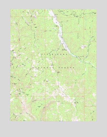
Shannon Butte, CA USGS Topographic Map
Click on map above to begin viewing in our Map Viewer.

This topographic map contains these locations and features:
Feature Name Type Latitude Longitude GNIS ID View Map
Armstrong CreekStreamN40.2229°W123.3031°218376View Map
Barry CreekStreamN40.1915°W123.2717°218704View Map
Barry Creek MineMineN40.1974°W123.2684°218705View Map
Barry Creek TrailTrailN40.2313°W123.2603°218706View Map
Beaver SlideSlopeN40.2007°W123.3175°218949View Map
Ben Arthur TrailTrailN40.2082°W123.3575°219022View Map
Blair CreekStreamN40.2338°W123.3061°219430View Map
Browns CampLocaleN40.2429°W123.3111°219900View Map
Cox CreekStreamN40.1571°W123.3603°221721View Map
Crabtree PlacePopulated PlaceN40.1535°W123.3514°1658341View Map
Double A RanchLocaleN40.2049°W123.2967°222542View Map
Dutchman CreekStreamN40.1765°W123.3731°222781View Map
Gilman CreekStreamN40.1940°W123.3717°224175View Map
Gilman RanchLocaleN40.2007°W123.3725°224178View Map
Horse RidgeRidgeN40.2390°W123.2747°234034View Map
Kettenpom CreekStreamN40.1740°W123.3709°226542View Map
Littlefield CreekStreamN40.2499°W123.3175°266932View Map
Lynch CreekStreamN40.2449°W123.3447°227860View Map
Mad River DivisionCivilN40.1820°W123.2867°1935191View Map
Maple FlatFlatN40.2451°W123.2547°228059View Map
Maple SpringSpringN40.2463°W123.2544°1655232View Map
Packwood FlatFlatN40.1401°W123.3339°230226View Map
Perrys KnobSummitN40.2299°W123.3075°1659374View Map
Raglan FlatFlatN40.1874°W123.3564°231166View Map
Raglan GulchValleyN40.1707°W123.3597°231167View Map
Russ PlacePopulated PlaceN40.1457°W123.2789°1659559View Map
Ruth AirportAirportN40.2084°W123.2961°1653902View Map
Salt CreekStreamN40.1349°W123.3559°232313View Map
Shannon ButteSummitN40.1663°W123.3714°232860View Map
Shannon PlacePopulated PlaceN40.1546°W123.3622°1659631View Map
Smith CreekStreamN40.2313°W123.3053°233319View Map
Smith PeakSummitN40.2293°W123.3406°234716View Map
Soldier BasinBasinN40.2032°W123.3739°234857View Map
Soldier Basin TrailTrailN40.1896°W123.3722°234858View Map
Soldier CreekStreamN40.2032°W123.3742°234863View Map
Surveyor SpringSpringN40.2288°W123.3570°275168View Map
Tub CreekStreamN40.1674°W123.3450°255160View Map
Tub SpringSpringN40.1873°W123.3140°236585View Map
Van Horn CreekStreamN40.1910°W123.2689°237004View Map
Water Trough SpringSpringN40.2421°W123.2777°237329View Map
Wiregrass SpringSpringN40.1792°W123.3083°238070View Map
Yellowjacket CreekStreamN40.1399°W123.3547°238249View Map
Yellowjacket PlacePopulated PlaceN40.1693°W123.3236°1660212View Map

Note: Coordinates in the location and feature list above are referenced to NAD83 datum.


Copyright (C) 2008-2025 Ryan Niemi / Sunset Dynamics ... All Rights Reserved