TopoQuest Logo
Do you find TopoQuest useful?
Help keep TopoQuest running and adding new maps/features by donating!
Bitcoin:  19c7KJd3qBynnjoSw5npx9KScwjBe4ifkT
Litecoin:  LXs6TkuXGGXo1vDsWCkWVdjQX94eUKd6ui
Home View Maps Find Maps Find Places Resources & Links


Sportshaven, California Topographic Map

USGS Map Title: Sportshaven, CA
USGS Map MRC: 40123D4
DRG (GeoTIFF) Download: o40123d4.tif


Neighboring USGS Topographic Map Quads:


  Blake Mountain, CA  
40123E5
 

  Hyampom, CA  
40123E4
 

  Halfway Ridge, CA  
40123E3
 

  Dinsmore, CA  
40123D5
 

  Sportshaven, CA  
40123D4
 

  Naufus Creek, CA  
40123D3
 

  Black Lassic, CA  
40123C5
 

  Ruth Lake, CA  
40123C4
 

  Forest Glen, CA  
40123C3


Map MRC Location:

N41°
W124°
N41°
W123°
H8 H7 H6 H5 H4 H3 H2 H1
G8 G7 G6 G5 G4 G3 G2 G1
F8 F7 F6 F5 F4 F3 F2 F1
E8 E7 E6 E5 E4 E3 E2 E1
D8 D7 D6 D5 D4 D3 D2 D1
C8 C7 C6 C5 C4 C3 C2 C1
B8 B7 B6 B5 B4 B3 B2 B1
A8 A7 A6 A5 A4 A3 A2 A1
N40°
W124°
N40°
W123°

Sportshaven, CA USGS 1:24K Topographic Map Preview:
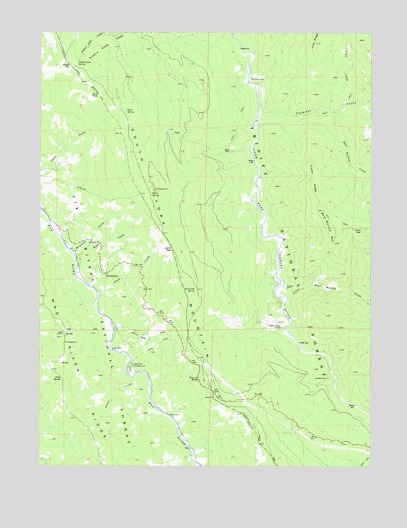
Sportshaven, CA USGS Topographic Map
Click on map above to begin viewing in our Map Viewer.

This topographic map contains these locations and features:
Feature Name Type Latitude Longitude GNIS ID View Map
Bear Wallow CreekStreamN40.4774°W123.3900°233474View Map
Bear Wallow MountainSummitN40.4393°W123.3895°233476View Map
Buck SpringSpringN40.4771°W123.4686°233563View Map
Cherry Glade CreekStreamN40.4160°W123.4739°233661View Map
Chris GapGapN40.4432°W123.3792°233673View Map
Feldmiller RanchLocaleN40.4474°W123.4889°276136View Map
Fisher RidgeRidgeN40.4579°W123.3984°233884View Map
Grace CreekStreamN40.4004°W123.4661°233943View Map
Graham PlacePopulated PlaceN40.4265°W123.4081°1659729View Map
Grunerts PlaceLocaleN40.4196°W123.4570°276140View Map
Hidden Valley RanchLocaleN40.4151°W123.4092°234008View Map
Jims CreekStreamN40.4790°W123.3836°234082View Map
Jims RidgeRidgeN40.4968°W123.3970°234083View Map
Klondike MineMineN40.4001°W123.3920°1659740View Map
Lamb GapGapN40.4376°W123.4511°234130View Map
Lemonade SpringSpringN40.4257°W123.4423°234154View Map
Little Bear Wallow CreekStreamN40.4268°W123.4089°234164View Map
Mad River CampgroundLocaleN40.4035°W123.4670°276139View Map
Mad River CampgroundLocaleN40.4032°W123.4667°234220View Map
Mad River Census Designated PlaceCensusN40.4320°W123.4924°2583071View Map
Mad River RidgeRidgeN40.4238°W123.4981°234221View Map
Maynard CreekStreamN40.4368°W123.4895°234256View Map
McClellan PlacePopulated PlaceN40.4871°W123.4200°1659748View Map
Miller PlacePopulated PlaceN40.4657°W123.4295°1659758View Map
Miller SpringSpringN40.4538°W123.4592°234304View Map
Miller Spring Recreation SiteLocaleN40.4526°W123.4584°276141View Map
Norgaar (historical)Populated PlaceN40.4157°W123.4081°1683010View Map
Norse ButteSummitN40.3999°W123.4386°1659767View Map
Oak GroveWoodsN40.4135°W123.4923°234398View Map
Olsen CreekStreamN40.4249°W123.4795°234412View Map
Pine ButteSummitN40.4004°W123.4925°1659779View Map
Plummer CreekStreamN40.4771°W123.4186°234486View Map
Rock CreekStreamN40.4335°W123.4873°234579View Map
Sand PlaceLocaleN40.4582°W123.4900°276137View Map
Sheep Camp SpringSpringN40.4908°W123.4875°234685View Map
Sids PlacePopulated PlaceN40.4190°W123.4567°1665696View Map
SportshavenLocaleN40.4301°W123.4759°235215View Map
Windy NipLocaleN40.4901°W123.4900°238026View Map

Note: Coordinates in the location and feature list above are referenced to NAD83 datum.


Copyright (C) 2008-2025 Ryan Niemi / Sunset Dynamics ... All Rights Reserved