TopoQuest Logo
Do you find TopoQuest useful?
Help keep TopoQuest running and adding new maps/features by donating!
Bitcoin:  19c7KJd3qBynnjoSw5npx9KScwjBe4ifkT
Litecoin:  LXs6TkuXGGXo1vDsWCkWVdjQX94eUKd6ui
Home View Maps Find Maps Find Places Resources & Links


Southeast Pontiac, Illinois Topographic Map

USGS Map Title: Southeast Pontiac, IL
USGS Map MRC: 40088G5
DRG (GeoTIFF) Download: o40088g5.tif


Neighboring USGS Topographic Map Quads:


  Northwest Pontiac, IL  
40088H6
 

  Northeast Pontiac, IL  
40088H5
 

  Saunemin, IL  
40088H4
 

  Southwest Pontiac, IL  
40088G6
 

  Southeast Pontiac, IL  
40088G5
 

  Forrest North, IL  
40088G4
 

  Chenoa, IL  
40088F6
 

  Fairbury, IL  
40088F5
 

  Forrest South, IL  
40088F4


Map MRC Location:

N41°
W89°
N41°
W88°
H8 H7 H6 H5 H4 H3 H2 H1
G8 G7 G6 G5 G4 G3 G2 G1
F8 F7 F6 F5 F4 F3 F2 F1
E8 E7 E6 E5 E4 E3 E2 E1
D8 D7 D6 D5 D4 D3 D2 D1
C8 C7 C6 C5 C4 C3 C2 C1
B8 B7 B6 B5 B4 B3 B2 B1
A8 A7 A6 A5 A4 A3 A2 A1
N40°
W89°
N40°
W88°

Southeast Pontiac, IL USGS 1:24K Topographic Map Preview:
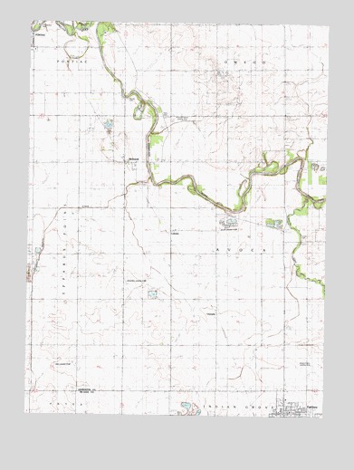
Southeast Pontiac, IL USGS Topographic Map
Click on map above to begin viewing in our Map Viewer.

This topographic map contains these locations and features:
Feature Name Type Latitude Longitude GNIS ID View Map
Apostolic Christian ChurchChurchN40.7548°W88.5112°1737538View Map
Avoca (historical)Populated PlaceN40.8061°W88.5181°1737540View Map
Avoca CemeteryCemeteryN40.8064°W88.5098°1719380View Map
Avoca Church (historical)ChurchN40.8067°W88.5101°403761View Map
Avoca School (historical)SchoolN40.8017°W88.5273°403763View Map
Bakers Corner School (historical)SchoolN40.7731°W88.5642°403840View Map
Brick School (historical)SchoolN40.8025°W88.6028°404845View Map
Brights Corner School (historical)SchoolN40.7742°W88.5270°404870View Map
Camp-Humiston PoolParkN40.8745°W88.6226°1737546View Map
ChamplinPopulated PlaceN40.7831°W88.5459°422540View Map
Chautauqua ParkParkN40.8736°W88.6228°1719386View Map
Fairbury QuarryMineN40.7511°W88.5559°1985973View Map
Ficklin-Airtech AirportAirportN40.7636°W88.5060°427269View Map
Frederick Landing Strip (historical)AirportN40.7925°W88.5792°1719392View Map
Gilpin School (historical)SchoolN40.8392°W88.5001°409033View Map
Grace Episcopal ChurchChurchN40.8661°W88.6231°1737604View Map
Hickory CreekStreamN40.7523°W88.5856°410142View Map
Houder CemeteryCemeteryN40.8506°W88.5843°410619View Map
Lake Side School (historical)SchoolN40.7711°W88.6037°411734View Map
LodemiaPopulated PlaceN40.8073°W88.5659°422918View Map
Martimore School (historical)SchoolN40.8614°W88.5178°413059View Map
McDowellPopulated PlaceN40.8306°W88.5851°413252View Map
McDowell Methodist ChurchChurchN40.8303°W88.5817°1737622View Map
Morrison School (historical)SchoolN40.8450°W88.5467°413848View Map
Norman Rittenhouse HeliportAirportN40.7575°W88.5134°427271View Map
North Fork Vermilion RiverStreamN40.8198°W88.5081°414611View Map
Owega Church (historical)ChurchN40.8606°W88.5089°415270View Map
Patty CemeteryCemeteryN40.8450°W88.5684°415457View Map
Pick Landing Strip (historical)AirportN40.7661°W88.6092°1719409View Map
Prairie Central High SchoolSchoolN40.7520°W88.5064°1737652View Map
Riverode Farms AirportAirportN40.8443°W88.5647°427703View Map
Smith BranchStreamN40.8748°W88.6095°418615View Map
South Fork Vermilion RiverStreamN40.8198°W88.5081°418778View Map
Taylor School (historical)SchoolN40.8520°W88.6109°419569View Map
Township of AvocaCivilN40.8021°W88.5270°428625View Map
Wayne Ziller Jr AirportAirportN40.8089°W88.5452°427272View Map

Note: Coordinates in the location and feature list above are referenced to NAD83 datum.


Copyright (C) 2008-2024 Ryan Niemi / Sunset Dynamics ... All Rights Reserved