TopoQuest Logo
Do you find TopoQuest useful?
Help keep TopoQuest running and adding new maps/features by donating!
Bitcoin:  19c7KJd3qBynnjoSw5npx9KScwjBe4ifkT
Litecoin:  LXs6TkuXGGXo1vDsWCkWVdjQX94eUKd6ui
Home View Maps Find Maps Find Places Resources & Links


Fort Howes, Montana Topographic Map

USGS Map Title: Fort Howes, MT
USGS Map MRC: 45106C2
DRG (GeoTIFF) Download: o45106c2.tif


Neighboring USGS Topographic Map Quads:


  Green Creek, MT  
45106D3
 

  King Mountain, MT  
45106D2
 

  Yager Butte, MT  
45106D1
 

  Poker Jim Butte, MT  
45106C3
 

  Fort Howes, MT  
45106C2
 

  Goodspeed Butte, MT  
45106C1
 

  Hamilton Draw, MT  
45106B3
 

  Otter, MT  
45106B2
 

  Reanus Cone, MT  
45106B1


Map MRC Location:

N46°
W107°
N46°
W106°
H8 H7 H6 H5 H4 H3 H2 H1
G8 G7 G6 G5 G4 G3 G2 G1
F8 F7 F6 F5 F4 F3 F2 F1
E8 E7 E6 E5 E4 E3 E2 E1
D8 D7 D6 D5 D4 D3 D2 D1
C8 C7 C6 C5 C4 C3 C2 C1
B8 B7 B6 B5 B4 B3 B2 B1
A8 A7 A6 A5 A4 A3 A2 A1
N45°
W107°
N45°
W106°

Fort Howes, MT USGS 1:24K Topographic Map Preview:
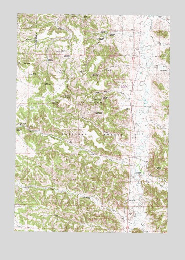
Fort Howes, MT USGS Topographic Map
Click on map above to begin viewing in our Map Viewer.

This topographic map contains these locations and features:
Feature Name Type Latitude Longitude GNIS ID View Map
05S45E26DBAC01 WellWellN45.3717°W106.1403°809152View Map
05S45E26DBAD01 WellWellN45.3722°W106.1403°809153View Map
05S45E26DBAD02 WellWellN45.3717°W106.1395°809151View Map
05S45E27BDDB01 WellWellN45.3744°W106.1675°809175View Map
05S45E27DDC_01 WellWellN45.3733°W106.1967°809164View Map
05S45E29ADDC01 SpringSpringN45.3736°W106.2050°809166View Map
05S45E29BDDD01 SpringSpringN45.3736°W106.2061°809167View Map
05S45E32BABB01 WellWellN45.3658°W106.2100°809112View Map
05S45E35BAAC01 WellWellN45.3647°W106.1464°809104View Map
05S45E35BABA01 WellWellN45.3656°W106.1475°809109View Map
05S45E35BABD01 WellWellN45.3650°W106.1470°809106View Map
05S45E35BCDC01 WellWellN45.3589°W106.1511°809082View Map
06S45E35CADD01 WellWellN45.2700°W106.1889°808663View Map
06S46E17CDAD01 WellWellN45.3111°W106.1281°808858View Map
06S46E18CBDD01 SpringSpringN45.3122°W106.1533°808867View Map
07S45E04CCCC01 WellWellN45.2522°W106.2089°808588View Map
07S46E06CACD01 WellWellN45.2547°W106.1503°808596View Map
Ash CreekStreamN45.3631°W106.1433°779159View Map
Butch SpringSpringN45.3597°W106.2373°780673View Map
Coal CreekStreamN45.3642°W106.1458°781433View Map
Coal Creek ReservoirReservoirN45.3610°W106.1846°781444View Map
Cow CreekStreamN45.2880°W106.1514°781782View Map
Cow Creek CampgroundLocaleN45.3103°W106.2445°781789View Map
Cow Creek ReservoirReservoirN45.3102°W106.2473°781790View Map
Cow Creek SpringSpringN45.3083°W106.2499°781791View Map
Cub Creek WellWellN45.2522°W106.2397°781978View Map
Cy SpringSpringN45.2804°W106.2050°782014View Map
Doubtful ReservoirReservoirN45.3508°W106.2075°782506View Map
Dry GulchValleyN45.3147°W106.1425°782629View Map
Dry Gulch WellWellN45.3111°W106.1278°782641View Map
Dunning ReservoirReservoirN45.3650°W106.1775°782713View Map
Dunning SpringSpringN45.3635°W106.1748°782714View Map
First CreekStreamN45.2994°W106.1495°783415View Map
First Creek SpringSpringN45.3237°W106.2215°783419View Map
First SpringSpringN45.3736°W106.2061°783422View Map
Fort Howes (historical)MilitaryN45.2833°W106.1481°794937View Map
Fort Howes Ranger StationLocaleN45.3006°W106.1550°783614View Map
Gate CreekStreamN45.3503°W106.1470°783859View Map
Gate Creek Spring Number OneSpringN45.3436°W106.1784°783862View Map
Gate Creek Spring Number TwoSpringN45.3399°W106.1883°783863View Map
Gumbo Point SpringSpringN45.3124°W106.1532°784408View Map
Horse CreekStreamN45.2561°W106.1522°785033View Map
Horse Creek WellWellN45.2700°W106.1886°785044View Map
Indian CreekStreamN45.2569°W106.1472°785252View Map
Lost SpringSpringN45.3462°W106.2449°786635View Map
Lyon CreekStreamN45.3461°W106.1414°786741View Map
Lyon Creek WellWellN45.3433°W106.1272°786744View Map
Otter Creek School (historical)SchoolN45.2686°W106.1581°788514View Map
Paget Reservoir Number ThreeReservoirN45.3538°W106.2118°788572View Map
Paget Spring Number FourSpringN45.3345°W106.2272°788578View Map
Paget Spring Number OneSpringN45.3418°W106.2124°788575View Map
Paget Spring Number ThreeSpringN45.3400°W106.2347°788577View Map
Paget Spring Number TwoSpringN45.3735°W106.1967°788576View Map
Peggy SpringSpringN45.3266°W106.1873°788745View Map
Perry SpringSpringN45.3677°W106.2379°788771View Map
Perry WellWellN45.3658°W106.2103°788772View Map
Rock Job SpringSpringN45.3417°W106.1997°789703View Map
Simon ReservoirReservoirN45.3487°W106.2249°790540View Map
Stag RockSummitN45.3211°W106.1578°791411View Map
Stag Rock CreekStreamN45.3278°W106.1464°791412View Map
Stag Rock MountainSummitN45.3189°W106.1853°791413View Map
Stag Rock SpringSpringN45.3273°W106.1797°791414View Map
Stag Rock Spring Number TwoSpringN45.3278°W106.2109°791415View Map
Taylor ButteSummitN45.2875°W106.1350°791903View Map
Taylor CreekStreamN45.2858°W106.1481°791911View Map

Note: Coordinates in the location and feature list above are referenced to NAD83 datum.


Copyright (C) 2008-2025 Ryan Niemi / Sunset Dynamics ... All Rights Reserved