TopoQuest Logo
Do you find TopoQuest useful?
Help keep TopoQuest running and adding new maps/features by donating!
Bitcoin:  19c7KJd3qBynnjoSw5npx9KScwjBe4ifkT
Litecoin:  LXs6TkuXGGXo1vDsWCkWVdjQX94eUKd6ui
Home View Maps Find Maps Find Places Resources & Links


Reanus Cone, Montana Topographic Map

USGS Map Title: Reanus Cone, MT
USGS Map MRC: 45106B1
DRG (GeoTIFF) Download: o45106b1.tif


Neighboring USGS Topographic Map Quads:


  Fort Howes, MT  
45106C2
 

  Goodspeed Butte, MT  
45106C1
 

  Phillips Butte, MT  
45105C8
 

  Otter, MT  
45106B2
 

  Reanus Cone, MT  
45106B1
 

  Sayle, MT  
45105B8
 

  Bear Creek School, MT  
45106A2
 

  Sayle Hall, MT  
45106A1
 

  Bradshaw Creek, MT  
45105A8


Map MRC Location:

N46°
W107°
N46°
W106°
H8 H7 H6 H5 H4 H3 H2 H1
G8 G7 G6 G5 G4 G3 G2 G1
F8 F7 F6 F5 F4 F3 F2 F1
E8 E7 E6 E5 E4 E3 E2 E1
D8 D7 D6 D5 D4 D3 D2 D1
C8 C7 C6 C5 C4 C3 C2 C1
B8 B7 B6 B5 B4 B3 B2 B1
A8 A7 A6 A5 A4 A3 A2 A1
N45°
W107°
N45°
W106°

Reanus Cone, MT USGS 1:24K Topographic Map Preview:
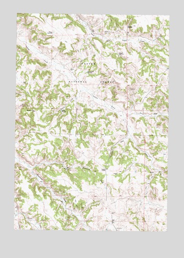
Reanus Cone, MT USGS Topographic Map
Click on map above to begin viewing in our Map Viewer.

This topographic map contains these locations and features:
Feature Name Type Latitude Longitude GNIS ID View Map
02S45E25DAC_01 SpringSpringN45.1283°W106.1125°808064View Map
07S46E11CACA01 WellWellN45.2436°W106.0683°808553View Map
08S46E01CDAC01 WellWellN45.1619°W106.0320°808241View Map
08S46E02AABC01 SpringSpringN45.1728°W106.0450°808305View Map
08S46E02ABCC01 SpringSpringN45.1714°W106.0489°808298View Map
08S46E02BDDC01 SpringSpringN45.1678°W106.0520°808271View Map
08S46E02DBCD01 WellWellN45.1639°W106.0486°808253View Map
08S46E04DACC01 WellWellN45.1644°W106.0847°808256View Map
08S46E04DDDB01 SpringSpringN45.1608°W106.0829°808236View Map
08S46E05CBDC01 WellWellN45.1639°W106.1186°808255View Map
08S46E05DADD01 WellWellN45.1639°W106.1020°808254View Map
08S46E05DDAB01 SpringSpringN45.1630°W106.1031°808246View Map
08S46E11AA__01 WellWellN45.1564°W106.0411°808215View Map
08S46E13AADC01 SpringSpringN45.1417°W106.0208°808150View Map
08S46E13BAAD01 SpringSpringN45.1436°W106.0311°808165View Map
08S46E15CDBA01 SpringSpringN45.1339°W106.0736°808103View Map
08S46E15CDBB01 SpringSpringN45.1339°W106.0725°808102View Map
08S46E16DABA01 WellWellN45.1375°W106.0842°808125View Map
08S46E17CBCD01 WellWellN45.1344°W106.1200°808108View Map
08S46E17CBCD02 WellWellN45.1347°W106.1200°808109View Map
08S46E17CDBC01 WellWellN45.1330°W106.1159°808095View Map
08S46E17CDCA01 SpringSpringN45.1314°W106.1145°808084View Map
08S46E17CDDC01 SpringSpringN45.1308°W106.1142°808080View Map
08S46E18DDAC01 WellWellN45.1330°W106.1234°808097View Map
08S46E18DDAC02 WellWellN45.1333°W106.1242°808099View Map
08S46E18DDAD01 WellWellN45.1330°W106.1228°808096View Map
08S46E23ABAB01 WellWellN45.1305°W106.0450°808078View Map
08S47E06BCAB01 WellWellN45.1703°W106.0161°808288View Map
08S47E07BAAB01 SpringSpringN45.1590°W106.0121°808224View Map
08S47E07CCBD01 WellWellN45.1469°W106.0181°808179View Map
Billup SchoolSchoolN45.1305°W106.0450°779918View Map
Howes ReservoirReservoirN45.2391°W106.0956°785117View Map
Indian Creek ReservoirReservoirN45.2166°W106.0674°785262View Map
Little Bradshaw CreekStreamN45.1611°W106.1128°786251View Map
North Fork Indian CreekStreamN45.1922°W106.0372°788189View Map
Pasture CreekStreamN45.1350°W106.1231°788678View Map
Reanus ConeSummitN45.1936°W106.1100°789429View Map
Reanus CreekStreamN45.2072°W106.0711°789430View Map
Reanus ReservoirReservoirN45.1945°W106.0882°789431View Map
Reanus WellWellN45.2178°W106.0811°789432View Map
Seymour ReservoirReservoirN45.2429°W106.0349°790258View Map
South Fork North Prong Indian CreekStreamN45.1919°W106.0111°1689978View Map
Stewart ReservoirReservoirN45.2267°W106.0416°791515View Map
Thompson DrawValleyN45.1850°W106.0331°792089View Map
Yonkee CutoffLocaleN45.1605°W106.0511°793617View Map

Note: Coordinates in the location and feature list above are referenced to NAD83 datum.


Copyright (C) 2008-2024 Ryan Niemi / Sunset Dynamics ... All Rights Reserved