TopoQuest Logo
Do you find TopoQuest useful?
Help keep TopoQuest running and adding new maps/features by donating!
Bitcoin:  19c7KJd3qBynnjoSw5npx9KScwjBe4ifkT
Litecoin:  LXs6TkuXGGXo1vDsWCkWVdjQX94eUKd6ui
Home View Maps Find Maps Find Places Resources & Links


Fort Miller, New York Topographic Map

USGS Map Title: Fort Miller, NY
USGS Map MRC: 43073B5
DRG (GeoTIFF) Download: o43073b5.tif


Neighboring USGS Topographic Map Quads:


  Glens Falls, NY  
43073C6
 

  Hudson Falls, NY  
43073C5
 

  Hartford, NY  
43073C4
 

  Gansevoort, NY  
43073B6
 

  Fort Miller, NY  
43073B5
 

  Cossayuna, NY  
43073B4
 

  Quaker Springs, NY  
43073A6
 

  Schuylerville, NY  
43073A5
 

  Cambridge, NY  
43073A4


Map MRC Location:

N44°
W74°
N44°
W73°
H8 H7 H6 H5 H4 H3 H2 H1
G8 G7 G6 G5 G4 G3 G2 G1
F8 F7 F6 F5 F4 F3 F2 F1
E8 E7 E6 E5 E4 E3 E2 E1
D8 D7 D6 D5 D4 D3 D2 D1
C8 C7 C6 C5 C4 C3 C2 C1
B8 B7 B6 B5 B4 B3 B2 B1
A8 A7 A6 A5 A4 A3 A2 A1
N43°
W74°
N43°
W73°

Fort Miller, NY USGS 1:24K Topographic Map Preview:
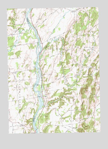
Fort Miller, NY USGS Topographic Map
Click on map above to begin viewing in our Map Viewer.

This topographic map contains these locations and features:
Feature Name Type Latitude Longitude GNIS ID View Map
August FieldAirportN43.2100°W73.5818°2443143View Map
Bacon HillPopulated PlaceN43.1334°W73.6057°942764View Map
Bacon Hill CemeteryCemeteryN43.1348°W73.6063°2426134View Map
Bald MountainPopulated PlaceN43.1295°W73.5382°942857View Map
Bald MountainSummitN43.1298°W73.5201°942874View Map
Barber Brothers DairyLocaleN43.1553°W73.6242°2519130View Map
Black House CreekStreamN43.2312°W73.5890°944136View Map
Black Orchid StablesLocaleN43.1756°W73.6194°2543432View Map
Clear Echo FarmLocaleN43.1417°W73.6200°2519131View Map
Dead CreekStreamN43.2156°W73.5673°948122View Map
DurkeetownPopulated PlaceN43.2467°W73.5323°948836View Map
Durkeetown Baptist ChurchChurchN43.2464°W73.5312°2598349View Map
Fort MillerPopulated PlaceN43.1609°W73.5779°950483View Map
Fort Miller Road BridgeBridgeN43.1668°W73.5797°2599516View Map
Foster FarmLocaleN43.1528°W73.5878°2519147View Map
Galusha IslandIslandN43.1720°W73.5826°950864View Map
Gavettes BrookStreamN43.1476°W73.5321°950950View Map
Gavettes MountainSummitN43.1665°W73.5212°950951View Map
Griffin IslandIslandN43.2087°W73.5826°973383View Map
Half-A-Chance FarmLocaleN43.1831°W73.6011°2543433View Map
Jewell CornerPopulated PlaceN43.1859°W73.6193°972665View Map
Lick SpringsPopulated PlaceN43.1829°W73.5157°972722View Map
Lock Number 6DamN43.1617°W73.5801°974730View Map
M And A FarmLocaleN43.2339°W73.5361°2559416View Map
Moses Creek FarmLocaleN43.2153°W73.5608°2559441View Map
Moses KillStreamN43.1992°W73.5821°957729View Map
North Branch Snook KillStreamN43.2267°W73.6082°958724View Map
North River Road BridgeBridgeN43.1777°W73.5792°2599518View Map
NorthumberlandPopulated PlaceN43.1273°W73.5882°958985View Map
Papp AirparkAirportN43.2496°W73.5631°2787185View Map
Pecks CreekStreamN43.1559°W73.5829°960087View Map
Pine Meadow FarmLocaleN43.2194°W73.5767°2632207View Map
Pleasant Valley FarmLocaleN43.1992°W73.5233°2559420View Map
Purintondale FarmLocaleN43.1764°W73.6058°2519120View Map
Slocum CreekStreamN43.1529°W73.5779°965433View Map
Snook KillStreamN43.2312°W73.5932°965576View Map
Stonebridge FarmLocaleN43.1719°W73.6083°2543436View Map
Thomas Poultry Farm of SchuylervilleLocaleN43.1533°W73.6125°2519151View Map
Thompson CemeteryCemeteryN43.1870°W73.5876°2426135View Map
Thompson IslandIslandN43.1845°W73.5834°967412View Map
ThomsonPopulated PlaceN43.1259°W73.5829°967427View Map
Town of Fort EdwardCivilN43.2294°W73.5600°978967View Map
Tuttle BrookStreamN43.1659°W73.5865°968007View Map
Van Antwerp CreekStreamN43.1437°W73.5868°968381View Map
Welcome Stock FarmLocaleN43.1469°W73.6008°2519133View Map

Note: Coordinates in the location and feature list above are referenced to NAD83 datum.


Copyright (C) 2008-2024 Ryan Niemi / Sunset Dynamics ... All Rights Reserved