TopoQuest Logo
Do you find TopoQuest useful?
Help keep TopoQuest running and adding new maps/features by donating!
Bitcoin:  19c7KJd3qBynnjoSw5npx9KScwjBe4ifkT
Litecoin:  LXs6TkuXGGXo1vDsWCkWVdjQX94eUKd6ui
Home View Maps Find Maps Find Places Resources & Links


Quaker Springs, New York Topographic Map

USGS Map Title: Quaker Springs, NY
USGS Map MRC: 43073A6
DRG (GeoTIFF) Download: o43073a6.tif


Neighboring USGS Topographic Map Quads:


  Corinth, NY  
43073B7
 

  Gansevoort, NY  
43073B6
 

  Fort Miller, NY  
43073B5
 

  Saratoga Springs, NY  
43073A7
 

  Quaker Springs, NY  
43073A6
 

  Schuylerville, NY  
43073A5
 

  Round Lake, NY  
42073H7
 

  Mechanicville, NY  
42073H6
 

  Schaghticoke, NY  
42073H5


Map MRC Location:

N44°
W74°
N44°
W73°
H8 H7 H6 H5 H4 H3 H2 H1
G8 G7 G6 G5 G4 G3 G2 G1
F8 F7 F6 F5 F4 F3 F2 F1
E8 E7 E6 E5 E4 E3 E2 E1
D8 D7 D6 D5 D4 D3 D2 D1
C8 C7 C6 C5 C4 C3 C2 C1
B8 B7 B6 B5 B4 B3 B2 B1
A8 A7 A6 A5 A4 A3 A2 A1
N43°
W74°
N43°
W73°

Quaker Springs, NY USGS 1:24K Topographic Map Preview:
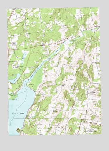
Quaker Springs, NY USGS Topographic Map
Click on map above to begin viewing in our Map Viewer.

This topographic map contains these locations and features:
Feature Name Type Latitude Longitude GNIS ID View Map
Balcarres Redoubt (historical)MilitaryN43.0053°W73.6372°2563984View Map
Balcarres Redoubt OverlookLocaleN43.0051°W73.6382°942844View Map
Barber Wheatfield OverlookLocaleN43.0006°W73.6454°942985View Map
Beacon HillPopulated PlaceN43.0689°W73.7161°2435505View Map
Bear HillSummitN43.0334°W73.6671°943268View Map
Bear SwampSwampN43.0631°W73.7335°969855View Map
Bog Meadow BrookStreamN43.0606°W73.7340°944389View Map
Breymann Redoubt OverlookLocaleN43.0092°W73.6379°944705View Map
BrookviewPopulated PlaceN43.0867°W73.7044°2435503View Map
Bryan Scidmore CemeteryCemeteryN43.0857°W73.6662°2426130View Map
Bryants BridgeBridgeN43.0926°W73.6601°944997View Map
BurgoynePopulated PlaceN43.0898°W73.6626°972284View Map
Caldwell CemeteryCemeteryN43.0291°W73.7066°2426129View Map
Carlyle EstatesPopulated PlaceN43.1097°W73.7239°2435492View Map
Cedar BluffsPopulated PlaceN43.0392°W73.7132°946100View Map
Cold BrookStreamN43.1004°W73.6487°947026View Map
Deans CornersPopulated PlaceN43.0490°W73.6773°948143View Map
Douw Winney CemeteryCemeteryN43.1046°W73.6470°2426131View Map
East RidgePopulated PlaceN43.0500°W73.7356°2435511View Map
Fish Creek MarinaLocaleN43.0733°W73.6956°2435502View Map
Floral EstatesPopulated PlaceN43.0981°W73.7183°2435490View Map
Freeman Farm OverlookLocaleN43.0062°W73.6465°950666View Map
Freeman HouseBuildingN43.0053°W73.6381°2079811View Map
GatesPopulated PlaceN43.0915°W73.6382°950940View Map
General Schuyler Emergency SquadBuildingN43.1025°W73.6484°2720213View Map
Gilbert CornersPopulated PlaceN43.0681°W73.7362°951092View Map
Gorsky Dairy FarmLocaleN43.0072°W73.7058°2519138View Map
Hannaford Plaza Shopping CenterLocaleN43.0961°W73.7461°2435495View Map
Hearthwood NorthPopulated PlaceN43.1047°W73.7008°2435487View Map
Hickeys CornersLocaleN43.0898°W73.7032°952681View Map
Highland HillsPopulated PlaceN43.1061°W73.6917°2435486View Map
InterlakenPopulated PlaceN43.0578°W73.7294°2435513View Map
Kayaderosseras CreekStreamN43.0409°W73.7373°954412View Map
Kaydeross ParkParkN43.0473°W73.7315°954414View Map
Ketchums CornersPopulated PlaceN43.0101°W73.6946°954560View Map
Kings-Ransom FarmLocaleN43.1189°W73.6261°2519132View Map
Knoll Spring ParkPopulated PlaceN43.0956°W73.7106°2435489View Map
Koval Brothers DairyLocaleN43.0519°W73.6750°2519135View Map
Lake LonelyLakeN43.0556°W73.7401°955823View Map
Lakeside Mobile Home ParkPopulated PlaceN43.0036°W73.7314°2435508View Map
Lomita Deer FarmLocaleN43.1156°W73.6847°2519149View Map
Lost Valley EstatesPopulated PlaceN43.1053°W73.7219°2435491View Map
Louden CemeteryCemeteryN43.1078°W73.7235°956045View Map
Louden MeadowsPopulated PlaceN43.0964°W73.7319°2435493View Map
Maple ShadePopulated PlaceN43.0187°W73.7262°956445View Map
Maplewood CemeteryCemeteryN43.0976°W73.7433°956478View Map
MeadowbrookPopulated PlaceN43.0758°W73.7161°2435504View Map
Mill BranchStreamN43.0181°W73.7273°957194View Map
Mill Creek FarmsLocaleN43.0292°W73.6892°2543435View Map
Myers CornersLocaleN43.0240°W73.6893°958228View Map
New Horizon ChurchChurchN43.1134°W73.7360°2616787View Map
New Life Fellowship ChurchChurchN43.1109°W73.7483°2616129View Map
Owl PondLakeN43.0596°W73.7414°959681View Map
Peckhaven FarmLocaleN43.0717°W73.6775°2519136View Map
Point Breeze MarinaLocaleN43.0522°W73.7219°2435507View Map
Pyramid Pines Mobile Home ParkPopulated PlaceN43.1106°W73.7411°2435499View Map
Quaker Church CemeteryCemeteryN43.0251°W73.6439°2426132View Map
Quaker SpringsPopulated PlaceN43.0395°W73.6429°962062View Map
Quaker Springs United Methodist ChurchChurchN43.0421°W73.6423°2616812View Map
Quaker Springs Volunteer Fire Department Station 1BuildingN43.0411°W73.6420°2735216View Map
Quaker Springs Volunteer Fire Department Station 2BuildingN43.0505°W73.7213°2735217View Map
Ramsdill CemeteryCemeteryN43.0484°W73.7340°2424893View Map
Regatta ViewPopulated PlaceN43.0589°W73.7214°2435506View Map
Ruckytucks FarmLocaleN43.0458°W73.6481°2519122View Map
Saratoga Industrial Park At WiltonLocaleN43.1183°W73.7331°2435500View Map
Saratoga LakeLakeN43.0167°W73.7415°964485View Map
Saratoga LakePopulated PlaceN43.0512°W73.7215°964486View Map
Saratoga Lake BridgeBridgeN43.0543°W73.7220°2614980View Map
Saratoga LandfillLocaleN43.0906°W73.7453°2499314View Map
Saratoga National Golf CourseLocaleN43.0625°W73.7417°2435509View Map
Saratoga Springs Air Force Station (historical)MilitaryN43.0122°W73.6825°2091469View Map
Saratoga Springs Ice RinkBuildingN43.0883°W73.7417°2435494View Map
Scidmore WoodsPopulated PlaceN43.0972°W73.6986°2435488View Map
Seventh Day Adventist ChurchChurchN43.0698°W73.7425°2616245View Map
Snake HillPopulated PlaceN43.0034°W73.7343°965552View Map
Spring RunStreamN43.0606°W73.7373°966089View Map
Staffords BridgeBridgeN43.0742°W73.6954°966203View Map
Stetkar OrchardsLocaleN43.0600°W73.6961°2516877View Map
Sucker BrookStreamN43.0909°W73.6723°966680View Map
Town of SaratogaCivilN43.0604°W73.6474°979461View Map
Waters EdgePopulated PlaceN43.0464°W73.7342°2435512View Map
WayvillePopulated PlaceN43.0009°W73.7079°973210View Map
Wilkinson National Recreation TrailTrailN43.0053°W73.6381°2079815View Map
Wilton Commons Shopping CenterLocaleN43.1064°W73.7414°2435498View Map
Wilton Mall Shopping CenterLocaleN43.1022°W73.7381°2435497View Map
Wilton Square Shopping CenterLocaleN43.1003°W73.7436°2435496View Map
Wood KnollsPopulated PlaceN43.1225°W73.7356°2435501View Map
WoodlandsPopulated PlaceN43.0486°W73.7411°2435510View Map
WSSV-FM (Stillwater)TowerN43.0120°W73.6826°977814View Map

Note: Coordinates in the location and feature list above are referenced to NAD83 datum.


Copyright (C) 2008-2025 Ryan Niemi / Sunset Dynamics ... All Rights Reserved