TopoQuest Logo
Do you find TopoQuest useful?
Help keep TopoQuest running and adding new maps/features by donating!
Bitcoin:  19c7KJd3qBynnjoSw5npx9KScwjBe4ifkT
Litecoin:  LXs6TkuXGGXo1vDsWCkWVdjQX94eUKd6ui
Home View Maps Find Maps Find Places Resources & Links


Schuylerville, New York Topographic Map

USGS Map Title: Schuylerville, NY
USGS Map MRC: 43073A5
DRG (GeoTIFF) Download: o43073a5.tif


Neighboring USGS Topographic Map Quads:


  Gansevoort, NY  
43073B6
 

  Fort Miller, NY  
43073B5
 

  Cossayuna, NY  
43073B4
 

  Quaker Springs, NY  
43073A6
 

  Schuylerville, NY  
43073A5
 

  Cambridge, NY  
43073A4
 

  Mechanicville, NY  
42073H6
 

  Schaghticoke, NY  
42073H5
 

  Eagle Bridge, NY  
42073H4


Map MRC Location:

N44°
W74°
N44°
W73°
H8 H7 H6 H5 H4 H3 H2 H1
G8 G7 G6 G5 G4 G3 G2 G1
F8 F7 F6 F5 F4 F3 F2 F1
E8 E7 E6 E5 E4 E3 E2 E1
D8 D7 D6 D5 D4 D3 D2 D1
C8 C7 C6 C5 C4 C3 C2 C1
B8 B7 B6 B5 B4 B3 B2 B1
A8 A7 A6 A5 A4 A3 A2 A1
N43°
W74°
N43°
W73°

Schuylerville, NY USGS 1:24K Topographic Map Preview:
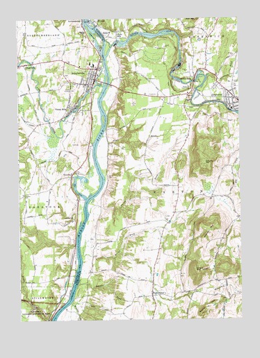
Schuylerville, NY USGS Topographic Map
Click on map above to begin viewing in our Map Viewer.

This topographic map contains these locations and features:
Feature Name Type Latitude Longitude GNIS ID View Map
Alcove MarinaLocaleN43.0586°W73.5933°2617471View Map
Assembly of God ChurchChurchN43.0981°W73.5832°2615551View Map
Batten KillStreamN43.1095°W73.5751°943164View Map
Batten Kill BridgeBridgeN43.1159°W73.5682°2614870View Map
Batten Kill BridgeBridgeN43.1159°W73.5682°2599512View Map
Batten Kill Country ClubLocaleN43.0967°W73.5273°974311View Map
Becker HillSummitN43.0065°W73.5165°943473View Map
Cement MountainSummitN43.0917°W73.5276°946169View Map
Cemetery of the VisitationCemeteryN43.0970°W73.5959°946177View Map
Church of the Visitation (historical)ChurchN43.0977°W73.5866°2420772View Map
Clarks MillsPopulated PlaceN43.1181°W73.5687°946785View Map
CovevillePopulated PlaceN43.0604°W73.5954°947582View Map
Easton Greenwich Rescue SquadBuildingN43.0934°W73.5349°2720218View Map
Easton LibraryBuildingN43.0109°W73.5499°2599531View Map
Edgewood FarmLocaleN43.0789°W73.5700°2559439View Map
Ensign BrookStreamN43.0270°W73.5901°949673View Map
Fairmount CemeteryCemeteryN43.0516°W73.6222°949837View Map
Finch CemeteryCemeteryN43.1020°W73.5983°2426139View Map
Fish CreekStreamN43.0970°W73.5771°950128View Map
Flatley BrookStreamN43.0442°W73.5854°950255View Map
Fort Hardy (historical)MilitaryN43.0981°W73.5769°2563983View Map
Fort Hardy ParkParkN43.1000°W73.5769°2463130View Map
Fraser Burial Site TrailTrailN43.0036°W73.6083°2079830View Map
Fryer BrookStreamN43.0762°W73.5776°950774View Map
Garnseys AirportAirportN43.0689°W73.5836°978287View Map
General Fraser Burial SiteCemeteryN43.0019°W73.6101°2079808View Map
Gerald B. H. Soloman Saratoga National CemeteryCemeteryN43.0293°W73.6082°2701912View Map
GrangervillePopulated PlaceN43.1059°W73.6212°951499View Map
Great RavineValleyN43.0025°W73.6131°2079835View Map
Greenwich CemeteryCemeteryN43.0973°W73.5052°2457305View Map
Greenwich Fire DepartmentBuildingN43.0914°W73.5031°2457295View Map
Greenwich Free LibraryBuildingN43.0915°W73.5019°2599533View Map
Hartshorn BrookStreamN43.1009°W73.5179°952313View Map
Holmes HillSummitN43.0426°W73.5943°953015View Map
Laing CemeteryCemeteryN43.1218°W73.5889°2426136View Map
Lock Number 5DamN43.1126°W73.5784°974727View Map
McAuley BrookStreamN43.0076°W73.5959°956719View Map
Middle FallsPopulated PlaceN43.1006°W73.5248°957097View Map
Middle Falls Fire DepartmentBuildingN43.1010°W73.5240°2457304View Map
Niagara-Mohawk Power Corporation Middle Falls Hydro StationBuildingN43.0984°W73.5261°2457303View Map
Niagara-Mohawk Power Corporation Schuylerville Hydro StationBuildingN43.0967°W73.5821°2420769View Map
North EastonPopulated PlaceN43.0101°W73.5501°958773View Map
Notre Dame CemeteryCemeteryN43.0989°W73.5979°2426142View Map
Notre Dame Visitation ChurchChurchN43.0957°W73.5853°2420773View Map
Old Saratoga Reformed ChurchChurchN43.0984°W73.5845°2420770View Map
Powers-Briggs Ferry (historical)CrossingN43.0081°W73.5969°2368012View Map
Prospect Hill CemeteryCemeteryN43.0972°W73.5943°2426143View Map
Quaker Springs United Methodist ChurchChurchN43.1010°W73.5827°2420790View Map
R And R FarmsLocaleN43.0850°W73.5281°2559421View Map
Saint Joseph's Roman Catholic ChurchChurchN43.0895°W73.5026°2457299View Map
Saint Josephs CemeteryCemeteryN43.0976°W73.5026°963733View Map
Saint Paul's Episcopal ChurchChurchN43.0912°W73.5006°2457297View Map
Saint Stephens Episcopal ChurchChurchN43.0968°W73.5836°2420789View Map
Saratoga Battle MonumentParkN43.0984°W73.5934°2426140View Map
Schuyler BrookStreamN43.0154°W73.5923°964628View Map
Schuyler Hose CompanyBuildingN43.1042°W73.5832°2420771View Map
Schuyler MountainSummitN43.0645°W73.5201°964637View Map
Schuyler Yacht BasinHarborN43.0979°W73.5762°2615044View Map
SchuylervillePopulated PlaceN43.1001°W73.5818°964639View Map
Schuylerville CemeteryCemeteryN43.1080°W73.5777°2426138View Map
Schuylerville Elementary SchoolSchoolN43.1042°W73.5800°2420792View Map
Schuylerville Junior-Senior High SchoolSchoolN43.1059°W73.5818°2420791View Map
Schuylerville Prep SchoolSchoolN43.1181°W73.5762°964640View Map
Schuylerville Public LibraryBuildingN43.1004°W73.5829°2617418View Map
Starks KnobPopulated PlaceN43.1217°W73.5876°966256View Map
Taylor HouseLocaleN43.0050°W73.6064°2079833View Map
The CoveBayN43.0551°W73.5932°967226View Map
Town of EastonCivilN43.0221°W73.5437°978920View Map
United Presbyterian ChurchChurchN43.0894°W73.5004°2457296View Map
Victory CemeteryCemeteryN43.0925°W73.5966°2426141View Map
Victory MillsPopulated PlaceN43.0879°W73.5940°979682View Map
Victory Mills Fire DepartmentBuildingN43.0886°W73.5965°2718337View Map
Victory Mills Fire DepartmentBuildingN43.0886°W73.5966°2718749View Map
Village of SchuylervilleCivilN43.1015°W73.5808°2391123View Map
Village of VictoryCivilN43.0919°W73.5918°2391186View Map
Washington County FairgroundsLocaleN43.0936°W73.5456°2499812View Map
Washington County Home For Aged Women (historical)BuildingN43.0913°W73.5025°2457298View Map
Whelden MountainSummitN43.0354°W73.5179°971027View Map
White Feather FarmLocaleN43.1081°W73.5264°2559440View Map
Willard MountainSummitN43.0201°W73.5232°971283View Map
Windy Hills Golf CourseLocaleN43.1134°W73.5376°2599527View Map

Note: Coordinates in the location and feature list above are referenced to NAD83 datum.


Copyright (C) 2008-2025 Ryan Niemi / Sunset Dynamics ... All Rights Reserved