TopoQuest Logo
Do you find TopoQuest useful?
Help keep TopoQuest running and adding new maps/features by donating!
Bitcoin:  19c7KJd3qBynnjoSw5npx9KScwjBe4ifkT
Litecoin:  LXs6TkuXGGXo1vDsWCkWVdjQX94eUKd6ui
Home View Maps Find Maps Find Places Resources & Links


Fort Mitchell, Virginia Topographic Map

USGS Map Title: Fort Mitchell, VA
USGS Map MRC: 36078H4
DRG (GeoTIFF) Download: o36078h4.tif


Neighboring USGS Topographic Map Quads:


  Eureka, VA  
37078A5
 

  Keysville, VA  
37078A4
 

  Meherrin, VA  
37078A3
 

  Drakes Branch, VA  
36078H5
 

  Fort Mitchell, VA  
36078H4
 

  Lunenburg, VA  
36078H3
 

  Wylliesburg, VA  
36078G5
 

  Chase City, VA  
36078G4
 

  Wightman, VA  
36078G3


Map MRC Location:

N37°
W79°
N37°
W78°
H8 H7 H6 H5 H4 H3 H2 H1
G8 G7 G6 G5 G4 G3 G2 G1
F8 F7 F6 F5 F4 F3 F2 F1
E8 E7 E6 E5 E4 E3 E2 E1
D8 D7 D6 D5 D4 D3 D2 D1
C8 C7 C6 C5 C4 C3 C2 C1
B8 B7 B6 B5 B4 B3 B2 B1
A8 A7 A6 A5 A4 A3 A2 A1
N36°
W79°
N36°
W78°

Fort Mitchell, VA USGS 1:24K Topographic Map Preview:
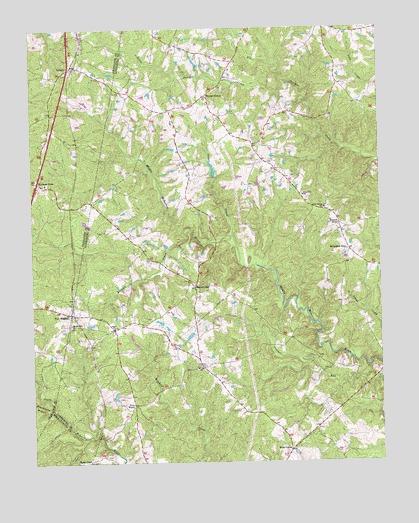
Fort Mitchell, VA USGS Topographic Map
Click on map above to begin viewing in our Map Viewer.

This topographic map contains these locations and features:
Feature Name Type Latitude Longitude GNIS ID View Map
Blackwater BranchStreamN36.8913°W78.4928°1463530View Map
Blevins CornerPopulated PlaceN36.9807°W78.4367°1477124View Map
Cool Spring ChurchChurchN36.9482°W78.3944°1465202View Map
Crupper RunStreamN36.9024°W78.3792°1465499View Map
FinneywoodPopulated PlaceN36.8754°W78.4803°1477324View Map
Five ForksPopulated PlaceN36.8915°W78.4636°1477328View Map
Fort MitchellPopulated PlaceN36.9182°W78.4861°1494938View Map
Friendship Baptist ChurchChurchN36.9554°W78.4944°1492385View Map
Friendship CemeteryCemeteryN36.9546°W78.4942°1492386View Map
Gregory CemeteryCemeteryN36.9146°W78.4328°1492157View Map
Kells CornerPopulated PlaceN36.8785°W78.4078°1477459View Map
Kirk DamDamN36.9118°W78.4431°1490360View Map
Knights CreekStreamN36.9415°W78.4450°1469069View Map
Kunath StoreLocaleN36.9435°W78.3892°1469081View Map
Little Juniper CreekStreamN36.9849°W78.4086°1469579View Map
Mount Mitchell ChurchChurchN36.9151°W78.4858°1470935View Map
Mount Zion ChurchChurchN36.9026°W78.4403°1471122View Map
Old Church (historical)ChurchN36.9204°W78.4675°1492196View Map
OntarioPopulated PlaceN36.9885°W78.4861°1495083View Map
PlantersvillePopulated PlaceN36.9260°W78.4417°1477628View Map
Rehoboth DistrictCivilN36.9641°W78.4028°1927460View Map
Robertson StoreLocaleN36.9360°W78.3858°1473325View Map
Salem ChurchChurchN36.9138°W78.4706°1473939View Map
Stokes CreekStreamN36.9404°W78.4272°1475170View Map
Wallaces StoreLocaleN36.9560°W78.4972°1476259View Map
West End SchoolSchoolN36.9518°W78.4022°1476479View Map

Note: Coordinates in the location and feature list above are referenced to NAD83 datum.


Copyright (C) 2008-2025 Ryan Niemi / Sunset Dynamics ... All Rights Reserved