TopoQuest Logo
Do you find TopoQuest useful?
Help keep TopoQuest running and adding new maps/features by donating!
Bitcoin:  19c7KJd3qBynnjoSw5npx9KScwjBe4ifkT
Litecoin:  LXs6TkuXGGXo1vDsWCkWVdjQX94eUKd6ui
Home View Maps Find Maps Find Places Resources & Links


Kinzua, Oregon Topographic Map

USGS Map Title: Kinzua, OR
USGS Map MRC: 44120H1
DRG (GeoTIFF) Download: o44120h1.tif


Neighboring USGS Topographic Map Quads:


  Fossil North, OR  
45120A2
 

  Salmon Fork, OR  
45120A1
 

  Lonerock, OR  
45119A8
 

  Fossil South, OR  
44120H2
 

  Kinzua, OR  
44120H1
 

  Wheeler Point, OR  
44119H8
 

  Rowe Creek, OR  
44120G2
 

  Service Creek, OR  
44120G1
 

  Masiker Mountain, OR  
44119G8


Map MRC Location:

N45°
W121°
N45°
W120°
H8 H7 H6 H5 H4 H3 H2 H1
G8 G7 G6 G5 G4 G3 G2 G1
F8 F7 F6 F5 F4 F3 F2 F1
E8 E7 E6 E5 E4 E3 E2 E1
D8 D7 D6 D5 D4 D3 D2 D1
C8 C7 C6 C5 C4 C3 C2 C1
B8 B7 B6 B5 B4 B3 B2 B1
A8 A7 A6 A5 A4 A3 A2 A1
N44°
W121°
N44°
W120°

Kinzua, OR USGS 1:24K Topographic Map Preview:
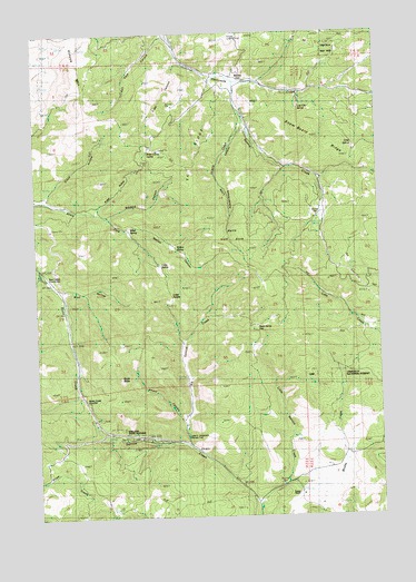
Kinzua, OR USGS Topographic Map
Click on map above to begin viewing in our Map Viewer.

This topographic map contains these locations and features:
Feature Name Type Latitude Longitude GNIS ID View Map
Bear Hollow County ParkParkN44.9374°W120.1234°1160514View Map
Big Service CreekStreamN44.8932°W120.0711°1117666View Map
Bledsoe CanyonValleyN44.9529°W120.1020°1117808View Map
Broad HollowValleyN44.9543°W120.1064°1118088View Map
Butte Creek SummitSummitN44.9035°W120.1036°1136110View Map
Cobb SaddleGapN44.9321°W120.0778°1119064View Map
Cobb SpringsSpringN44.9402°W120.0813°1119066View Map
Dead Horse GapGapN44.9243°W120.0472°1119740View Map
Drace HollowValleyN44.9585°W120.1247°1120065View Map
Emery CanyonValleyN44.9001°W120.0747°1120494View Map
Hells Half AcreAreaN44.9485°W120.0525°1160536View Map
Julia A Henderson Pioneer ParkParkN44.8963°W120.0722°1125434View Map
Kinzua (historical)Populated PlaceN44.9896°W120.0589°1158308View Map
Kinzua Dam (historical)DamN44.9752°W120.0483°1159122View Map
Kinzua MountainSummitN44.9868°W120.1120°1136441View Map
Kinzua Post Office (historical)Post OfficeN44.9896°W120.0589°1165489View Map
Kinzua Reservoir (historical)ReservoirN44.9743°W120.0476°1159123View Map
Little Searcy CreekStreamN44.9774°W120.0514°1158472View Map
Little Service CreekStreamN44.8779°W120.0467°1123280View Map
Lost City SpringSpringN44.9802°W120.0298°1123484View Map
Miller SpringSpringN44.9491°W120.0921°1124208View Map
Muddy CreekStreamN44.8832°W120.0364°1124503View Map
Powder House CanyonValleyN44.9754°W120.0517°1125631View Map
Prairie RanchLocaleN44.8804°W120.0325°1125647View Map
Ridge Camp SpringSpringN44.9696°W120.0845°1125995View Map
Scott ButteSummitN44.9110°W120.0958°1126677View Map
Searcy CreekStreamN44.9876°W120.0534°1158473View Map
Searcy FlatFlatN44.9540°W120.0220°1126713View Map
Shelton Wayside County ParkParkN44.8956°W120.0906°1126866View Map
T V RidgeRidgeN44.9676°W120.0697°1127854View Map
Tripp CanyonValleyN44.9929°W120.0750°1128232View Map
Walton CanyonValleyN44.9499°W120.0914°1160538View Map
Walton SpringSpringN44.9437°W120.0746°1160541View Map
Wolf HollowValleyN44.9340°W120.1197°1129281View Map

Note: Coordinates in the location and feature list above are referenced to NAD83 datum.


Copyright (C) 2008-2025 Ryan Niemi / Sunset Dynamics ... All Rights Reserved