TopoQuest Logo
Do you find TopoQuest useful?
Help keep TopoQuest running and adding new maps/features by donating!
Bitcoin:  19c7KJd3qBynnjoSw5npx9KScwjBe4ifkT
Litecoin:  LXs6TkuXGGXo1vDsWCkWVdjQX94eUKd6ui
Home View Maps Find Maps Find Places Resources & Links


Fossil South, Oregon Topographic Map

USGS Map Title: Fossil South, OR
USGS Map MRC: 44120H2
DRG (GeoTIFF) Download: o44120h2.tif


Neighboring USGS Topographic Map Quads:


  Buckhorn Canyon, OR  
45120A3
 

  Fossil North, OR  
45120A2
 

  Salmon Fork, OR  
45120A1
 

  Porcupine Butte, OR  
44120H3
 

  Fossil South, OR  
44120H2
 

  Kinzua, OR  
44120H1
 

  Jennies Peak, OR  
44120G3
 

  Rowe Creek, OR  
44120G2
 

  Service Creek, OR  
44120G1


Map MRC Location:

N45°
W121°
N45°
W120°
H8 H7 H6 H5 H4 H3 H2 H1
G8 G7 G6 G5 G4 G3 G2 G1
F8 F7 F6 F5 F4 F3 F2 F1
E8 E7 E6 E5 E4 E3 E2 E1
D8 D7 D6 D5 D4 D3 D2 D1
C8 C7 C6 C5 C4 C3 C2 C1
B8 B7 B6 B5 B4 B3 B2 B1
A8 A7 A6 A5 A4 A3 A2 A1
N44°
W121°
N44°
W120°

Fossil South, OR USGS 1:24K Topographic Map Preview:
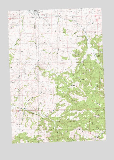
Fossil South, OR USGS Topographic Map
Click on map above to begin viewing in our Map Viewer.

This topographic map contains these locations and features:
Feature Name Type Latitude Longitude GNIS ID View Map
Bald MountainSummitN44.9599°W120.1828°1117179View Map
Bear HollowValleyN44.9382°W120.1289°1117385View Map
Brown CanyonValleyN44.9510°W120.1553°1118124View Map
Cave HollowValleyN44.9901°W120.1681°1118711View Map
City of FossilCivilN44.9981°W120.2146°2410533View Map
Clubfoot HollowValleyN44.8935°W120.1956°1119042View Map
Clymer CanyonValleyN44.9582°W120.1459°1160539View Map
Clymer SpringSpringN44.9468°W120.1573°1119044View Map
Coates CanyonValleyN44.9896°W120.2342°1119060View Map
Cold SpringSpringN44.9133°W120.1698°1119111View Map
Cottonwood CreekStreamN44.9993°W120.2220°1119323View Map
Crown RockSummitN44.8926°W120.2417°1119596View Map
FossilPopulated PlaceN44.9982°W120.2161°1120903View Map
Fossil DivisionCivilN44.9466°W120.1929°1938017View Map
Fossil IOOF CemeteryCemeteryN44.9923°W120.2136°1160540View Map
Fossil Museum and Pine Creek SchoolhouseBuildingN44.9997°W120.2147°2700308View Map
Fossil ParkParkN44.9090°W120.1359°1120904View Map
Fossil Post OfficePost OfficeN44.9991°W120.2135°1165270View Map
Grant CanyonValleyN44.9399°W120.1845°1158265View Map
Grant MeadowFlatN44.9335°W120.1589°1121299View Map
Grant SpringSpringN44.9791°W120.1971°1121302View Map
Griffin CanyonValleyN44.8954°W120.1903°1121431View Map
Herndon CanyonValleyN44.9754°W120.1517°1121775View Map
Huntley CanyonValleyN44.8990°W120.2095°1122163View Map
Jobe CanyonValleyN44.8996°W120.2039°1158559View Map
Jones CanyonStreamN44.9110°W120.2489°1122501View Map
Jordan CanyonValleyN44.9035°W120.2184°1122519View Map
Jordan SpringSpringN44.9031°W120.2205°1122533View Map
Juniper CanyonValleyN44.9626°W120.2114°1122571View Map
Leonard CanyonValleyN44.9243°W120.2020°1123045View Map
Lords TrailValleyN44.8854°W120.1947°1123480View Map
Morris CanyonStreamN44.9468°W120.2167°1124369View Map
Nielson CanyonValleyN44.8826°W120.1345°1124686View Map
Prindle PeakSummitN44.9535°W120.2386°1125670View Map
Rancheria RockSummitN44.8982°W120.1400°1125801View Map
Reno CanyonValleyN44.9921°W120.1850°1125950View Map
Sawpit CanyonValleyN44.9587°W120.1511°1126621View Map
Schoolhouse CanyonValleyN44.9374°W120.1892°1126657View Map
Steers CanyonValleyN44.9085°W120.2328°1127577View Map
Steiwer PeaksSummitN44.9599°W120.2339°1127585View Map
Stone Cabin CreekStreamN44.9993°W120.2239°1127628View Map
Straw Fork Butte CreekStreamN44.9604°W120.1428°1127651View Map
The RaffertyBasinN44.9254°W120.1714°1127996View Map
Todd CanyonValleyN44.9268°W120.1770°1128137View Map
Twin ButtesSummitN44.8871°W120.1636°1128340View Map
Watson CanyonValleyN44.9829°W120.1581°1128736View Map
Wheeler County CourthouseBuildingN44.9982°W120.2170°2700311View Map
Wheeler County FairgroundsLocaleN44.9985°W120.2109°1638462View Map
Wheeler County Health OfficeBuildingN44.9990°W120.2121°2700312View Map
Wheeler County Sheriff's OfficeBuildingN44.9983°W120.2170°2737882View Map
Wheeler Court House ParkParkN44.9900°W120.2153°2070836View Map
Wright CanyonValleyN44.9057°W120.2339°1129334View Map

Note: Coordinates in the location and feature list above are referenced to NAD83 datum.


Copyright (C) 2008-2025 Ryan Niemi / Sunset Dynamics ... All Rights Reserved