TopoQuest Logo
Do you find TopoQuest useful?
Help keep TopoQuest running and adding new maps/features by donating!
Bitcoin:  19c7KJd3qBynnjoSw5npx9KScwjBe4ifkT
Litecoin:  LXs6TkuXGGXo1vDsWCkWVdjQX94eUKd6ui
Home View Maps Find Maps Find Places Resources & Links


Fosston West, Minnesota Topographic Map

USGS Map Title: Fosston West, MN
USGS Map MRC: 47095E7
DRG (GeoTIFF) Download: o47095e7.tif


Neighboring USGS Topographic Map Quads:


  McIntosh, MN  
47095F8
 

  McIntosh NE, MN  
47095F7
 

  Olga, MN  
47095F6
 

  Winger, MN  
47095E8
 

  Fosston West, MN  
47095E7
 

  Fosston East, MN  
47095E6
 

  Bejou, MN  
47095D8
 

  Mahnomen NE, MN  
47095D7
 

  Ebro NW, MN  
47095D6


Map MRC Location:

N48°
W96°
N48°
W95°
H8 H7 H6 H5 H4 H3 H2 H1
G8 G7 G6 G5 G4 G3 G2 G1
F8 F7 F6 F5 F4 F3 F2 F1
E8 E7 E6 E5 E4 E3 E2 E1
D8 D7 D6 D5 D4 D3 D2 D1
C8 C7 C6 C5 C4 C3 C2 C1
B8 B7 B6 B5 B4 B3 B2 B1
A8 A7 A6 A5 A4 A3 A2 A1
N47°
W96°
N47°
W95°

Fosston West, MN USGS 1:24K Topographic Map Preview:
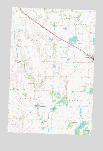
Fosston West, MN USGS Topographic Map
Click on map above to begin viewing in our Map Viewer.

This topographic map contains these locations and features:
Feature Name Type Latitude Longitude GNIS ID View Map
Castor State Wildlife Management AreasParkN47.5513°W95.8414°640971View Map
City of FosstonCivilN47.5857°W95.7585°2394799View Map
City of Fosston CampgroundLocaleN47.5750°W95.7578°2081444View Map
County Ditch Number FiftyfiveCanalN47.5936°W95.8395°642189View Map
County Ditch Number FortyeightCanalN47.5652°W95.7617°642135View Map
County Ditch Number FortynineCanalN47.5136°W95.8164°642142View Map
County Ditch Number One Hundred ThirtythreeCanalN47.5277°W95.8623°641668View Map
County Ditch Number SixteenCanalN47.5916°W95.8700°641721View Map
First Baptist ChurchChurchN47.5842°W95.7533°2081453View Map
FosstonPopulated PlaceN47.5763°W95.7514°643832View Map
FosstonLocaleN47.5767°W95.7542°2081443View Map
Fosston Fire DepartmentBuildingN47.5736°W95.7539°2081438View Map
Fosston Golf ClubLocaleN47.5913°W95.7864°659826View Map
Fosston Municipal AirportAirportN47.5928°W95.7735°660168View Map
Fosston Post OfficePost OfficeN47.5761°W95.7506°2081440View Map
Hansville CemeteryCemeteryN47.5289°W95.7960°644651View Map
Hasselton State Wildlife Management AreaParkN47.5030°W95.7575°644714View Map
Homme LakeLakeN47.5099°W95.7654°645153View Map
Kroening LakeLakeN47.5275°W95.8315°646257View Map
Kroening State Wildlife Management AreaParkN47.5258°W95.8261°646258View Map
Landsverk CemeteryCemeteryN47.5729°W95.8485°646472View Map
Lavoi State Wildlife Management AreaParkN47.5097°W95.7845°646530View Map
Newton LakeLakeN47.5253°W95.8080°648535View Map
Ouff LakeLakeN47.5948°W95.7827°649064View Map
Sand Hill ChurchChurchN47.5436°W95.8650°651144View Map
Strand LakeLakeN47.6053°W95.7946°652714View Map
Township of SlettenCivilN47.5427°W95.8749°665634View Map
West View CourtPopulated PlaceN47.5764°W95.7511°2081429View Map

Note: Coordinates in the location and feature list above are referenced to NAD83 datum.


Copyright (C) 2008-2024 Ryan Niemi / Sunset Dynamics ... All Rights Reserved