TopoQuest Logo
Do you find TopoQuest useful?
Help keep TopoQuest running and adding new maps/features by donating!
Bitcoin:  19c7KJd3qBynnjoSw5npx9KScwjBe4ifkT
Litecoin:  LXs6TkuXGGXo1vDsWCkWVdjQX94eUKd6ui
Home View Maps Find Maps Find Places Resources & Links


Ladelle, Arkansas Topographic Map

USGS Map Title: Ladelle, AR
USGS Map MRC: 33091D7
DRG (GeoTIFF) Download: o33091d7.tif


Neighboring USGS Topographic Map Quads:


  Wilmar South, AR  
33091E8
 

  Monticello South, AR  
33091E7
 

  Cominto, AR  
33091E6
 

  Longview, AR  
33091D8
 

  Ladelle, AR  
33091D7
 

  Mist NW, AR  
33091D6
 

  Milo, AR  
33091C8
 

  Fountain Hill, AR  
33091C7
 

  Mist, AR  
33091C6


Map MRC Location:

N34°
W92°
N34°
W91°
H8 H7 H6 H5 H4 H3 H2 H1
G8 G7 G6 G5 G4 G3 G2 G1
F8 F7 F6 F5 F4 F3 F2 F1
E8 E7 E6 E5 E4 E3 E2 E1
D8 D7 D6 D5 D4 D3 D2 D1
C8 C7 C6 C5 C4 C3 C2 C1
B8 B7 B6 B5 B4 B3 B2 B1
A8 A7 A6 A5 A4 A3 A2 A1
N33°
W92°
N33°
W91°

Ladelle, AR USGS 1:24K Topographic Map Preview:
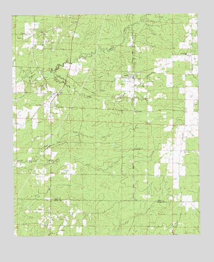
Ladelle, AR USGS Topographic Map
Click on map above to begin viewing in our Map Viewer.

This topographic map contains these locations and features:
Feature Name Type Latitude Longitude GNIS ID View Map
BeulahPopulated PlaceN33.4893°W91.8540°78971View Map
Beulah Baptist ChurchChurchN33.4893°W91.8537°76328View Map
Beulah CemeteryCemeteryN33.4893°W91.8546°78972View Map
CarpenterPopulated PlaceN33.4107°W91.8501°78979View Map
Courtney CemeteryCemeteryN33.3904°W91.8557°48094View Map
Deal CemeteryCemeteryN33.4569°W91.8165°48428View Map
Goose HollowPopulated PlaceN33.4218°W91.8499°79008View Map
Goose Hollow ChurchChurchN33.4084°W91.8543°49511View Map
Gray CemeteryCemeteryN33.4101°W91.8546°79009View Map
Jumper CreekStreamN33.4637°W91.8687°50760View Map
LaceyPopulated PlaceN33.4551°W91.8468°77426View Map
Lacey CemeteryCemeteryN33.4598°W91.8535°50927View Map
Lacey Ladelle Volunteer Fire Department Station 1BuildingN33.4654°W91.7930°2116675View Map
Lacey Ladelle Volunteer Fire Department Station 2BuildingN33.4521°W91.8509°2116674View Map
Lacey Ladelle Volunteer Fire Department Station 3BuildingN33.4090°W91.7635°2625421View Map
Lacey School (historical)SchoolN33.4546°W91.8465°79027View Map
LadellePopulated PlaceN33.4646°W91.7937°58033View Map
Ladelle Baptist ChurchChurchN33.4648°W91.7979°79028View Map
LewisPopulated PlaceN33.4876°W91.7910°77483View Map
Lone Sasafras (historical)Populated PlaceN33.4998°W91.7937°79033View Map
Lone Sassafras CemeteryCemeteryN33.4771°W91.7565°51401View Map
Long PrairieAreaN33.4268°W91.7640°79035View Map
North Fork Panther CreekStreamN33.4176°W91.8615°52825View Map
Prairie GrovePopulated PlaceN33.4226°W91.7626°79074View Map
Prairie Grove Baptist ChurchChurchN33.4221°W91.7599°78092View Map
Prairie Grove CemeteryCemeteryN33.4226°W91.7596°79075View Map
ScipioPopulated PlaceN33.3962°W91.7940°57180View Map
South Fork Panther CreekStreamN33.4176°W91.8618°55027View Map
Township of VeaseyCivilN33.4682°W91.8207°66519View Map
Valley JunctionPopulated PlaceN33.4454°W91.7937°58791View Map
YoungstownPopulated PlaceN33.4234°W91.7937°57243View Map

Note: Coordinates in the location and feature list above are referenced to NAD83 datum.


Copyright (C) 2008-2025 Ryan Niemi / Sunset Dynamics ... All Rights Reserved