TopoQuest Logo
Do you find TopoQuest useful?
Help keep TopoQuest running and adding new maps/features by donating!
Bitcoin:  19c7KJd3qBynnjoSw5npx9KScwjBe4ifkT
Litecoin:  LXs6TkuXGGXo1vDsWCkWVdjQX94eUKd6ui
Home View Maps Find Maps Find Places Resources & Links


Franklin Forks, Pennsylvania Topographic Map

USGS Map Title: Franklin Forks, PA
USGS Map MRC: 41075H7
DRG (GeoTIFF) Download: o41075h7.tif


Neighboring USGS Topographic Map Quads:


  Binghamton West, NY  
42075A8
 

  Binghamton East, NY  
42075A7
 

  Windsor, NY  
42075A6
 

  Laurel Lake, PA  
41075H8
 

  Franklin Forks, PA  
41075H7
 

  Great Bend, PA  
41075H6
 

  Montrose West, PA  
41075G8
 

  Montrose East, PA  
41075G7
 

  Harford, PA  
41075G6


Map MRC Location:

N42°
W76°
N42°
W75°
H8 H7 H6 H5 H4 H3 H2 H1
G8 G7 G6 G5 G4 G3 G2 G1
F8 F7 F6 F5 F4 F3 F2 F1
E8 E7 E6 E5 E4 E3 E2 E1
D8 D7 D6 D5 D4 D3 D2 D1
C8 C7 C6 C5 C4 C3 C2 C1
B8 B7 B6 B5 B4 B3 B2 B1
A8 A7 A6 A5 A4 A3 A2 A1
N41°
W76°
N41°
W75°

Franklin Forks, PA USGS 1:24K Topographic Map Preview:
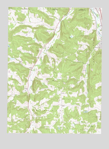
Franklin Forks, PA USGS Topographic Map
Click on map above to begin viewing in our Map Viewer.

This topographic map contains these locations and features:
Feature Name Type Latitude Longitude GNIS ID View Map
Bel-Air LakeReservoirN41.9489°W75.8686°1195866View Map
Bel-Air Lake DamDamN41.9501°W75.8696°1195867View Map
Blue Ridge Mobile Home ParkPopulated PlaceN41.9997°W75.7914°2490637View Map
Bradley CornersLocaleN41.8826°W75.7641°1170132View Map
BrookdalePopulated PlaceN41.9773°W75.8113°1170320View Map
Darrow PondReservoirN41.8844°W75.7859°1172963View Map
DuBois Creek DamDamN41.9384°W75.7696°1195864View Map
DuBois ReservoirReservoirN41.9380°W75.7702°1195863View Map
Fall BrookStreamN41.9123°W75.8621°1198065View Map
Fish School (historical)SchoolN41.9854°W75.8532°1197740View Map
Franklin CornersLocaleN41.9031°W75.8019°1175149View Map
Franklin ForksPopulated PlaceN41.9181°W75.8474°1175152View Map
Franklin Hill ChurchChurchN41.9092°W75.8021°1175158View Map
Franklin Hill SchoolSchoolN41.9095°W75.8030°1197738View Map
Jones CreekStreamN41.9504°W75.8299°1178145View Map
Kirkwood Airpark (historical)AirportN41.9998°W75.7598°978104View Map
Lake RoyLakeN41.8804°W75.8053°1193236View Map
Lawsville CenterPopulated PlaceN41.9390°W75.8424°1179064View Map
Mingo LakeReservoirN41.9712°W75.7902°1181333View Map
Mingo Lake DamDamN41.9734°W75.7896°1195875View Map
Oteyokwa LakeLakeN41.8969°W75.7698°1183081View Map
Oteyokwa Lake DamDamN41.8984°W75.7663°1195842View Map
Rhiney CreekStreamN41.9770°W75.8069°1184980View Map
Rose PondReservoirN41.8872°W75.7775°1185453View Map
RoundtopSummitN41.9542°W75.7535°1185565View Map
Salt SpringsSpringN41.9109°W75.8646°1201457View Map
Salt Springs SchoolSchoolN41.9134°W75.8680°1197739View Map
Salt Springs State ParkParkN41.9140°W75.8663°1196515View Map
Silver CreekStreamN41.9181°W75.8460°1187674View Map
Snake Creek Volunteer Fire Company Station 1BuildingN41.9807°W75.8105°2653019View Map
Snake Creek Volunteer Fire Company Station 2BuildingN41.9381°W75.8419°2653021View Map
StanfordvillePopulated PlaceN41.9570°W75.8294°1188395View Map
Stonecrop HillSummitN41.9270°W75.8152°1188742View Map
Township of FranklinCivilN41.8985°W75.8293°1217082View Map
Township of LibertyCivilN41.9627°W75.8300°1217092View Map
Tripp LakeLakeN41.9617°W75.8745°1189816View Map
Trowbridge CreekStreamN41.9812°W75.7538°970725View Map
UpsonvillePopulated PlaceN41.9148°W75.8030°1204859View Map

Note: Coordinates in the location and feature list above are referenced to NAD83 datum.


Copyright (C) 2008-2024 Ryan Niemi / Sunset Dynamics ... All Rights Reserved