TopoQuest Logo
Do you find TopoQuest useful?
Help keep TopoQuest running and adding new maps/features by donating!
Bitcoin:  19c7KJd3qBynnjoSw5npx9KScwjBe4ifkT
Litecoin:  LXs6TkuXGGXo1vDsWCkWVdjQX94eUKd6ui
Home View Maps Find Maps Find Places Resources & Links


Montrose West, Pennsylvania Topographic Map

USGS Map Title: Montrose West, PA
USGS Map MRC: 41075G8
DRG (GeoTIFF) Download: o41075g8.tif


Neighboring USGS Topographic Map Quads:


  Friendsville, PA  
41076H1
 

  Laurel Lake, PA  
41075H8
 

  Franklin Forks, PA  
41075H7
 

  Lawton, PA  
41076G1
 

  Montrose West, PA  
41075G8
 

  Montrose East, PA  
41075G7
 

  Auburn Center, PA  
41076F1
 

  Springville, PA  
41075F8
 

  Hop Bottom, PA  
41075F7


Map MRC Location:

N42°
W76°
N42°
W75°
H8 H7 H6 H5 H4 H3 H2 H1
G8 G7 G6 G5 G4 G3 G2 G1
F8 F7 F6 F5 F4 F3 F2 F1
E8 E7 E6 E5 E4 E3 E2 E1
D8 D7 D6 D5 D4 D3 D2 D1
C8 C7 C6 C5 C4 C3 C2 C1
B8 B7 B6 B5 B4 B3 B2 B1
A8 A7 A6 A5 A4 A3 A2 A1
N41°
W76°
N41°
W75°

Montrose West, PA USGS 1:24K Topographic Map Preview:
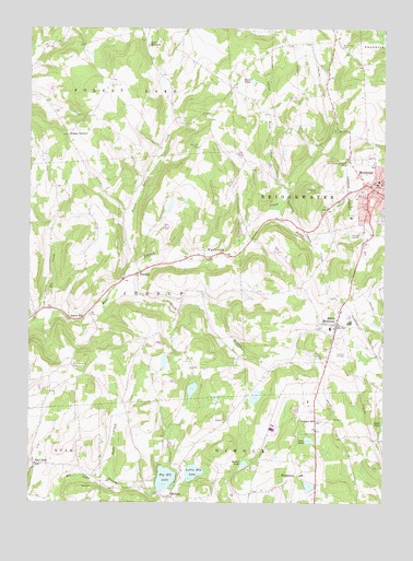
Montrose West, PA USGS Topographic Map
Click on map above to begin viewing in our Map Viewer.

This topographic map contains these locations and features:
Feature Name Type Latitude Longitude GNIS ID View Map
Beebe CreekStreamN41.8329°W75.9085°1169094View Map
Big Elk LakeReservoirN41.7564°W75.9515°1169500View Map
Big Elk Lake DamDamN41.7534°W75.9546°1195780View Map
Booth MillpondLakeN41.8711°W75.9583°1170003View Map
Borough of MontroseCivilN41.8334°W75.8761°1215614View Map
Bumps CornersLocaleN41.8470°W75.9863°1170665View Map
Bush PondLakeN41.8612°W75.9210°1170768View Map
Cope PondLakeN41.7667°W75.9010°1172435View Map
East RushPopulated PlaceN41.7604°W75.9974°1203480View Map
Elk LakePopulated PlaceN41.7517°W75.9502°1203505View Map
Elk Lake Volunteer Fire CompanyBuildingN41.7503°W75.9505°2653501View Map
Fair Hill CemeteryCemeteryN41.8437°W75.9399°1174410View Map
Fair Hill School (historical)SchoolN41.8437°W75.9405°1197630View Map
FairdalePopulated PlaceN41.8104°W75.9613°1174424View Map
Forest Lake CreekStreamN41.8115°W75.9646°1174978View Map
Hamlin School (historical)SchoolN41.8517°W75.9780°1197629View Map
Holy Name of Mary CemeteryCemeteryN41.8398°W75.8874°1177280View Map
Husky Haven AirportAirportN41.7889°W75.8920°1194289View Map
Indian LakeReservoirN41.7601°W75.9239°1177760View Map
Indian Lake DamDamN41.7584°W75.9246°1195783View Map
Jessup OverlookLocaleN41.7795°W75.9963°1205139View Map
Little Elk LakeReservoirN41.7581°W75.9416°1179536View Map
Louden HillPopulated PlaceN41.7717°W75.8983°1204067View Map
MontrosePopulated PlaceN41.8340°W75.8771°1213638View Map
Montrose Post OfficePost OfficeN41.8340°W75.8759°2779959View Map
North Hill CemeteryCemeteryN41.8703°W75.8899°1182595View Map
Pettis CreekStreamN41.8279°W75.9138°1183645View Map
Prospect Hill CemeteryCemeteryN41.7859°W75.9846°1184451View Map
Roe CreekStreamN41.8001°W75.9919°1185380View Map
Shelp CreekStreamN41.7579°W75.9727°1187456View Map
Snows MillPopulated PlaceN41.7984°W75.9849°1204681View Map
South Branch Wyalusing CreekStreamN41.8070°W75.9671°1188043View Map
South MontrosePopulated PlaceN41.7973°W75.8913°1188088View Map
South Montrose Post OfficePost OfficeN41.7989°W75.8912°2780022View Map
Township of JessupCivilN41.8085°W75.9724°1217089View Map
Tyler SchoolSchoolN41.8270°W75.9110°1197631View Map
United Fire CompanyBuildingN41.8344°W75.8756°2652868View Map
WoodburnPopulated PlaceN41.7573°W75.9055°1204984View Map

Note: Coordinates in the location and feature list above are referenced to NAD83 datum.


Copyright (C) 2008-2024 Ryan Niemi / Sunset Dynamics ... All Rights Reserved