TopoQuest Logo
Do you find TopoQuest useful?
Help keep TopoQuest running and adding new maps/features by donating!
Bitcoin:  19c7KJd3qBynnjoSw5npx9KScwjBe4ifkT
Litecoin:  LXs6TkuXGGXo1vDsWCkWVdjQX94eUKd6ui
Home View Maps Find Maps Find Places Resources & Links


Laurel Lake, Pennsylvania Topographic Map

USGS Map Title: Laurel Lake, PA
USGS Map MRC: 41075H8
DRG (GeoTIFF) Download: o41075h8.tif


Neighboring USGS Topographic Map Quads:


  Endicott, NY  
42076A1
 

  Binghamton West, NY  
42075A8
 

  Binghamton East, NY  
42075A7
 

  Friendsville, PA  
41076H1
 

  Laurel Lake, PA  
41075H8
 

  Franklin Forks, PA  
41075H7
 

  Lawton, PA  
41076G1
 

  Montrose West, PA  
41075G8
 

  Montrose East, PA  
41075G7


Map MRC Location:

N42°
W76°
N42°
W75°
H8 H7 H6 H5 H4 H3 H2 H1
G8 G7 G6 G5 G4 G3 G2 G1
F8 F7 F6 F5 F4 F3 F2 F1
E8 E7 E6 E5 E4 E3 E2 E1
D8 D7 D6 D5 D4 D3 D2 D1
C8 C7 C6 C5 C4 C3 C2 C1
B8 B7 B6 B5 B4 B3 B2 B1
A8 A7 A6 A5 A4 A3 A2 A1
N41°
W76°
N41°
W75°

Laurel Lake, PA USGS 1:24K Topographic Map Preview:
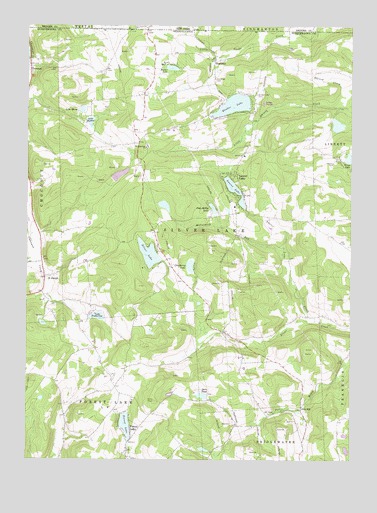
Laurel Lake, PA USGS Topographic Map
Click on map above to begin viewing in our Map Viewer.

This topographic map contains these locations and features:
Feature Name Type Latitude Longitude GNIS ID View Map
Baker DamDamN41.9767°W75.8813°1195877View Map
BrackneyPopulated PlaceN41.9898°W75.9269°1170116View Map
Brackney CemeteryCemeteryN41.9848°W75.9266°1170117View Map
Brackney Post OfficePost OfficeN41.9707°W75.9402°2773082View Map
ChoconutPopulated PlaceN41.9787°W75.9996°1171795View Map
Cranberry LakeReservoirN41.9308°W75.9364°1172623View Map
Cranberry Lake DamDamN41.9284°W75.9346°1195860View Map
Dacey School (historical)SchoolN41.9034°W75.9163°1197625View Map
Dora PondReservoirN41.8937°W75.9318°1173391View Map
Fisk MillPopulated PlaceN41.8904°W75.8933°1203573View Map
Forest LakeReservoirN41.8853°W75.9612°1174975View Map
Forest LakePopulated PlaceN41.8842°W75.9594°1174976View Map
Forest Lake DamDamN41.8801°W75.9596°1195827View Map
Forest Lake Volunteer Fire Company 1BuildingN41.8890°W75.9658°2653023View Map
Hurley BranchStreamN41.9334°W75.9941°1177641View Map
J P Reilly AirportAirportN41.9032°W75.9896°2787266View Map
Kane School (historical)SchoolN41.9015°W75.9608°1197624View Map
Lake MargeReservoirN41.9759°W75.9787°1192891View Map
Lake SophiaReservoirN41.9724°W75.9753°1193394View Map
Lake Sophia DamDamN41.9717°W75.9780°1195874View Map
Lake StanmorReservoirN41.9767°W75.8813°1195876View Map
Lake TimberlineReservoirN41.9164°W75.9722°1195854View Map
Lake Timberline DamDamN41.9167°W75.9763°1195855View Map
Laurel LakePopulated PlaceN41.9570°W75.9183°1178951View Map
Laurel LakeReservoirN41.9528°W75.9197°1178954View Map
Laurel Lake CreekStreamN41.9148°W75.8882°1198080View Map
Little Rhiney CreekStreamN41.9792°W75.8766°1179657View Map
Longford LakeReservoirN41.9571°W75.9640°1195871View Map
Longford Lake DamDamN41.9551°W75.9663°1195870View Map
McCormick RunStreamN41.9342°W75.9008°1180659View Map
Meeker LakeLakeN41.9879°W75.9441°1180865View Map
Pops Hobby LakeReservoirN41.9475°W75.9279°1184267View Map
Quaker LakeReservoirN41.9773°W75.9202°1184522View Map
Quaker Lake CemeteryCemeteryN41.9803°W75.9105°1184523View Map
Saint Augustine ChurchChurchN41.9651°W75.9533°1185799View Map
Saint JosephPopulated PlaceN41.9279°W75.9924°1186185View Map
Silver LakeReservoirN41.9343°W75.9526°1187684View Map
Silver Lake DamDamN41.9317°W75.9480°1195861View Map
Silver Lake Volunteer Fire CompanyBuildingN41.9712°W75.9356°2652909View Map
Township of Forest LakeCivilN41.8752°W75.9868°1217246View Map
Township of Silver LakeCivilN41.9503°W75.9343°1217096View Map
Ward SchoolSchoolN41.9637°W75.9158°1197626View Map

Note: Coordinates in the location and feature list above are referenced to NAD83 datum.


Copyright (C) 2008-2025 Ryan Niemi / Sunset Dynamics ... All Rights Reserved