TopoQuest Logo
Do you find TopoQuest useful?
Help keep TopoQuest running and adding new maps/features by donating!
Bitcoin:  19c7KJd3qBynnjoSw5npx9KScwjBe4ifkT
Litecoin:  LXs6TkuXGGXo1vDsWCkWVdjQX94eUKd6ui
Home View Maps Find Maps Find Places Resources & Links


Franklinville, New York Topographic Map

USGS Map Title: Franklinville, NY
USGS Map MRC: 42078C4
DRG (GeoTIFF) Download: o42078c4.tif


Neighboring USGS Topographic Map Quads:


  West Valley, NY  
42078D5
 

  Delevan, NY  
42078D4
 

  Freedom, NY  
42078D3
 

  Ashford, NY  
42078C5
 

  Franklinville, NY  
42078C4
 

  Rawson, NY  
42078C3
 

  Humphrey, NY  
42078B5
 

  Hinsdale, NY  
42078B4
 

  Cuba, NY  
42078B3


Map MRC Location:

N43°
W79°
N43°
W78°
H8 H7 H6 H5 H4 H3 H2 H1
G8 G7 G6 G5 G4 G3 G2 G1
F8 F7 F6 F5 F4 F3 F2 F1
E8 E7 E6 E5 E4 E3 E2 E1
D8 D7 D6 D5 D4 D3 D2 D1
C8 C7 C6 C5 C4 C3 C2 C1
B8 B7 B6 B5 B4 B3 B2 B1
A8 A7 A6 A5 A4 A3 A2 A1
N42°
W79°
N42°
W78°

Franklinville, NY USGS 1:24K Topographic Map Preview:
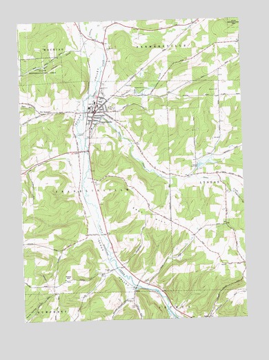
Franklinville, NY USGS Topographic Map
Click on map above to begin viewing in our Map Viewer.

This topographic map contains these locations and features:
Feature Name Type Latitude Longitude GNIS ID View Map
Bear CreekStreamN42.3559°W78.4539°943254View Map
Blount LibraryBuildingN42.3382°W78.4572°2598252View Map
Boyce RunStreamN42.3381°W78.4634°944539View Map
CadizPopulated PlaceN42.3206°W78.4672°945420View Map
Cadiz CemeteryCemeteryN42.3180°W78.4666°2554910View Map
Christian and Missionary Alliance ChurchChurchN42.3422°W78.4504°2597397View Map
East HillSummitN42.2895°W78.4209°949109View Map
First Baptist ChurchChurchN42.3348°W78.4592°2597405View Map
FitchPopulated PlaceN42.2628°W78.4375°950182View Map
Fitch CemeteryCemeteryN42.2554°W78.4377°950184View Map
FranklinvillePopulated PlaceN42.3370°W78.4581°950636View Map
Franklinville Elementary SchoolSchoolN42.3413°W78.4577°2597375View Map
Franklinville Fire DepartmentBuildingN42.3431°W78.4555°2701079View Map
Franklinville Free Methodist ChurchChurchN42.3333°W78.4597°2597413View Map
Franklinville Junior - Senior High SchoolSchoolN42.3401°W78.4561°2597386View Map
Franklinville Post OfficePost OfficeN42.3361°W78.4579°2598452View Map
Gates CreekStreamN42.3201°W78.4617°970160View Map
Ischua CemeteryCemeteryN42.2503°W78.3957°2554908View Map
Ischua ValleyValleyN42.2637°W78.4350°953812View Map
Ischua Valley Country ClubLocaleN42.3587°W78.4554°2598249View Map
Ishua Valley Estates Mobile Home ParkPopulated PlaceN42.3480°W78.4522°2598231View Map
Johnson CreekStreamN42.3681°W78.4581°954115View Map
Mount Prospect CemeteryCemeteryN42.3391°W78.4487°957894View Map
Pierce HillSummitN42.2667°W78.4756°960356View Map
Presbyterian ChurchChurchN42.3353°W78.4590°2597433View Map
Saint Philomena Roman Catholic ChurchChurchN42.3433°W78.4512°2597445View Map
Saunders CreekStreamN42.3434°W78.4578°964504View Map
Storrs CreekStreamN42.3098°W78.4642°966604View Map
Ten Broeck CemeteryCemeteryN42.3634°W78.4506°967151View Map
The NarrowsPopulated PlaceN42.3365°W78.4870°967304View Map
Town of FranklinvilleCivilN42.3054°W78.4999°978972View Map
Triple R CampgroundLocaleN42.3334°W78.4934°2598247View Map
Village of FranklinvilleCivilN42.3347°W78.4548°2390850View Map
Woodhill Estates Mobile Home ParkPopulated PlaceN42.3592°W78.4486°2598237View Map

Note: Coordinates in the location and feature list above are referenced to NAD83 datum.


Copyright (C) 2008-2024 Ryan Niemi / Sunset Dynamics ... All Rights Reserved