TopoQuest Logo
Do you find TopoQuest useful?
Help keep TopoQuest running and adding new maps/features by donating!
Bitcoin:  19c7KJd3qBynnjoSw5npx9KScwjBe4ifkT
Litecoin:  LXs6TkuXGGXo1vDsWCkWVdjQX94eUKd6ui
Home View Maps Find Maps Find Places Resources & Links


Freedom, New York Topographic Map

USGS Map Title: Freedom, NY
USGS Map MRC: 42078D3
DRG (GeoTIFF) Download: o42078d3.tif


Neighboring USGS Topographic Map Quads:


  Arcade, NY  
42078E4
 

  Bliss, NY  
42078E3
 

  Pike, NY  
42078E2
 

  Delevan, NY  
42078D4
 

  Freedom, NY  
42078D3
 

  Houghton, NY  
42078D2
 

  Franklinville, NY  
42078C4
 

  Rawson, NY  
42078C3
 

  Black Creek, NY  
42078C2


Map MRC Location:

N43°
W79°
N43°
W78°
H8 H7 H6 H5 H4 H3 H2 H1
G8 G7 G6 G5 G4 G3 G2 G1
F8 F7 F6 F5 F4 F3 F2 F1
E8 E7 E6 E5 E4 E3 E2 E1
D8 D7 D6 D5 D4 D3 D2 D1
C8 C7 C6 C5 C4 C3 C2 C1
B8 B7 B6 B5 B4 B3 B2 B1
A8 A7 A6 A5 A4 A3 A2 A1
N42°
W79°
N42°
W78°

Freedom, NY USGS 1:24K Topographic Map Preview:
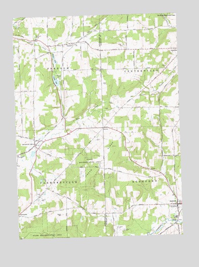
Freedom, NY USGS Topographic Map
Click on map above to begin viewing in our Map Viewer.

This topographic map contains these locations and features:
Feature Name Type Latitude Longitude GNIS ID View Map
Burleson PondSwampN42.4892°W78.3586°945218View Map
Bush HillSummitN42.3881°W78.3417°945309View Map
Centerville CemeteryCemeteryN42.4804°W78.2546°2057585View Map
Central SchoolSchoolN42.3856°W78.2542°946290View Map
County Line CemeteryCemeteryN42.4692°W78.3081°947557View Map
Cream RidgeRidgeN42.4101°W78.3208°947726View Map
Crystal LakeLakeN42.4641°W78.3435°947897View Map
Edelweiss FarmsLocaleN42.4736°W78.3353°2703673View Map
FairviewPopulated PlaceN42.4367°W78.3083°972455View Map
Farmersville CemeteryCemeteryN42.3917°W78.3691°2554891View Map
Farmersville Center Community ChurchChurchN42.3893°W78.3732°2597404View Map
Farmersville StationPopulated PlaceN42.4276°W78.3608°949917View Map
Farmersville Station Post OfficePost OfficeN42.4280°W78.3606°2599615View Map
Farmersville Volunteer Fire DepartmentBuildingN42.4286°W78.3597°2700885View Map
FreedomPopulated PlaceN42.4848°W78.3311°950659View Map
Freedom CemeteryCemeteryN42.4834°W78.3369°2554889View Map
Freedom Mobile Home ParkPopulated PlaceN42.4862°W78.3213°2598229View Map
Moores PondLakeN42.4746°W78.3433°957609View Map
Old Burying GroundsCemeteryN42.3913°W78.2555°959259View Map
RushfordPopulated PlaceN42.3923°W78.2536°963104View Map
Rushford CemeteryCemeteryN42.3942°W78.2507°2544276View Map
Rushford Census Designated PlaceCensusN42.3890°W78.2523°2628184View Map
Rushford Elementary SchoolSchoolN42.4261°W78.3611°2597379View Map
Salem CemeteryCemeteryN42.4865°W78.3586°2554886View Map
Salem ChurchChurchN42.4865°W78.3586°964296View Map
Scouthaven CampLocaleN42.4653°W78.3414°964698View Map
Town of RushfordCivilN42.3925°W78.2502°979441View Map

Note: Coordinates in the location and feature list above are referenced to NAD83 datum.


Copyright (C) 2008-2025 Ryan Niemi / Sunset Dynamics ... All Rights Reserved