TopoQuest Logo
Do you find TopoQuest useful?
Help keep TopoQuest running and adding new maps/features by donating!
Bitcoin:  19c7KJd3qBynnjoSw5npx9KScwjBe4ifkT
Litecoin:  LXs6TkuXGGXo1vDsWCkWVdjQX94eUKd6ui
Home View Maps Find Maps Find Places Resources & Links


Fredericksburg, Indiana Topographic Map

USGS Map Title: Fredericksburg, IN
USGS Map MRC: 38086D2
DRG (GeoTIFF) Download: o38086d2.tif


Neighboring USGS Topographic Map Quads:


  Livonia, IN  
38086E3
 

  Becks Mill, IN  
38086E2
 

  Salem, IN  
38086E1
 

  Hardinsburg, IN  
38086D3
 

  Fredericksburg, IN  
38086D2
 

  Palmyra, IN  
38086D1
 

  Milltown, IN  
38086C3
 

  Depauw, IN  
38086C2
 

  Crandall, IN  
38086C1


Map MRC Location:

N39°
W87°
N39°
W86°
H8 H7 H6 H5 H4 H3 H2 H1
G8 G7 G6 G5 G4 G3 G2 G1
F8 F7 F6 F5 F4 F3 F2 F1
E8 E7 E6 E5 E4 E3 E2 E1
D8 D7 D6 D5 D4 D3 D2 D1
C8 C7 C6 C5 C4 C3 C2 C1
B8 B7 B6 B5 B4 B3 B2 B1
A8 A7 A6 A5 A4 A3 A2 A1
N38°
W87°
N38°
W86°

Fredericksburg, IN USGS 1:24K Topographic Map Preview:
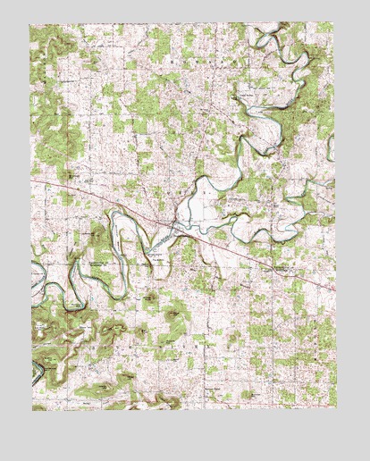
Fredericksburg, IN USGS Topographic Map
Click on map above to begin viewing in our Map Viewer.

This topographic map contains these locations and features:
Feature Name Type Latitude Longitude GNIS ID View Map
Adams HillSummitN38.3823°W86.2191°430012View Map
Baldy CreekStreamN38.3792°W86.2397°430454View Map
Ball KnobSummitN38.4006°W86.2053°430458View Map
Blice PointCliffN38.4292°W86.2008°446880View Map
Blue River Fire DepartmentBuildingN38.4845°W86.1743°2625989View Map
Boston CemeteryCemeteryN38.3912°W86.1925°431368View Map
Britton HillSummitN38.3915°W86.2414°431539View Map
Brunner HillSummitN38.3795°W86.1608°431669View Map
FredericksburgPopulated PlaceN38.4331°W86.1897°434794View Map
Fredericksburg Census Designated PlaceCensusN38.4352°W86.1970°2761658View Map
Goodman BendBendN38.4126°W86.2469°450968View Map
Grace Assembly ChurchChurchN38.4201°W86.1508°435256View Map
Greene Mill HillSummitN38.4314°W86.2233°435434View Map
Hancock ChapelPopulated PlaceN38.3817°W86.1794°435663View Map
Hancock HillSummitN38.4020°W86.2155°435667View Map
Hancocks Post Office (historical)Post OfficeN38.3798°W86.1797°453008View Map
Heiser HillSummitN38.3856°W86.2116°435987View Map
Horners ChapelChurchN38.4409°W86.1511°436484View Map
Hunter SpringSpringN38.4248°W86.1986°436627View Map
Jacobi AirportAirportN38.4124°W86.1268°2676950View Map
Joe Walk HillSummitN38.4026°W86.2464°437013View Map
Kay BottomBendN38.4239°W86.1972°437178View Map
Kays ChapelChurchN38.4492°W86.2255°437179View Map
Lambert HillSummitN38.4287°W86.2311°437581View Map
Leatherwood IslandIslandN38.3884°W86.2464°437714View Map
Licking CreekStreamN38.4378°W86.1375°437875View Map
McIntosh HillSummitN38.4506°W86.2347°438884View Map
Mitchell PlainPlainN38.4395°W86.1666°452426View Map
Moore HillSummitN38.4215°W86.2016°439400View Map
Mount Carmel ChurchChurchN38.4714°W86.1769°439544View Map
Organ SpringsPopulated PlaceN38.4767°W86.1647°440697View Map
Posey Township Volunteer Fire DepartmentBuildingN38.4426°W86.2203°2626276View Map
Reno CemeteryCemeteryN38.3995°W86.1861°441899View Map
Reno HillSummitN38.4059°W86.1928°441900View Map
Roberts HillSummitN38.3970°W86.1955°442159View Map
South Fork Blue RiverStreamN38.4334°W86.1850°443802View Map
Stout HillSummitN38.4026°W86.2272°444247View Map
Town of Fredericksburg (historical)CivilN38.4286°W86.1887°2396950View Map
Township of Blue RiverCivilN38.3768°W86.2017°453118View Map
Township of PoseyCivilN38.4461°W86.2146°453767View Map
Walk BottomBendN38.4198°W86.2319°445369View Map
Warehouse RiffleRapidsN38.4090°W86.2289°445470View Map
Whittman BottomBendN38.4314°W86.2155°445997View Map
Wildcat KnobSummitN38.4112°W86.2005°446018View Map

Note: Coordinates in the location and feature list above are referenced to NAD83 datum.


Copyright (C) 2008-2025 Ryan Niemi / Sunset Dynamics ... All Rights Reserved