TopoQuest Logo
Do you find TopoQuest useful?
Help keep TopoQuest running and adding new maps/features by donating!
Bitcoin:  19c7KJd3qBynnjoSw5npx9KScwjBe4ifkT
Litecoin:  LXs6TkuXGGXo1vDsWCkWVdjQX94eUKd6ui
Home View Maps Find Maps Find Places Resources & Links


Salem, Indiana Topographic Map

USGS Map Title: Salem, IN
USGS Map MRC: 38086E1
DRG (GeoTIFF) Download: o38086e1.tif


Neighboring USGS Topographic Map Quads:


  Smedley, IN  
38086F2
 

  Kossuth, IN  
38086F1
 

  Little York, IN  
38085F8
 

  Becks Mill, IN  
38086E2
 

  Salem, IN  
38086E1
 

  South Boston, IN  
38085E8
 

  Fredericksburg, IN  
38086D2
 

  Palmyra, IN  
38086D1
 

  Borden, IN  
38085D8


Map MRC Location:

N39°
W87°
N39°
W86°
H8 H7 H6 H5 H4 H3 H2 H1
G8 G7 G6 G5 G4 G3 G2 G1
F8 F7 F6 F5 F4 F3 F2 F1
E8 E7 E6 E5 E4 E3 E2 E1
D8 D7 D6 D5 D4 D3 D2 D1
C8 C7 C6 C5 C4 C3 C2 C1
B8 B7 B6 B5 B4 B3 B2 B1
A8 A7 A6 A5 A4 A3 A2 A1
N38°
W87°
N38°
W86°

Salem, IN USGS 1:24K Topographic Map Preview:
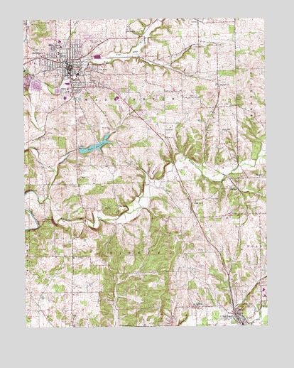
Salem, IN USGS Topographic Map
Click on map above to begin viewing in our Map Viewer.

This topographic map contains these locations and features:
Feature Name Type Latitude Longitude GNIS ID View Map
Blue River Baptist CemeteryCemeteryN38.5603°W86.0044°1923627View Map
Blue River ChurchChurchN38.5492°W86.0761°431241View Map
Blue River ChurchChurchN38.5603°W86.0036°431250View Map
Blue River MoundSummitN38.6178°W86.0641°448362View Map
CantonPopulated PlaceN38.6239°W86.0347°432116View Map
City of SalemCivilN38.6048°W86.0977°2396525View Map
Fair AcresPopulated PlaceN38.6042°W86.0903°434280View Map
FarabeePopulated PlaceN38.5570°W86.0158°434387View Map
Hardin AirportAirportN38.5645°W86.0587°449335View Map
HarristownPopulated PlaceN38.5978°W86.0241°435806View Map
Hicksite Church CemeteryCemeteryN38.6202°W86.0716°1923555View Map
Hoggatt BranchStreamN38.5636°W86.1089°436298View Map
Lake SalindaLakeN38.5735°W86.0887°442931View Map
Martin HeightsPopulated PlaceN38.6126°W86.1080°438675View Map
McCol PlacePopulated PlaceN38.6092°W86.1144°438804View Map
Mount Pleasant ChurchChurchN38.5084°W86.0378°439667View Map
Mount Pleasant Church CemeteryCemeteryN38.5083°W86.0376°1923626View Map
New Old Blue River CemeteryCemeteryN38.5488°W86.0765°1923634View Map
New PekinPopulated PlaceN38.5051°W86.0169°440094View Map
Norris CemeteryCemeteryN38.5955°W86.0516°1923559View Map
Old Blue River CemeteryCemeteryN38.5484°W86.0839°440540View Map
Old Blue River Friends ChurchChurchN38.6198°W86.0714°1923554View Map
Old Hebron CemeteryCemeteryN38.5673°W86.0156°440568View Map
Paynter CemeteryCemeteryN38.5801°W86.0520°1923564View Map
Pierce - Polk Township Volunteer Fire DepartmentBuildingN38.5030°W86.0150°2626150View Map
Pierce Consolidated SchoolSchoolN38.5006°W86.0769°441108View Map
Poor Farm CemeteryCemeteryN38.5784°W86.0191°1923565View Map
Saint Vincent Salem HospitalHospitalN38.6132°W86.1071°2660443View Map
SalemPopulated PlaceN38.6056°W86.1011°442876View Map
Salem Fire DepartmentBuildingN38.6049°W86.0997°2625613View Map
Salem Police DepartmentBuildingN38.6056°W86.1007°2758456View Map
Salem QuarryMineN38.5989°W86.1197°2567522View Map
Stalker CemeteryCemeteryN38.5936°W86.0390°1923558View Map
Tash CemeteryCemeteryN38.5088°W86.0099°444579View Map
The GradeSlopeN38.5317°W86.0269°448367View Map
Town of New PekinCivilN38.5029°W86.0152°2396806View Map
Township of PierceCivilN38.5148°W86.0677°453730View Map
Township of WashingtonCivilN38.6144°W86.1020°454023View Map
Washington CountyCivilN38.6000°W86.1053°451665View Map
Washington County Sheriff's OfficeBuildingN38.5970°W86.0921°2758169View Map
West Fork Blue RiverStreamN38.5636°W86.1090°445741View Map
Wilson - Mead CemeteryCemeteryN38.5440°W86.1140°446123View Map
Wright CemeteryCemeteryN38.5609°W86.0956°446339View Map
WSLM-AM (Salem)TowerN38.6153°W86.0861°448470View Map
WSLM-FMTowerN38.5998°W86.0880°448921View Map

Note: Coordinates in the location and feature list above are referenced to NAD83 datum.


Copyright (C) 2008-2025 Ryan Niemi / Sunset Dynamics ... All Rights Reserved