TopoQuest Logo
Do you find TopoQuest useful?
Help keep TopoQuest running and adding new maps/features by donating!
Bitcoin:  19c7KJd3qBynnjoSw5npx9KScwjBe4ifkT
Litecoin:  LXs6TkuXGGXo1vDsWCkWVdjQX94eUKd6ui
Home View Maps Find Maps Find Places Resources & Links


Livonia, Indiana Topographic Map

USGS Map Title: Livonia, IN
USGS Map MRC: 38086E3
DRG (GeoTIFF) Download: o38086e3.tif


Neighboring USGS Topographic Map Quads:


  Mitchell, IN  
38086F4
 

  Campbellsburg, IN  
38086F3
 

  Smedley, IN  
38086F2
 

  Paoli, IN  
38086E4
 

  Livonia, IN  
38086E3
 

  Becks Mill, IN  
38086E2
 

  Valeene, IN  
38086D4
 

  Hardinsburg, IN  
38086D3
 

  Fredericksburg, IN  
38086D2


Map MRC Location:

N39°
W87°
N39°
W86°
H8 H7 H6 H5 H4 H3 H2 H1
G8 G7 G6 G5 G4 G3 G2 G1
F8 F7 F6 F5 F4 F3 F2 F1
E8 E7 E6 E5 E4 E3 E2 E1
D8 D7 D6 D5 D4 D3 D2 D1
C8 C7 C6 C5 C4 C3 C2 C1
B8 B7 B6 B5 B4 B3 B2 B1
A8 A7 A6 A5 A4 A3 A2 A1
N38°
W87°
N38°
W86°

Livonia, IN USGS 1:24K Topographic Map Preview:
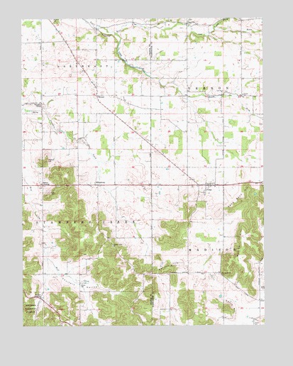
Livonia, IN USGS Topographic Map
Click on map above to begin viewing in our Map Viewer.

This topographic map contains these locations and features:
Feature Name Type Latitude Longitude GNIS ID View Map
BromerPopulated PlaceN38.5937°W86.3358°450713View Map
ClaysvillePopulated PlaceN38.6226°W86.2894°450779View Map
Copelin CemeteryCemeteryN38.5170°W86.3444°450803View Map
Coulters HollowValleyN38.5234°W86.3576°450805View Map
Davis HillSummitN38.5076°W86.2680°450834View Map
Edward CemeteryCemeteryN38.6242°W86.3583°450884View Map
Hardin CemeteryCemeteryN38.5006°W86.2554°451008View Map
LivoniaPopulated PlaceN38.5570°W86.2775°451166View Map
Livonia Volunteer Fire and RescueBuildingN38.5579°W86.2791°2626149View Map
Lost River ChurchChurchN38.5948°W86.2700°451176View Map
Mahan CrossingPopulated PlaceN38.5573°W86.3644°451194View Map
Mahan HillSummitN38.5673°W86.3633°451195View Map
MillersburgPopulated PlaceN38.5573°W86.3355°451224View Map
Myers Farm AirportAirportN38.5856°W86.2519°2676987View Map
North Fork Lost RiverStreamN38.6203°W86.2747°451282View Map
Patton HillSummitN38.5231°W86.2997°451318View Map
Pleasant Grove ChurchChurchN38.5323°W86.3280°441255View Map
Posey ChapelChurchN38.5145°W86.2505°451361View Map
Pumpkin CenterPopulated PlaceN38.5895°W86.3644°451371View Map
Sand Bank HillSummitN38.5514°W86.2578°451431View Map
Sinking Spring CemeteryCemeteryN38.5209°W86.2734°451469View Map
South Fork Lost RiverStreamN38.6192°W86.3264°451482View Map
Town of LivoniaCivilN38.5549°W86.2777°2396720View Map
Township of MadisonCivilN38.5172°W86.2711°453600View Map
Township of Stampers CreekCivilN38.5356°W86.3457°453870View Map
Township of VernonCivilN38.6027°W86.2515°453958View Map
Trimble CemeteryCemeteryN38.6184°W86.3316°451581View Map
Trotter CrossingPopulated PlaceN38.5114°W86.3655°451582View Map
Vernon SchoolSchoolN38.5937°W86.2605°451597View Map
Warren HillSummitN38.5345°W86.2622°451609View Map

Note: Coordinates in the location and feature list above are referenced to NAD83 datum.


Copyright (C) 2008-2025 Ryan Niemi / Sunset Dynamics ... All Rights Reserved