TopoQuest Logo
Do you find TopoQuest useful?
Help keep TopoQuest running and adding new maps/features by donating!
Bitcoin:  19c7KJd3qBynnjoSw5npx9KScwjBe4ifkT
Litecoin:  LXs6TkuXGGXo1vDsWCkWVdjQX94eUKd6ui
Home View Maps Find Maps Find Places Resources & Links


Frelsburg, Texas Topographic Map

USGS Map Title: Frelsburg, TX
USGS Map MRC: 29096G5
DRG (GeoTIFF) Download: o29096g5.tif


Neighboring USGS Topographic Map Quads:


  Fayetteville, TX  
29096H6
 

  Industry, TX  
29096H5
 

  New Ulm, TX  
29096H4
 

  Ellinger, TX  
29096G6
 

  Frelsburg, TX  
29096G5
 

  Bernardo, TX  
29096G4
 

  Borden, TX  
29096F6
 

  Columbus, TX  
29096F5
 

  Alleyton, TX  
29096F4


Map MRC Location:

N30°
W97°
N30°
W96°
H8 H7 H6 H5 H4 H3 H2 H1
G8 G7 G6 G5 G4 G3 G2 G1
F8 F7 F6 F5 F4 F3 F2 F1
E8 E7 E6 E5 E4 E3 E2 E1
D8 D7 D6 D5 D4 D3 D2 D1
C8 C7 C6 C5 C4 C3 C2 C1
B8 B7 B6 B5 B4 B3 B2 B1
A8 A7 A6 A5 A4 A3 A2 A1
N29°
W97°
N29°
W96°

Frelsburg, TX USGS 1:24K Topographic Map Preview:
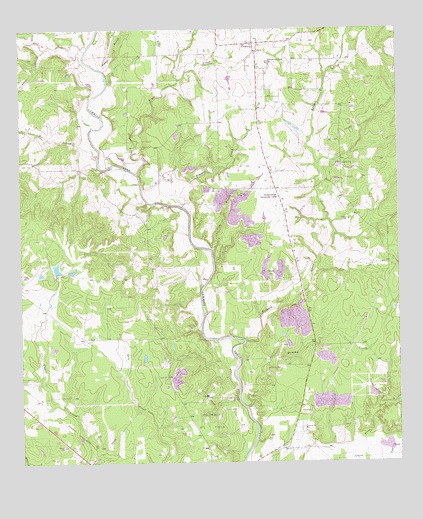
Frelsburg, TX USGS Topographic Map
Click on map above to begin viewing in our Map Viewer.

This topographic map contains these locations and features:
Feature Name Type Latitude Longitude GNIS ID View Map
Balch Springs Public LibraryBuildingN29.7763°W96.6061°2015081View Map
Bee BranchStreamN29.8391°W96.5983°1330306View Map
Brushy CreekStreamN29.7661°W96.5505°1331428View Map
Bull CreekStreamN29.8691°W96.6022°1372814View Map
Circle M Ranch Airport (historical)AirportN29.8350°W96.5144°1386697View Map
Columbus DivisionCivilN29.7713°W96.5311°1938638View Map
Cullen LakeReservoirN29.8064°W96.6134°1862083View Map
Cullen Lake DamDamN29.8052°W96.6136°1862082View Map
FrelsburgPopulated PlaceN29.8711°W96.5466°1336190View Map
Frelsburg Oil FieldOilfieldN29.8352°W96.5197°1336191View Map
Frelsburg Volunteer Fire DepartmentBuildingN29.8712°W96.5485°2552464View Map
Gabriel Long BranchStreamN29.7558°W96.5016°1336327View Map
Hobson BranchStreamN29.8636°W96.5975°1374085View Map
Kleberg - Rylie Branch LibraryBuildingN29.8711°W96.5975°2014901View Map
Piper CreekStreamN29.8336°W96.5858°1375488View Map
Plum BranchStreamN29.8113°W96.5611°1344260View Map
Redgate CreekStreamN29.7855°W96.5505°1375686View Map
Saint Peter and Paul SchoolSchoolN29.8650°W96.5419°1346093View Map
Stein BranchStreamN29.8697°W96.6161°1347875View Map
Zimmer CreekStreamN29.8233°W96.5694°1350735View Map
Zimmerscheidt Community CenterLocaleN29.8269°W96.5391°1350736View Map
Zimmerscheidt-Leyendecker HouseBuildingN29.8075°W96.5302°2032356View Map

Note: Coordinates in the location and feature list above are referenced to NAD83 datum.


Copyright (C) 2008-2024 Ryan Niemi / Sunset Dynamics ... All Rights Reserved