TopoQuest Logo
Do you find TopoQuest useful?
Help keep TopoQuest running and adding new maps/features by donating!
Bitcoin:  19c7KJd3qBynnjoSw5npx9KScwjBe4ifkT
Litecoin:  LXs6TkuXGGXo1vDsWCkWVdjQX94eUKd6ui
Home View Maps Find Maps Find Places Resources & Links


Industry, Texas Topographic Map

USGS Map Title: Industry, TX
USGS Map MRC: 29096H5
DRG (GeoTIFF) Download: o29096h5.tif


Neighboring USGS Topographic Map Quads:


  Round Top, TX  
30096A6
 

  Greenvine, TX  
30096A5
 

  Welcome, TX  
30096A4
 

  Fayetteville, TX  
29096H6
 

  Industry, TX  
29096H5
 

  New Ulm, TX  
29096H4
 

  Ellinger, TX  
29096G6
 

  Frelsburg, TX  
29096G5
 

  Bernardo, TX  
29096G4


Map MRC Location:

N30°
W97°
N30°
W96°
H8 H7 H6 H5 H4 H3 H2 H1
G8 G7 G6 G5 G4 G3 G2 G1
F8 F7 F6 F5 F4 F3 F2 F1
E8 E7 E6 E5 E4 E3 E2 E1
D8 D7 D6 D5 D4 D3 D2 D1
C8 C7 C6 C5 C4 C3 C2 C1
B8 B7 B6 B5 B4 B3 B2 B1
A8 A7 A6 A5 A4 A3 A2 A1
N29°
W97°
N29°
W96°

Industry, TX USGS 1:24K Topographic Map Preview:
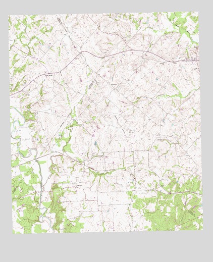
Industry, TX USGS Topographic Map
Click on map above to begin viewing in our Map Viewer.

This topographic map contains these locations and features:
Feature Name Type Latitude Longitude GNIS ID View Map
Albert CemeteryCemeteryN29.9616°W96.6155°1350948View Map
Bethune SchoolSchoolN29.9713°W96.5230°1351979View Map
Boggy CreekStreamN29.8994°W96.6050°1352572View Map
Cherry ChapelChurchN29.9713°W96.5180°1354353View Map
Cliff CreekStreamN29.9444°W96.6186°1354662View Map
Dogwood CreekStreamN29.9927°W96.5161°1373419View Map
Floyd CemeteryCemeteryN29.9216°W96.5986°1357505View Map
IndustryPopulated PlaceN29.9724°W96.5022°1360006View Map
Industry Post OfficePost OfficeN29.9737°W96.5020°2731602View Map
Knolle CemeteryCemeteryN29.9671°W96.5128°1360725View Map
Kreb BranchStreamN29.9874°W96.6178°1360766View Map
KrebsvillePopulated PlaceN29.9905°W96.5847°1380041View Map
Lone OakPopulated PlaceN29.9016°W96.5819°1380105View Map
McElroy CemeteryCemeteryN29.9099°W96.5419°1362347View Map
Mesquite Public LibraryBuildingN29.9205°W96.6022°2014820View Map
Pagel CemeteryCemeteryN29.9549°W96.6136°1364692View Map
PisekPopulated PlaceN29.9169°W96.5830°1380364View Map
Pool BranchStreamN29.9219°W96.6200°1365571View Map
Poplar CreekStreamN29.9216°W96.5897°1365588View Map
Post Oak PointPopulated PlaceN29.9288°W96.5261°1365661View Map
Rock HousePopulated PlaceN29.9574°W96.5552°1366671View Map
RockhousePopulated PlaceN29.9572°W96.5561°2034855View Map
Sawmill CreekStreamN29.9902°W96.5116°1367800View Map
Soil Conservation Service Site 26 DamDamN29.9902°W96.6219°1858004View Map
Soil Conservation Service Site 26 ReservoirReservoirN29.9915°W96.6229°1858005View Map
Stein BranchStreamN29.9155°W96.5778°1369164View Map
West End SchoolSchoolN29.9674°W96.5022°1371118View Map
Willow BranchStreamN29.9413°W96.5836°1371617View Map
Willow SpringsPopulated PlaceN29.9666°W96.5989°1380787View Map

Note: Coordinates in the location and feature list above are referenced to NAD83 datum.


Copyright (C) 2008-2024 Ryan Niemi / Sunset Dynamics ... All Rights Reserved