TopoQuest Logo
Do you find TopoQuest useful?
Help keep TopoQuest running and adding new maps/features by donating!
Bitcoin:  19c7KJd3qBynnjoSw5npx9KScwjBe4ifkT
Litecoin:  LXs6TkuXGGXo1vDsWCkWVdjQX94eUKd6ui
Home View Maps Find Maps Find Places Resources & Links


French Mountain, Idaho Topographic Map

USGS Map Title: French Mountain, ID
USGS Map MRC: 46115E6
DRG (GeoTIFF) Download: o46115e6.tif


Neighboring USGS Topographic Map Quads:


  Headquarters, ID  
46115F7
 

  Browns Rock, ID  
46115F6
 

  Clarke Mountain, ID  
46115F5
 

  Jaype, ID  
46115E7
 

  French Mountain, ID  
46115E6
 

  Larch Butte, ID  
46115E5
 

  Pierce, ID  
46115D7
 

  Hemlock Butte, ID  
46115D6
 

  Snowy Summit, ID  
46115D5


Map MRC Location:

N47°
W116°
N47°
W115°
H8 H7 H6 H5 H4 H3 H2 H1
G8 G7 G6 G5 G4 G3 G2 G1
F8 F7 F6 F5 F4 F3 F2 F1
E8 E7 E6 E5 E4 E3 E2 E1
D8 D7 D6 D5 D4 D3 D2 D1
C8 C7 C6 C5 C4 C3 C2 C1
B8 B7 B6 B5 B4 B3 B2 B1
A8 A7 A6 A5 A4 A3 A2 A1
N46°
W116°
N46°
W115°

French Mountain, ID USGS 1:24K Topographic Map Preview:
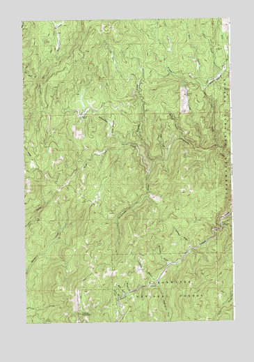
French Mountain, ID USGS Topographic Map
Click on map above to begin viewing in our Map Viewer.

This topographic map contains these locations and features:
Feature Name Type Latitude Longitude GNIS ID View Map
Arnett MeadowsFlatN46.5810°W115.6971°376720View Map
Bailey GulchValleyN46.5760°W115.6546°376852View Map
Blue GulchValleyN46.5116°W115.6907°377908View Map
Bluebell GulchValleyN46.5124°W115.6882°377953View Map
Breakfast CreekStreamN46.5619°W115.6751°378200View Map
Business GulchValleyN46.5244°W115.6643°378582View Map
Camp Fifty-SevenLocaleN46.5855°W115.7157°396221View Map
Campbell MineMineN46.5935°W115.6526°378829View Map
Chas Parker (historical)LocaleN46.5319°W115.6807°399062View Map
China GulchValleyN46.5102°W115.6938°379299View Map
Copper CreekStreamN46.6024°W115.6310°379701View Map
Crystal CreekStreamN46.5660°W115.6718°380118View Map
East Fork Elk CreekStreamN46.5960°W115.6413°381093View Map
East Fork French CreekStreamN46.5160°W115.6713°381103View Map
Elk CreekStreamN46.5727°W115.6321°381341View Map
Fidelity GulchValleyN46.5171°W115.6715°381681View Map
Fred Forsman (historical)LocaleN46.5466°W115.6963°399021View Map
French MountainSummitN46.5035°W115.7171°382072View Map
Irish CreekStreamN46.5707°W115.6638°383746View Map
Johnson GulchValleyN46.5307°W115.6518°383996View Map
Nellie Langam (historical)LocaleN46.5532°W115.6768°399060View Map
Oxford MeadowsFlatN46.5999°W115.6346°388067View Map
Oxford MineMineN46.6119°W115.6332°388068View Map
P. T. Langam (historical)LocaleN46.5535°W115.6768°399061View Map
Silver CreekStreamN46.5705°W115.6429°390421View Map
South Fork Breakfast CreekStreamN46.5735°W115.6896°390889View Map
Sylvan CreekStreamN46.5399°W115.6332°391789View Map
West Fork Elk CreekStreamN46.5960°W115.6413°393095View Map

Note: Coordinates in the location and feature list above are referenced to NAD83 datum.


Copyright (C) 2008-2025 Ryan Niemi / Sunset Dynamics ... All Rights Reserved