TopoQuest Logo
Do you find TopoQuest useful?
Help keep TopoQuest running and adding new maps/features by donating!
Bitcoin:  19c7KJd3qBynnjoSw5npx9KScwjBe4ifkT
Litecoin:  LXs6TkuXGGXo1vDsWCkWVdjQX94eUKd6ui
Home View Maps Find Maps Find Places Resources & Links


Pierce, Idaho Topographic Map

USGS Map Title: Pierce, ID
USGS Map MRC: 46115D7
DRG (GeoTIFF) Download: o46115d7.tif


Neighboring USGS Topographic Map Quads:


  Whiskey Butte, ID  
46115E8
 

  Jaype, ID  
46115E7
 

  French Mountain, ID  
46115E6
 

  Weippe North, ID  
46115D8
 

  Pierce, ID  
46115D7
 

  Hemlock Butte, ID  
46115D6
 

  Weippe South, ID  
46115C8
 

  Brown Creek Ridge, ID  
46115C7
 

  Musselshell, ID  
46115C6


Map MRC Location:

N47°
W116°
N47°
W115°
H8 H7 H6 H5 H4 H3 H2 H1
G8 G7 G6 G5 G4 G3 G2 G1
F8 F7 F6 F5 F4 F3 F2 F1
E8 E7 E6 E5 E4 E3 E2 E1
D8 D7 D6 D5 D4 D3 D2 D1
C8 C7 C6 C5 C4 C3 C2 C1
B8 B7 B6 B5 B4 B3 B2 B1
A8 A7 A6 A5 A4 A3 A2 A1
N46°
W116°
N46°
W115°

Pierce, ID USGS 1:24K Topographic Map Preview:
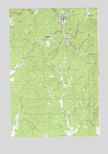
Pierce, ID USGS Topographic Map
Click on map above to begin viewing in our Map Viewer.

This topographic map contains these locations and features:
Feature Name Type Latitude Longitude GNIS ID View Map
Bat CreekStreamN46.3752°W115.7924°377027View Map
Brown Creek MillLocaleN46.3757°W115.7918°378268View Map
Brown Creek Moto Cross AreaLocaleN46.4260°W115.8004°395135View Map
Burcham CreekStreamN46.4077°W115.8040°396195View Map
Canal GulchValleyN46.4932°W115.7990°378839View Map
Canal Gulch CreekStreamN46.4924°W115.8004°399460View Map
Cardiff MillPopulated PlaceN46.4707°W115.7946°396231View Map
City of PierceCivilN46.4931°W115.7995°2411420View Map
Clearwater GulchValleyN46.4896°W115.7626°379403View Map
Clearwater Gulch Picnic AreaLocaleN46.4919°W115.7613°399017View Map
Dan Lee CreekStreamN46.3835°W115.7818°380231View Map
Flat CreekStreamN46.4960°W115.8365°381822View Map
Fohl Picnic AreaLocaleN46.4649°W115.8404°381904View Map
Gold Dollar FlatFlatN46.4613°W115.7685°394052View Map
Gold HillSummitN46.4869°W115.8601°396566View Map
Hanging Trees Historical MarkerParkN46.4716°W115.8179°382865View Map
Hildebrand CreekStreamN46.4774°W115.7988°383193View Map
Judge TownPopulated PlaceN46.4755°W115.7971°396719View Map
Lew Hand MeadowFlatN46.4271°W115.8346°384587View Map
Lost CreekStreamN46.4316°W115.8029°386138View Map
Moore GulchValleyN46.4977°W115.7940°387151View Map
Mutton GulchValleyN46.4719°W115.7979°387430View Map
Oro Fino (historical)Populated PlaceN46.4821°W115.7976°399168View Map
Peterson CornersLocaleN46.3757°W115.7963°388368View Map
PiercePopulated PlaceN46.4910°W115.7990°397030View Map
Pierce DivideGapN46.4596°W115.8443°388437View Map
Pierce Elementary SchoolSchoolN46.4913°W115.7965°401072View Map
Pierce Middle SchoolSchoolN46.4913°W115.7965°401071View Map
Pierce Police DepartmentBuildingN46.4879°W115.7998°2722380View Map
Pierce Post OfficePost OfficeN46.4896°W115.7987°2766843View Map
Pierce Volunteer Fire DepartmentBuildingN46.4878°W115.7993°2619204View Map
Pierce Work CenterLocaleN46.4966°W115.7954°394912View Map
Pierson CreekStreamN46.3785°W115.7946°388441View Map
Preacher CreekStreamN46.4919°W115.7668°388853View Map
Quartz CreekStreamN46.4991°W115.8138°388968View Map
Rhodes CreekStreamN46.4730°W115.7968°389331View Map
Saint Louis GulchValleyN46.4594°W115.7776°389835View Map
Sourdough CreekStreamN46.4238°W115.7982°390840View Map
Swede CreekStreamN46.3757°W115.7943°391759View Map
Weaver CreekStreamN46.3913°W115.7957°392965View Map

Note: Coordinates in the location and feature list above are referenced to NAD83 datum.


Copyright (C) 2008-2025 Ryan Niemi / Sunset Dynamics ... All Rights Reserved