TopoQuest Logo
Do you find TopoQuest useful?
Help keep TopoQuest running and adding new maps/features by donating!
Bitcoin:  19c7KJd3qBynnjoSw5npx9KScwjBe4ifkT
Litecoin:  LXs6TkuXGGXo1vDsWCkWVdjQX94eUKd6ui
Home View Maps Find Maps Find Places Resources & Links


Jaype, Idaho Topographic Map

USGS Map Title: Jaype, ID
USGS Map MRC: 46115E7
DRG (GeoTIFF) Download: o46115e7.tif


Neighboring USGS Topographic Map Quads:


  John Lewis Mountain, ID  
46115F8
 

  Headquarters, ID  
46115F7
 

  Browns Rock, ID  
46115F6
 

  Whiskey Butte, ID  
46115E8
 

  Jaype, ID  
46115E7
 

  French Mountain, ID  
46115E6
 

  Weippe North, ID  
46115D8
 

  Pierce, ID  
46115D7
 

  Hemlock Butte, ID  
46115D6


Map MRC Location:

N47°
W116°
N47°
W115°
H8 H7 H6 H5 H4 H3 H2 H1
G8 G7 G6 G5 G4 G3 G2 G1
F8 F7 F6 F5 F4 F3 F2 F1
E8 E7 E6 E5 E4 E3 E2 E1
D8 D7 D6 D5 D4 D3 D2 D1
C8 C7 C6 C5 C4 C3 C2 C1
B8 B7 B6 B5 B4 B3 B2 B1
A8 A7 A6 A5 A4 A3 A2 A1
N46°
W116°
N46°
W115°

Jaype, ID USGS 1:24K Topographic Map Preview:
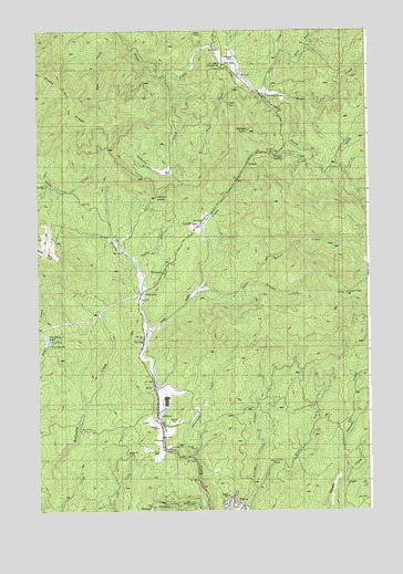
Jaype, ID USGS Topographic Map
Click on map above to begin viewing in our Map Viewer.

This topographic map contains these locations and features:
Feature Name Type Latitude Longitude GNIS ID View Map
Bear CreekStreamN46.6227°W115.8435°377092View Map
Calhoun CreekStreamN46.6127°W115.8263°378716View Map
Campbell PondsLakeN46.5446°W115.8719°399816View Map
CardiffPopulated PlaceN46.5744°W115.8124°396232View Map
Clearwater Timber Protective Assoc HeadqtrsLocaleN46.6124°W115.7996°379407View Map
Cptpa Headquarters AirportAirportN46.6164°W115.7998°400330View Map
Deer CreekStreamN46.6088°W115.7893°380448View Map
East Canal GulchValleyN46.5055°W115.7929°381029View Map
East Fork Deer CreekStreamN46.6180°W115.7835°381083View Map
EC Rettig CampgroundLocaleN46.6155°W115.8051°394713View Map
Fohl CreekStreamN46.6119°W115.7974°381903View Map
HollywoodPopulated PlaceN46.5552°W115.8365°383259View Map
Hollywood Recreation AreaLocaleN46.5619°W115.8274°394699View Map
JaypePopulated PlaceN46.5302°W115.8299°396701View Map
Little Beaver CreekStreamN46.5574°W115.8151°384736View Map
Pierce CreekStreamN46.5063°W115.7632°388434View Map
Revling SpurLocaleN46.5435°W115.8351°389320View Map
Shanghai CreekStreamN46.5099°W115.7590°390148View Map
Shanghai LookoutLocaleN46.5566°W115.7588°390149View Map
South Fork Reeds CreekStreamN46.6071°W115.7779°391004View Map
SummitLocaleN46.5910°W115.7949°391612View Map
Summit LookoutLocaleN46.5991°W115.7949°391636View Map
Threemile CreekStreamN46.5132°W115.8185°400137View Map
Trail CreekStreamN46.5455°W115.8343°392282View Map
Trapper CreekStreamN46.5594°W115.7963°392342View Map

Note: Coordinates in the location and feature list above are referenced to NAD83 datum.


Copyright (C) 2008-2025 Ryan Niemi / Sunset Dynamics ... All Rights Reserved