TopoQuest Logo
Do you find TopoQuest useful?
Help keep TopoQuest running and adding new maps/features by donating!
Bitcoin:  19c7KJd3qBynnjoSw5npx9KScwjBe4ifkT
Litecoin:  LXs6TkuXGGXo1vDsWCkWVdjQX94eUKd6ui
Home View Maps Find Maps Find Places Resources & Links


Frisco City, Alabama Topographic Map

USGS Map Title: Frisco City, AL
USGS Map MRC: 31087D4
DRG (GeoTIFF) Download: o31087d4.tif


Neighboring USGS Topographic Map Quads:


  Claiborne, AL  
31087E5
 

  Mexia, AL  
31087E4
 

  Monroeville, AL  
31087E3
 

  Flynns Lake, AL  
31087D5
 

  Frisco City, AL  
31087D4
 

  Excel, AL  
31087D3
 

  Uriah West, AL  
31087C5
 

  Uriah East, AL  
31087C4
 

  Frisco City SE, AL  
31087C3


Map MRC Location:

N32°
W88°
N32°
W87°
H8 H7 H6 H5 H4 H3 H2 H1
G8 G7 G6 G5 G4 G3 G2 G1
F8 F7 F6 F5 F4 F3 F2 F1
E8 E7 E6 E5 E4 E3 E2 E1
D8 D7 D6 D5 D4 D3 D2 D1
C8 C7 C6 C5 C4 C3 C2 C1
B8 B7 B6 B5 B4 B3 B2 B1
A8 A7 A6 A5 A4 A3 A2 A1
N31°
W88°
N31°
W87°

Frisco City, AL USGS 1:24K Topographic Map Preview:
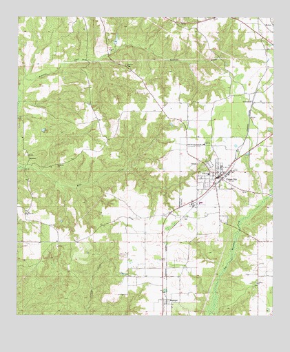
Frisco City, AL USGS Topographic Map
Click on map above to begin viewing in our Map Viewer.

This topographic map contains these locations and features:
Feature Name Type Latitude Longitude GNIS ID View Map
Baas CemeteryCemeteryN31.4163°W87.4183°113320View Map
Beaumont Church (historical)ChurchN31.4627°W87.4297°136484View Map
Bert Boroughs Pond DamDamN31.4885°W87.4533°129858View Map
Boroughs PondReservoirN31.4906°W87.4520°129857View Map
Bright Morning Star Baptist ChurchChurchN31.4468°W87.4105°154997View Map
Coleman CemeteryCemeteryN31.3882°W87.3828°1805526View Map
Coleman ChurchChurchN31.3888°W87.3825°116412View Map
Community Chapel Holiness ChurchChurchN31.3991°W87.4292°154565View Map
First Baptist ChurchChurchN31.4307°W87.4028°154566View Map
Frisco CityPopulated PlaceN31.4335°W87.4014°151784View Map
Frisco City DivisionCivilN31.3954°W87.4184°165899View Map
Frisco City Oil FieldOilfieldN31.4229°W87.4253°151206View Map
Frisco City Police DepartmentBuildingN31.4331°W87.4014°2751810View Map
Frisco City Post OfficePost OfficeN31.4350°W87.3995°167011View Map
Frisco City United Methodist ChurchChurchN31.4352°W87.3992°154567View Map
Frisco City Volunteer Fire DepartmentBuildingN31.4324°W87.4011°2331087View Map
Lilly ChurchChurchN31.4799°W87.4464°121620View Map
Macedonia Baptist ChurchChurchN31.4250°W87.4935°2580368View Map
Macedonia ChurchChurchN31.4382°W87.4803°122147View Map
ManisteePopulated PlaceN31.4410°W87.4944°156652View Map
MegargelPopulated PlaceN31.3799°W87.4283°122634View Map
Megargel Assembly of God ChurchChurchN31.3816°W87.4292°154568View Map
Megargel Census Designated PlaceCensusN31.3781°W87.4306°2628598View Map
Mexia ChurchChurchN31.4954°W87.4150°154596View Map
Moores PondLakeN31.4526°W87.4873°136577View Map
Mount Pisgah CemeteryCemeteryN31.4160°W87.3966°1805623View Map
Mount Pisgah Primitive Baptist ChurchChurchN31.4168°W87.3969°152482View Map
Negro Pond (historical)LakeN31.4593°W87.4878°136587View Map
New Chapel Baptist ChurchChurchN31.4970°W87.3759°2580508View Map
Oak Grove Baptist ChurchChurchN31.4652°W87.3861°152728View Map
Pleasant Hill Baptist ChurchChurchN31.4177°W87.4958°152989View Map
Pleasant Hill CemeteryCemeteryN31.4182°W87.4953°1805527View Map
Provo School (historical)SchoolN31.3960°W87.4378°136612View Map
Shiloh CemeteryCemeteryN31.4393°W87.4116°1805661View Map
Shiloh Primitive Baptist ChurchChurchN31.4385°W87.4119°153417View Map
Snider (historical)LocaleN31.4463°W87.4050°136635View Map
Town of Frisco CityCivilN31.4353°W87.4037°2406528View Map

Note: Coordinates in the location and feature list above are referenced to NAD83 datum.


Copyright (C) 2008-2024 Ryan Niemi / Sunset Dynamics ... All Rights Reserved