TopoQuest Logo
Do you find TopoQuest useful?
Help keep TopoQuest running and adding new maps/features by donating!
Bitcoin:  19c7KJd3qBynnjoSw5npx9KScwjBe4ifkT
Litecoin:  LXs6TkuXGGXo1vDsWCkWVdjQX94eUKd6ui
Home View Maps Find Maps Find Places Resources & Links


Gage, New Mexico Topographic Map

USGS Map Title: Gage, NM
USGS Map MRC: 32108B1
DRG (GeoTIFF) Download: o32108b1.tif


Neighboring USGS Topographic Map Quads:


  Grandmother Mountain West, NM  
32108C2
 

  Grandmother Mountain East, NM  
32108C1
 

  Williams Ranch, NM  
32107C8
 

  Gage NW, NM  
32108B2
 

  Gage, NM  
32108B1
 

  Red Mountain, NM  
32107B8
 

  Gage SW, NM  
32108A2
 

  Gage SE, NM  
32108A1
 

  Bisbee Hills, NM  
32107A8


Map MRC Location:

N33°
W109°
N33°
W108°
H8 H7 H6 H5 H4 H3 H2 H1
G8 G7 G6 G5 G4 G3 G2 G1
F8 F7 F6 F5 F4 F3 F2 F1
E8 E7 E6 E5 E4 E3 E2 E1
D8 D7 D6 D5 D4 D3 D2 D1
C8 C7 C6 C5 C4 C3 C2 C1
B8 B7 B6 B5 B4 B3 B2 B1
A8 A7 A6 A5 A4 A3 A2 A1
N32°
W109°
N32°
W108°

Gage, NM USGS 1:24K Topographic Map Preview:
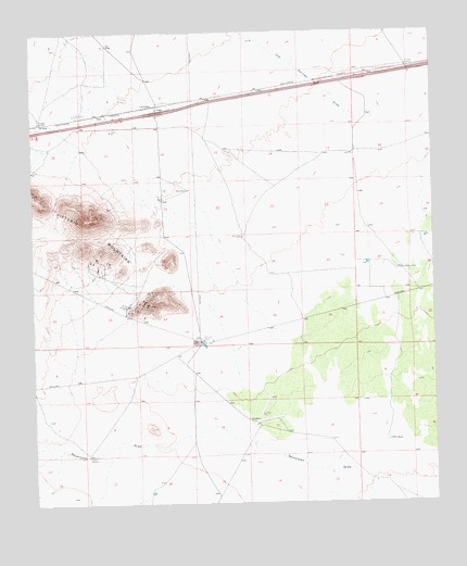
Gage, NM USGS Topographic Map
Click on map above to begin viewing in our Map Viewer.

This topographic map contains these locations and features:
Feature Name Type Latitude Longitude GNIS ID View Map
00626 Water WellWellN32.1956°W108.0075°922471View Map
00627 Water WellWellN32.1912°W108.0036°930322View Map
00628 Water WellWellN32.1834°W108.0261°930377View Map
00629 Water WellWellN32.1881°W108.0214°922469View Map
00631 Water WellWellN32.1859°W108.0117°930319View Map
01390 Water WellWellN32.2309°W108.0861°929787View Map
01391 Water WellWellN32.2248°W108.1105°923292View Map
01392 Water WellWellN32.2085°W108.0768°922473View Map
01393 Water WellWellN32.1959°W108.0606°922472View Map
01394 Water WellWellN32.1751°W108.0936°930375View Map
01395 Water WellWellN32.1690°W108.0670°923290View Map
01396 Water WellWellN32.1676°W108.0681°930317View Map
01421 Water WellWellN32.1383°W108.1091°930389View Map
01422 Water WellWellN32.1376°W108.0924°923288View Map
01423 Water WellWellN32.1390°W108.0770°923287View Map
01424 Water WellWellN32.1446°W108.0566°923289View Map
10228 Water WellWellN32.2406°W108.0084°923296View Map
10229 Water WellWellN32.2387°W108.0092°929988View Map
10248 Water WellWellN32.1948°W108.0050°930370View Map
1389 Water WellWellN32.2287°W108.1100°923294View Map
1569 Water WellWellN32.2256°W108.1239°923293View Map
1574 Water WellWellN32.2240°W108.1050°923291View Map
Airington WindmillLocaleN32.2268°W108.1231°933061View Map
Antelope WellsWellN32.1870°W108.0103°885806View Map
Berts WellWellN32.1956°W108.0598°886267View Map
Burke MineMineN32.1776°W108.0900°916186View Map
CCC TankReservoirN32.1414°W108.0157°887024View Map
Chance and Jessie MinesMineN32.1787°W108.0909°914786View Map
Cow Springs DrawValleyN32.2268°W108.0156°898294View Map
Earp RanchLocaleN32.2084°W108.0764°888633View Map
Excess MineMineN32.1770°W108.0964°916190View Map
GagePopulated PlaceN32.2295°W108.0861°899641View Map
Gage Post Office (historical)Post OfficeN32.2295°W108.0861°937331View Map
Gage Weather StationLocaleN32.2295°W108.0861°931883View Map
HelenMineN32.1759°W108.0970°916244View Map
Irish RoseMineN32.1876°W108.1053°916194View Map
Jessie MineMineN32.1779°W108.0867°916195View Map
M-2279 Water WellWellN32.1801°W108.0753°922468View Map
Mines WindmillLocaleN32.1776°W108.0956°892102View Map
Mongola WindmillLocaleN32.2409°W108.0081°892152View Map
Parole MineMineN32.1815°W108.0892°915281View Map
Rambler MineMineN32.1779°W108.0956°915268View Map
Rover GroupMineN32.1695°W108.0909°917166View Map
Separ WindmillLocaleN32.2287°W108.1098°894722View Map
Tedford ProspectMineN32.1843°W108.1192°915258View Map
Tidwich WindmillLocaleN32.1379°W108.1089°895669View Map
Victorio GroupMineN32.1820°W108.0839°915260View Map
Victorio MountainsRangeN32.2009°W108.1092°920731View Map
Walnut CreekStreamN32.2268°W108.0181°912152View Map

Note: Coordinates in the location and feature list above are referenced to NAD83 datum.


Copyright (C) 2008-2024 Ryan Niemi / Sunset Dynamics ... All Rights Reserved