TopoQuest Logo
Do you find TopoQuest useful?
Help keep TopoQuest running and adding new maps/features by donating!
Bitcoin:  19c7KJd3qBynnjoSw5npx9KScwjBe4ifkT
Litecoin:  LXs6TkuXGGXo1vDsWCkWVdjQX94eUKd6ui
Home View Maps Find Maps Find Places Resources & Links


Gallina, New Mexico Topographic Map

USGS Map Title: Gallina, NM
USGS Map MRC: 36106B7
DRG (GeoTIFF) Download: o36106b7.tif


Neighboring USGS Topographic Map Quads:


  Laguna Gurule, NM  
36106C8
 

  French Mesa, NM  
36106C7
 

  Laguna Peak, NM  
36106C6
 

  Regina, NM  
36106B8
 

  Gallina, NM  
36106B7
 

  Arroyo Del Agua, NM  
36106B6
 

  Cuba, NM  
36106A8
 

  Nacimiento Peak, NM  
36106A7
 

  Jarosa, NM  
36106A6


Map MRC Location:

N37°
W107°
N37°
W106°
H8 H7 H6 H5 H4 H3 H2 H1
G8 G7 G6 G5 G4 G3 G2 G1
F8 F7 F6 F5 F4 F3 F2 F1
E8 E7 E6 E5 E4 E3 E2 E1
D8 D7 D6 D5 D4 D3 D2 D1
C8 C7 C6 C5 C4 C3 C2 C1
B8 B7 B6 B5 B4 B3 B2 B1
A8 A7 A6 A5 A4 A3 A2 A1
N36°
W107°
N36°
W106°

Gallina, NM USGS 1:24K Topographic Map Preview:
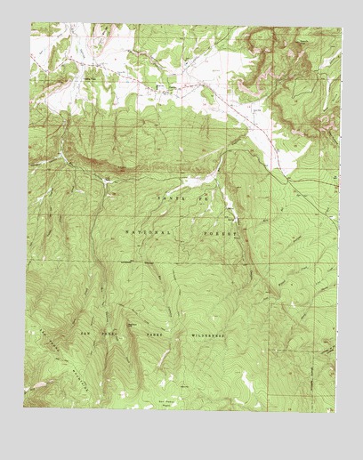
Gallina, NM USGS Topographic Map
Click on map above to begin viewing in our Map Viewer.

This topographic map contains these locations and features:
Feature Name Type Latitude Longitude GNIS ID View Map
Austin RanchLocaleN36.1986°W106.8445°903464View Map
Caņon CapulinValleyN36.2406°W106.8550°904630View Map
Caņon de la VegitasValleyN36.2056°W106.8600°904526View Map
CapulinPopulated PlaceN36.2311°W106.8059°933969View Map
Capulin PeakSummitN36.2447°W106.7673°923576View Map
Capulin Post OfficePost OfficeN36.2311°W106.8059°937961View Map
Capulin SchoolSchoolN36.2275°W106.8214°904767View Map
Cave CreekStreamN36.1534°W106.8414°904849View Map
Cecilia CanyonValleyN36.2014°W106.8006°898275View Map
Cecilia SpringSpringN36.1906°W106.7956°899316View Map
Chavez SPringSpringN36.2128°W106.8408°899315View Map
Clear CreekStreamN36.2028°W106.8562°905202View Map
Corral CanyonValleyN36.2081°W106.8614°905372View Map
Corralitos CreekStreamN36.1250°W106.7934°905383View Map
Coyote DivisionCivilN36.2494°W106.7686°1937516View Map
Dove CreekStreamN36.1734°W106.8470°905843View Map
GallinaPopulated PlaceN36.2283°W106.8189°923601View Map
Gallina Census Designated PlaceCensusN36.2297°W106.8088°2584067View Map
Gallina PlazaLocaleN36.2317°W106.8537°906451View Map
Gallina Post OfficePost OfficeN36.2287°W106.8173°937580View Map
Jose Miguel CreekStreamN36.1797°W106.7506°907450View Map
Lime SpringSpringN36.1503°W106.8384°936790View Map
Red Rock CliffCliffN36.1522°W106.8342°910077View Map
Rio CapulinStreamN36.2403°W106.8550°910232View Map
Rito del OjoStreamN36.1933°W106.7536°910280View Map
River TrailTrailN36.1756°W106.8731°910326View Map
Salt DrawValleyN36.2492°W106.8609°910572View Map
San Jose TrailTrailN36.1403°W106.8595°910642View Map
San Pedro Mountain TrailTrailN36.1514°W106.8481°910704View Map
San Pedro Parks TrailTrailN36.1659°W106.8142°910706View Map
Santo Niņo ChurchChurchN36.2214°W106.7850°910808View Map
TJBD 1MineN36.1950°W106.8692°917018View Map
Upper Gallina River TrailTrailN36.1550°W106.8289°911988View Map
Wild BlueMineN36.1334°W106.8339°916757View Map

Note: Coordinates in the location and feature list above are referenced to NAD83 datum.


Copyright (C) 2008-2024 Ryan Niemi / Sunset Dynamics ... All Rights Reserved