TopoQuest Logo
Do you find TopoQuest useful?
Help keep TopoQuest running and adding new maps/features by donating!
Bitcoin:  19c7KJd3qBynnjoSw5npx9KScwjBe4ifkT
Litecoin:  LXs6TkuXGGXo1vDsWCkWVdjQX94eUKd6ui
Home View Maps Find Maps Find Places Resources & Links


Arroyo Del Agua, New Mexico Topographic Map

USGS Map Title: Arroyo Del Agua, NM
USGS Map MRC: 36106B6
DRG (GeoTIFF) Download: o36106b6.tif


Neighboring USGS Topographic Map Quads:


  French Mesa, NM  
36106C7
 

  Laguna Peak, NM  
36106C6
 

  Echo Amphitheater, NM  
36106C5
 

  Gallina, NM  
36106B7
 

  Arroyo Del Agua, NM  
36106B6
 

  Youngsville, NM  
36106B5
 

  Nacimiento Peak, NM  
36106A7
 

  Jarosa, NM  
36106A6
 

  Cerro del Grant, NM  
36106A5


Map MRC Location:

N37°
W107°
N37°
W106°
H8 H7 H6 H5 H4 H3 H2 H1
G8 G7 G6 G5 G4 G3 G2 G1
F8 F7 F6 F5 F4 F3 F2 F1
E8 E7 E6 E5 E4 E3 E2 E1
D8 D7 D6 D5 D4 D3 D2 D1
C8 C7 C6 C5 C4 C3 C2 C1
B8 B7 B6 B5 B4 B3 B2 B1
A8 A7 A6 A5 A4 A3 A2 A1
N36°
W107°
N36°
W106°

Arroyo Del Agua, NM USGS 1:24K Topographic Map Preview:
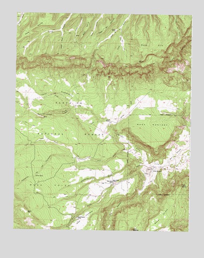
Arroyo Del Agua, NM USGS Topographic Map
Click on map above to begin viewing in our Map Viewer.

This topographic map contains these locations and features:
Feature Name Type Latitude Longitude GNIS ID View Map
Agua SarcaStreamN36.1722°W106.6650°903018View Map
Arroyo del AguaPopulated PlaceN36.1595°W106.6523°903323View Map
Arroyo JaspeStreamN36.1847°W106.6798°903390View Map
Caņada BrazoStreamN36.2406°W106.7181°904439View Map
Canada SpringSpringN36.2292°W106.7320°913801View Map
Caņada TusasStreamN36.2422°W106.6756°904489View Map
Caņon OjoValleyN36.1956°W106.7014°904673View Map
Caņon PinabetosoValleyN36.1942°W106.6970°904679View Map
Caņoncito de los CordovasValleyN36.1667°W106.7061°904707View Map
Caņoncito SecoValleyN36.1636°W106.6620°904715View Map
Casey SpringSpringN36.2473°W106.7134°913840View Map
Cordovas SpringSpringN36.1559°W106.7351°905341View Map
Coyote Ranger DistrictForestN36.2020°W106.6795°2038424View Map
Cuesta NavajoRidgeN36.2270°W106.6353°905553View Map
Dead Horse SpringSpringN36.2360°W106.7374°913838View Map
Escondido SpringSpringN36.2492°W106.6609°913803View Map
Fuertes SpringSpringN36.2405°W106.6799°906425View Map
Gurule SpringSpringN36.2492°W106.7450°913839View Map
Jaramillo-MontoyaMineN36.1692°W106.6336°916704View Map
Jaspe Trick TankReservoirN36.2025°W106.6773°913835View Map
La Cueba TankReservoirN36.2037°W106.7457°913841View Map
Lino CreekStreamN36.1772°W106.7275°907975View Map
Lino SpringSpringN36.1742°W106.7468°913830View Map
Loma CoyoteSummitN36.1514°W106.6311°908128View Map
Mesa AltaSummitN36.2258°W106.6578°908587View Map
Mesa Alta Wildlife Trick TankReservoirN36.2261°W106.7156°913842View Map
Mesa CorralSummitN36.2388°W106.7018°908594View Map
Mesa del CaminoSummitN36.2408°W106.6873°908582View Map
Mesa GuruleSummitN36.2367°W106.7448°908616View Map
Mesa MontosaSummitN36.1764°W106.6586°908623View Map
Mesa OjitosSummitN36.1286°W106.6489°908625View Map
Mesa PinabetalSummitN36.1309°W106.7000°908626View Map
Mesa Pinabetal SchoolSchoolN36.1322°W106.7045°908627View Map
Mesa PoleoBenchN36.1503°W106.7259°908629View Map
Mesa Poleo SchoolSchoolN36.1522°W106.6798°908630View Map
Morfins TankReservoirN36.1351°W106.7404°908903View Map
Navajo TankReservoirN36.1918°W106.6707°913833View Map
Navajo Trick TankReservoirN36.1989°W106.6575°913834View Map
Ojitos SpringSpringN36.1313°W106.6532°913827View Map
Ojo CorralLocaleN36.2075°W106.7067°913837View Map
Poleo CreekStreamN36.1622°W106.6456°909773View Map
ResurrectionMineN36.1759°W106.6689°917276View Map
Salazar TankReservoirN36.1443°W106.7423°913828View Map
Salitral CorralLocaleN36.1878°W106.6767°913832View Map
Salitral CreekStreamN36.1634°W106.6578°910558View Map
Salitral SpringSpringN36.1886°W106.6856°910559View Map
Sandy Deer SpringSpringN36.2291°W106.7308°913843View Map
Santa TeresaPopulated PlaceN36.1534°W106.6795°901587View Map
Santa Teresa ChurchChurchN36.1534°W106.6795°910789View Map
Sarca SpringSpringN36.1702°W106.7457°913829View Map
South Salitral Trick TankReservoirN36.1747°W106.6920°913831View Map
Upper Potrero SpringSpringN36.2475°W106.6355°2035511View Map
West Trick TankReservoirN36.2001°W106.6837°913836View Map

Note: Coordinates in the location and feature list above are referenced to NAD83 datum.


Copyright (C) 2008-2024 Ryan Niemi / Sunset Dynamics ... All Rights Reserved