TopoQuest Logo
Do you find TopoQuest useful?
Help keep TopoQuest running and adding new maps/features by donating!
Bitcoin:  19c7KJd3qBynnjoSw5npx9KScwjBe4ifkT
Litecoin:  LXs6TkuXGGXo1vDsWCkWVdjQX94eUKd6ui
Home View Maps Find Maps Find Places Resources & Links


Bellevue, Idaho Topographic Map

USGS Map Title: Bellevue, ID
USGS Map MRC: 43114D3
DRG (GeoTIFF) Download: o43114d3.tif


Neighboring USGS Topographic Map Quads:


  Mahoney Butte, ID  
43114E4
 

  Hailey, ID  
43114E3
 

  Baugh Creek SW, ID  
43114E2
 

  Richardson Summit, ID  
43114D4
 

  Bellevue, ID  
43114D3
 

  Seamans Creek, ID  
43114D2
 

  Magic Reservoir West, ID  
43114C4
 

  Magic Reservoir East, ID  
43114C3
 

  Gannett, ID  
43114C2


Map MRC Location:

N44°
W115°
N44°
W114°
H8 H7 H6 H5 H4 H3 H2 H1
G8 G7 G6 G5 G4 G3 G2 G1
F8 F7 F6 F5 F4 F3 F2 F1
E8 E7 E6 E5 E4 E3 E2 E1
D8 D7 D6 D5 D4 D3 D2 D1
C8 C7 C6 C5 C4 C3 C2 C1
B8 B7 B6 B5 B4 B3 B2 B1
A8 A7 A6 A5 A4 A3 A2 A1
N43°
W115°
N43°
W114°

Bellevue, ID USGS 1:24K Topographic Map Preview:
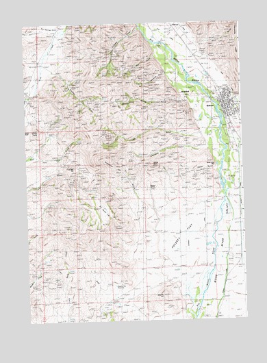
Bellevue, ID USGS Topographic Map
Click on map above to begin viewing in our Map Viewer.

This topographic map contains these locations and features:
Feature Name Type Latitude Longitude GNIS ID View Map
Bannon SpringSpringN43.4306°W114.3039°371363View Map
BellevuePopulated PlaceN43.4635°W114.2606°397425View Map
Bellevue CanalCanalN43.4552°W114.2592°371443View Map
Bellevue Elementary SchoolSchoolN43.4683°W114.2562°401267View Map
Bellevue Fire DepartmentBuildingN43.4635°W114.2599°2619072View Map
Bellevue Post OfficePost OfficeN43.4631°W114.2598°2766798View Map
BroadfordPopulated PlaceN43.4696°W114.2803°396179View Map
Bunker HillSummitN43.4396°W114.3475°371794View Map
Bypass CanalCanalN43.4030°W114.2598°371826View Map
City of BellevueCivilN43.4684°W114.2551°2409819View Map
Climax MineMineN43.4980°W114.3420°372062View Map
Colorado GulchValleyN43.4982°W114.3067°372094View Map
Cowcatcher RidgeRidgeN43.4830°W114.2523°372207View Map
Croesus GulchValleyN43.4802°W114.3609°372259View Map
Croesus MineMineN43.4738°W114.3473°372260View Map
Diebenow GulchValleyN43.4138°W114.3025°372407View Map
Dipper GulchValleyN43.4377°W114.2650°372415View Map
District CanalCanalN43.4274°W114.2520°395307View Map
Gilman ButteSummitN43.4555°W114.3681°372848View Map
Glendale SchoolSchoolN43.4130°W114.2875°372856View Map
Hope MineMineN43.4730°W114.3503°373131View Map
Horse Collar RockPillarN43.4394°W114.2659°373139View Map
Hot Spring GulchValleyN43.4971°W114.3523°373163View Map
Lees GulchValleyN43.4530°W114.2725°373536View Map
Mabelle HillSummitN43.3852°W114.2973°373784View Map
Mammoth GulchValleyN43.4794°W114.2923°373816View Map
McCoy MineMineN43.4594°W114.3567°373870View Map
Minnie Moore GulchValleyN43.4685°W114.2875°373973View Map
Minnie Moore MineMineN43.4691°W114.2939°373974View Map
Poverty FlatFlatN43.4096°W114.2848°374526View Map
Poverty Flat ReservoirReservoirN43.3897°W114.3246°374527View Map
Rattler ButteSummitN43.4405°W114.3014°397085View Map
Silver Star QueenMineN43.4680°W114.2842°375034View Map
Sky Ranch FlatFlatN43.4188°W114.3306°375058View Map
Slaughterhouse CreekStreamN43.4669°W114.2525°375062View Map
Sluder AirstripAirportN43.4018°W114.2726°400757View Map
Snoose MineMineN43.4882°W114.3225°375090View Map
Star GulchValleyN43.4869°W114.2967°375251View Map
Townsend GulchValleyN43.4482°W114.2692°375556View Map
Water GulchValleyN43.4910°W114.2767°375760View Map
Wilson GulchValleyN43.4969°W114.3617°393556View Map
Wood River Fire Protection District Station 3BuildingN43.4501°W114.2532°2619104View Map

Note: Coordinates in the location and feature list above are referenced to NAD83 datum.


Copyright (C) 2008-2025 Ryan Niemi / Sunset Dynamics ... All Rights Reserved