TopoQuest Logo
Do you find TopoQuest useful?
Help keep TopoQuest running and adding new maps/features by donating!
Bitcoin:  19c7KJd3qBynnjoSw5npx9KScwjBe4ifkT
Litecoin:  LXs6TkuXGGXo1vDsWCkWVdjQX94eUKd6ui
Home View Maps Find Maps Find Places Resources & Links


Garden Grove SW, Iowa Topographic Map

USGS Map Title: Garden Grove SW, IA
USGS Map MRC: 40093G6
DRG (GeoTIFF) Download: o40093g6.tif


Neighboring USGS Topographic Map Quads:


  Lacelle, IA  
40093H7
 

  Weldon, IA  
40093H6
 

  Le Roy, IA  
40093H5
 

  Van Wert, IA  
40093G7
 

  Garden Grove SW, IA  
40093G6
 

  Garden Grove, IA  
40093G5
 

  Davis City, IA  
40093F7
 

  Leon, IA  
40093F6
 

  Woodland, IA  
40093F5


Map MRC Location:

N41°
W94°
N41°
W93°
H8 H7 H6 H5 H4 H3 H2 H1
G8 G7 G6 G5 G4 G3 G2 G1
F8 F7 F6 F5 F4 F3 F2 F1
E8 E7 E6 E5 E4 E3 E2 E1
D8 D7 D6 D5 D4 D3 D2 D1
C8 C7 C6 C5 C4 C3 C2 C1
B8 B7 B6 B5 B4 B3 B2 B1
A8 A7 A6 A5 A4 A3 A2 A1
N40°
W94°
N40°
W93°

Garden Grove SW, IA USGS 1:24K Topographic Map Preview:
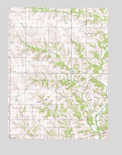
Garden Grove SW, IA USGS Topographic Map
Click on map above to begin viewing in our Map Viewer.

This topographic map contains these locations and features:
Feature Name Type Latitude Longitude GNIS ID View Map
Cobbville CreekStreamN40.8050°W93.6683°455505View Map
CrownLocaleN40.7972°W93.7269°466370View Map
Crown Post Office (historical)Post OfficeN40.7972°W93.7269°1969588View Map
Decatur County FairgroundLocaleN40.7536°W93.7488°463562View Map
Decatur County HospitalHospitalN40.7509°W93.7469°463563View Map
Decatur County Hospital HeliportAirportN40.7506°W93.7358°466856View Map
Decatur Medical Services CenterHospitalN40.7514°W93.7488°1969612View Map
Doze CemeteryCemeteryN40.8613°W93.6415°1969695View Map
FranklinLocaleN40.7972°W93.6897°466371View Map
Franklin CemeteryCemeteryN40.7819°W93.6990°1969708View Map
Franklin ChurchChurchN40.7822°W93.6986°456729View Map
Franklin Post Office (historical)Post OfficeN40.7964°W93.6911°467219View Map
Johnson CemeteryCemeteryN40.8242°W93.7145°457965View Map
Jonathan CreekStreamN40.7556°W93.6352°457984View Map
Kobville ParkParkN40.8111°W93.6905°1969731View Map
McCullough CemeteryCemeteryN40.8041°W93.6434°458900View Map
Morman CemeteryCemeteryN40.8273°W93.6286°1969696View Map
Mormon PoolStreamN40.8331°W93.6266°459237View Map
Township of CenterCivilN40.7715°W93.7265°467573View Map
Township of FranklinCivilN40.8559°W93.7289°467853View Map
Trullinger CemeteryCemeteryN40.7825°W93.6332°462349View Map
Weldon CreekStreamN40.8639°W93.6297°462785View Map
Winters CemeteryCemeteryN40.8612°W93.6532°463137View Map

Note: Coordinates in the location and feature list above are referenced to NAD83 datum.


Copyright (C) 2008-2025 Ryan Niemi / Sunset Dynamics ... All Rights Reserved