TopoQuest Logo
Do you find TopoQuest useful?
Help keep TopoQuest running and adding new maps/features by donating!
Bitcoin:  19c7KJd3qBynnjoSw5npx9KScwjBe4ifkT
Litecoin:  LXs6TkuXGGXo1vDsWCkWVdjQX94eUKd6ui
Home View Maps Find Maps Find Places Resources & Links


Van Wert, Iowa Topographic Map

USGS Map Title: Van Wert, IA
USGS Map MRC: 40093G7
DRG (GeoTIFF) Download: o40093g7.tif


Neighboring USGS Topographic Map Quads:


  Hopeville, IA  
40093H8
 

  Lacelle, IA  
40093H7
 

  Weldon, IA  
40093H6
 

  Grand River, IA  
40093G8
 

  Van Wert, IA  
40093G7
 

  Garden Grove SW, IA  
40093G6
 

  Lamoni North, IA  
40093F8
 

  Davis City, IA  
40093F7
 

  Leon, IA  
40093F6


Map MRC Location:

N41°
W94°
N41°
W93°
H8 H7 H6 H5 H4 H3 H2 H1
G8 G7 G6 G5 G4 G3 G2 G1
F8 F7 F6 F5 F4 F3 F2 F1
E8 E7 E6 E5 E4 E3 E2 E1
D8 D7 D6 D5 D4 D3 D2 D1
C8 C7 C6 C5 C4 C3 C2 C1
B8 B7 B6 B5 B4 B3 B2 B1
A8 A7 A6 A5 A4 A3 A2 A1
N40°
W94°
N40°
W93°

Van Wert, IA USGS 1:24K Topographic Map Preview:
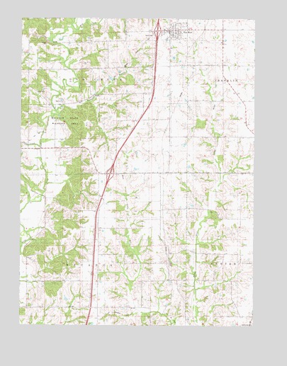
Van Wert, IA USGS Topographic Map
Click on map above to begin viewing in our Map Viewer.

This topographic map contains these locations and features:
Feature Name Type Latitude Longitude GNIS ID View Map
Assembly of God ChurchChurchN40.8697°W93.7930°1969681View Map
City of Van WertCivilN40.8711°W93.7918°2397118View Map
Clinton CemeteryCemeteryN40.8611°W93.8336°1969697View Map
De KalbLocaleN40.8397°W93.8533°466368View Map
Decatur State Wildlife AreaParkN40.8328°W93.8516°1822881View Map
Dekalb Post Office (historical)Post OfficeN40.8397°W93.8533°1969587View Map
Des Moines Junction (historical)LocaleN40.8744°W93.7952°1969596View Map
Fierce (historical)LocaleN40.8203°W93.8230°466369View Map
Fierce Post Office (historical)Post OfficeN40.8250°W93.8230°1969585View Map
Interchange 18CrossingN40.8117°W93.8274°1969652View Map
Interchange 22CrossingN40.8700°W93.8024°1969651View Map
KingstonPopulated PlaceN40.8142°W93.8352°467224View Map
Kingston (historical)LocaleN40.8142°W93.8352°1969595View Map
Little River Recreation AreaParkN40.7750°W93.7794°1969570View Map
McKee CemeteryCemeteryN40.8646°W93.8619°1822884View Map
Patriot Post Office (historical)Post OfficeN40.8706°W93.7669°467218View Map
Prairieville Post Office (historical)Post OfficeN40.8736°W93.7947°1969577View Map
Redmans BranchStreamN40.8372°W93.8558°1822882View Map
Short CreekStreamN40.8231°W93.8655°461586View Map
Shy CemeteryCemeteryN40.7752°W93.7957°1822880View Map
Township of DecaturCivilN40.7682°W93.8433°467689View Map
Township of Long CreekCivilN40.8547°W93.8435°468303View Map
United Methodist ChurchChurchN40.8697°W93.7930°1969682View Map
Van WertPopulated PlaceN40.8697°W93.7930°462538View Map
Van Wert (historical)LocaleN40.8739°W93.7927°1969685View Map
Van Wert CemeteryCemeteryN40.8630°W93.7949°1969702View Map
Van Wert City HallBuildingN40.8697°W93.7930°1969684View Map
Van Wert Emergency Medical ServicesBuildingN40.8694°W93.7963°2599651View Map
Van Wert Fire DepartmentBuildingN40.8694°W93.7963°1969683View Map
Van Wert Post OfficePost OfficeN40.8699°W93.7986°1969680View Map
West CemeteryCemeteryN40.8454°W93.8650°1822883View Map
Wolf CreekStreamN40.8703°W93.8458°1822919View Map

Note: Coordinates in the location and feature list above are referenced to NAD83 datum.


Copyright (C) 2008-2024 Ryan Niemi / Sunset Dynamics ... All Rights Reserved